Vernadsky Station-Petermann Island
Antarctic Science, Antarctic Vodka, Chicks
Sunday December 30, 2007
Expedition staff leader Jill got on the ship P.A. at 6:30am this morning to remind us to go out on deck and watch the ship negotiate the Lemaire Channel. The fact that Argentina had some how decided to switch to daylight savings time overnight didn't help anyone with the early reveille, but the scenery was certainly worth the bother. We're clearly in around-the-clock daylight territory now, which is a double edged sword. It's great when you want to be awake, but a bit of a bother when you're trying to get some sleep.
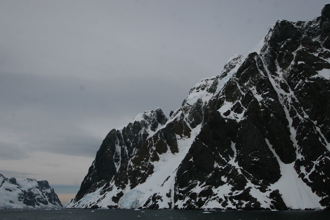
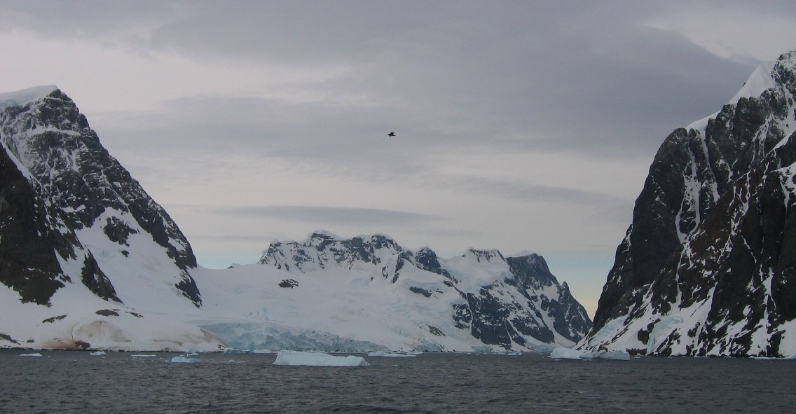
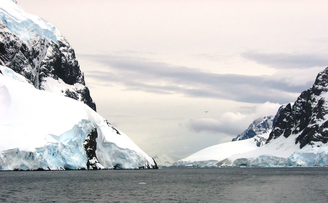
So here's why she wanted us to go look at the channel - The Lemaire channel is one mile across at its widest and 1/2 mile across at its narrowest point, and runs northeast to southwest. It separates Booth Islands from the Antarctic peninsula. The Lemaire was discovered by Dallmann's German Expedition of 1873-74, and first navigated by De Gerlache in 1878. De Gerlache named the channel for Charles Lemaire, who was a Belgian explorer of the Congo. And by the way, it is breathtakingly spectacular.
And here are some pictures of the channel...
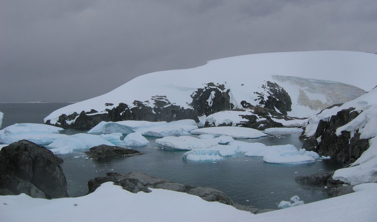
![]()
![]()
![]()
*************************************************************
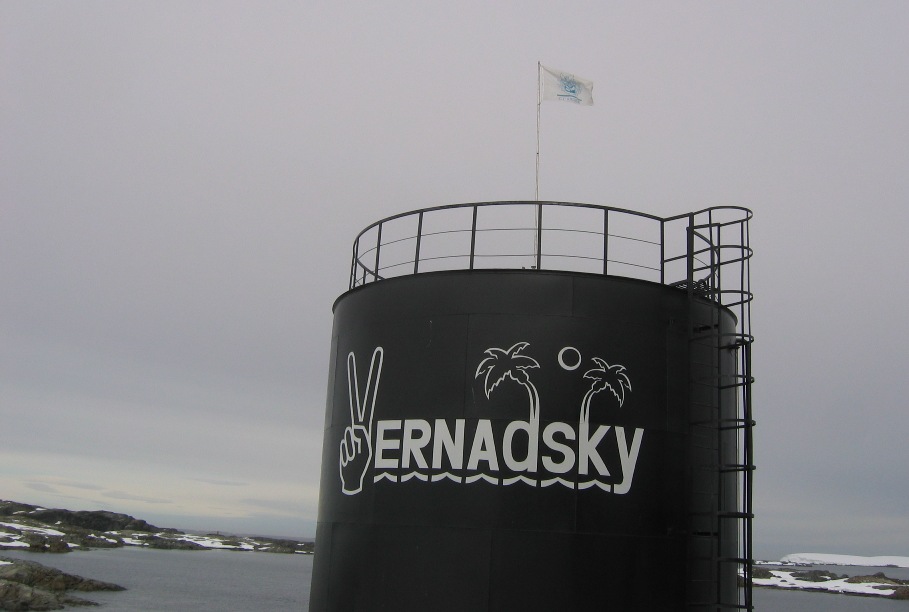
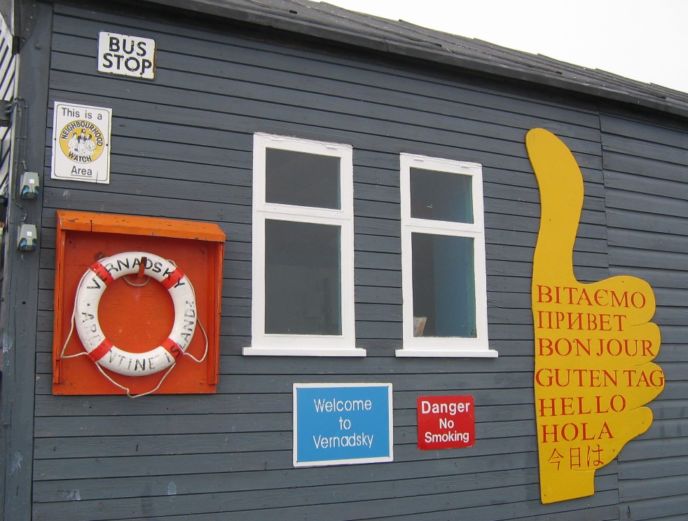
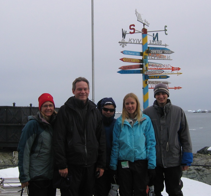
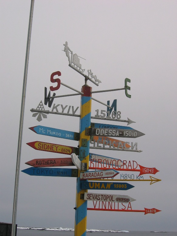
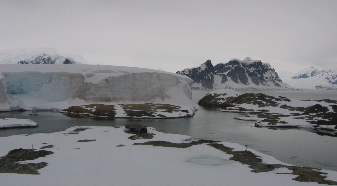
Later in the morning, our Ukranian captain set anchor near a small island in the cluster known as "Argentine Islands" (for geographic and not political reasons according to our ship historian). The expedition staff took us ashore on Winter Island in order to visit two different historic sites. The first was Vernadsky Research Station, an active Ukrainian research base housing scientists and support staff of about a dozen men. This base was originally built and staffed by the British, who sold the whole facility to the Ukraine in 1997 for one British pound on the condition that the Ukraine would continue with the research in progress. I think one of the main factors precipitating the sale was a need for Great Britain to reduce its physical presence in Antarctica in order to comply with terms of the Antarctic Treaty. For us, the good news is that the current Ukrainian staff of Vernadsky Research staff seems very happy to get a visit from the Ukrainian captain of our ship, and to give his tourists both a tour of their station and a taste of their homemade vodka.
Vernadsky Station (named "Faraday" at the time) was one of two Antarctic research stations to simultaneously discover the rapidly expanding hole in the ozone layer over the south pole. The phenomenon of an annually occurring "hole in the ozone" was first discovered in the 1970's. Subsequent measurements showed such a rapid increase in the size of the hole that two Antarctic stations independently making similar measurements both briefly concluded that there must be errors in their measurements and/or malfunctions with their instruments. In recent years, the expansion of the hole has almost stopped, and it is hoped that it will begin "closing" down to mid-20th century size soon. These days, global warming has taken over as a much greater and far more pressing concern, but the guys here at Vernadsky are still dutifully recording the ozone layer in the upper atmosphere - and sipping their vodka to stave off the cold and the boredom.
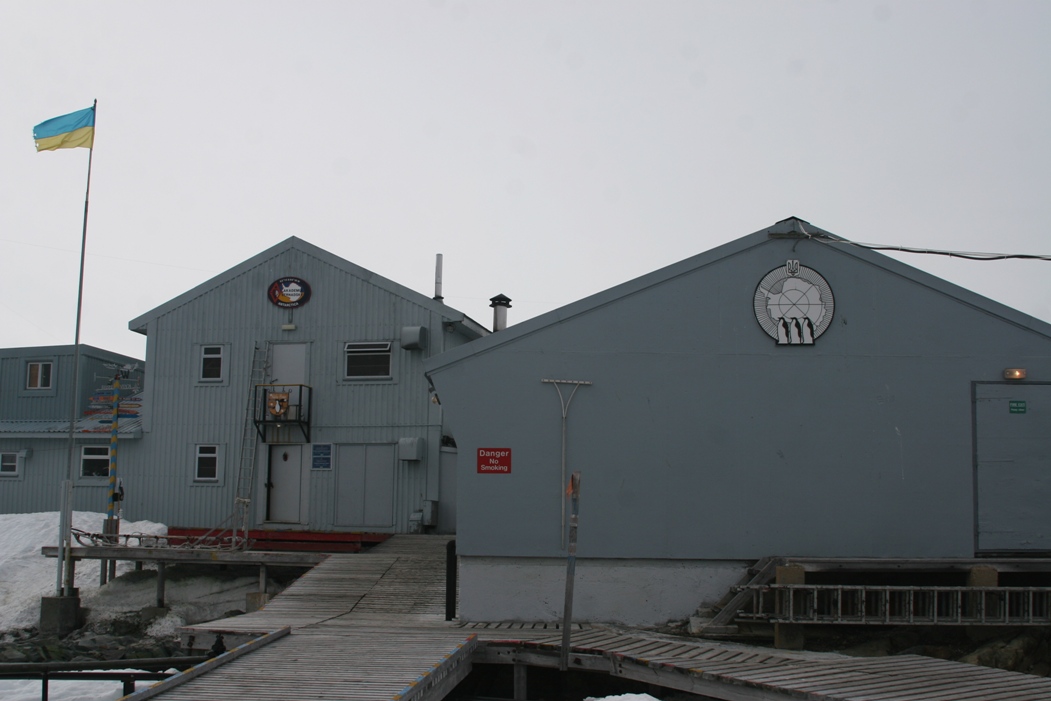
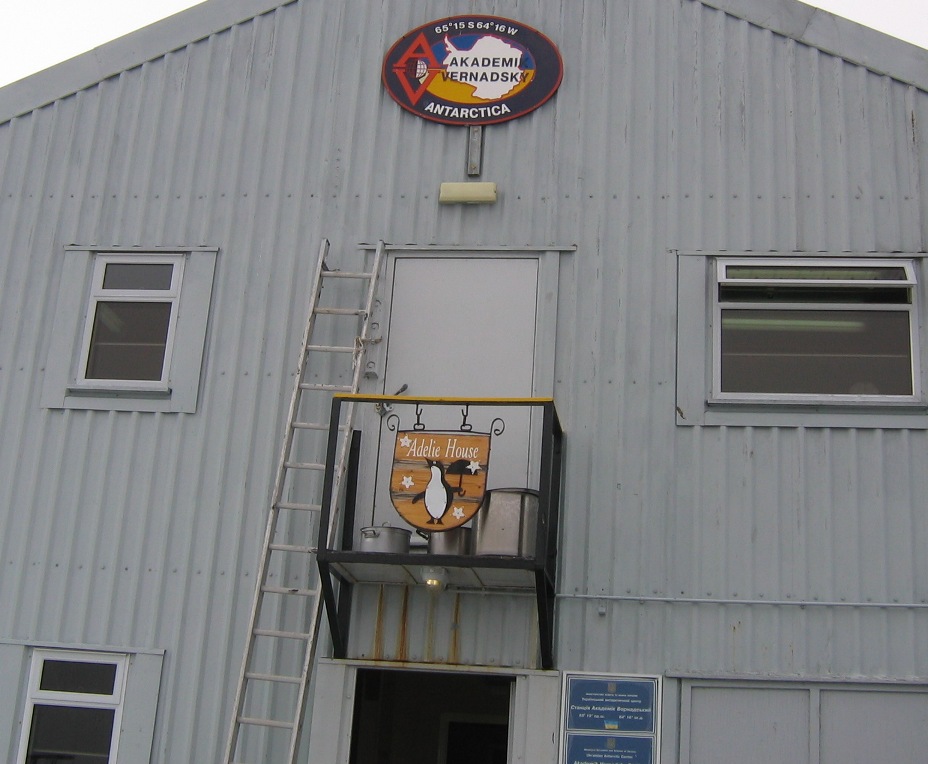
Looking at the outside of Vernadsky Station.
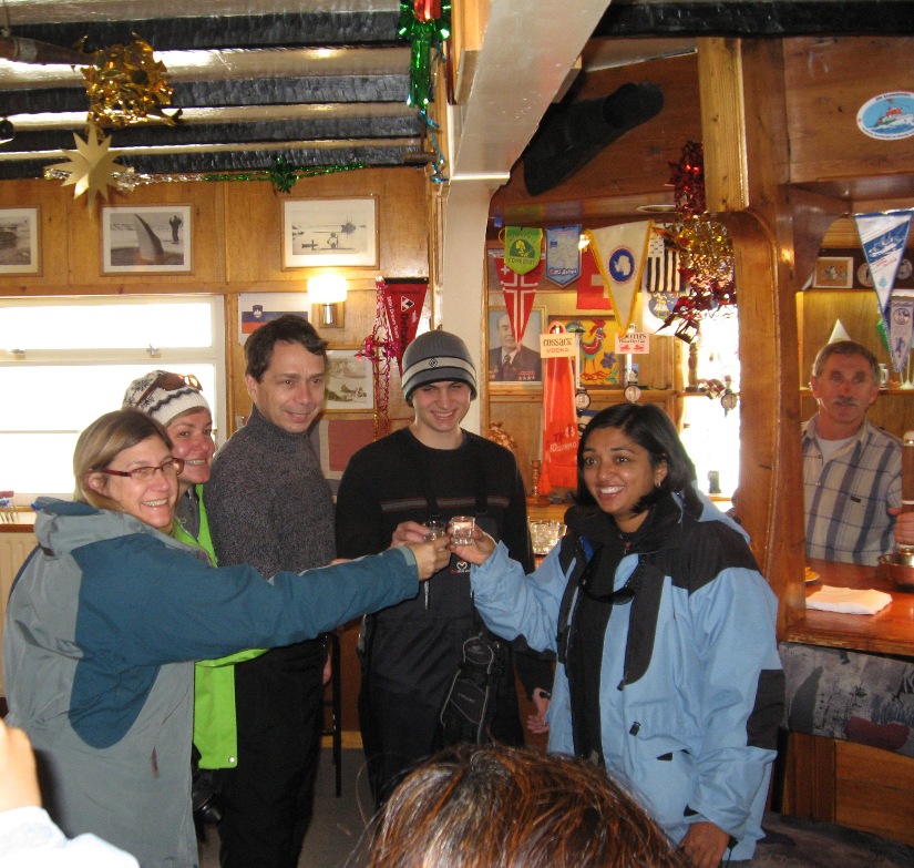
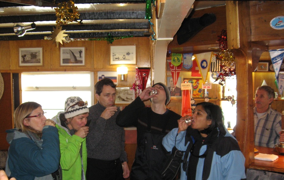
British, American, and Canadian tourists sample Ukranian vodka at a bar in Antarctica.
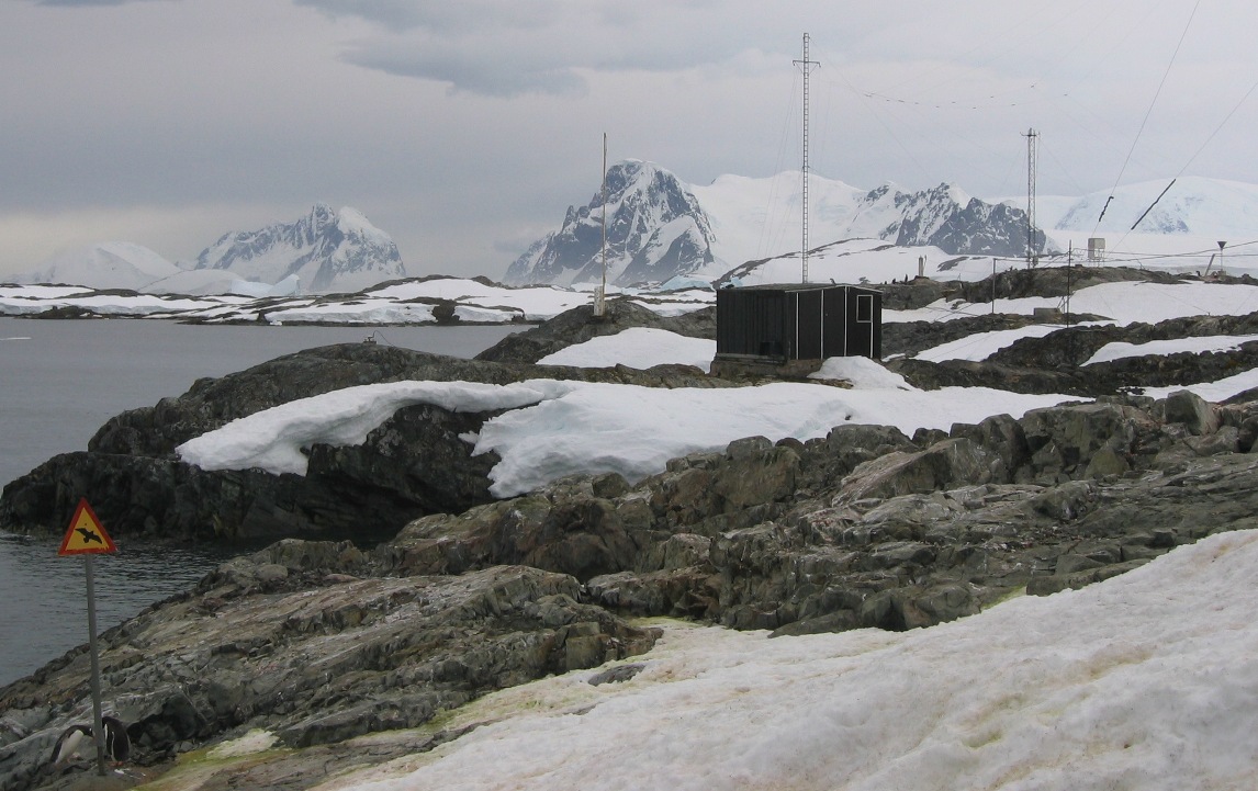
The "front yard" of Vernadsky Station.
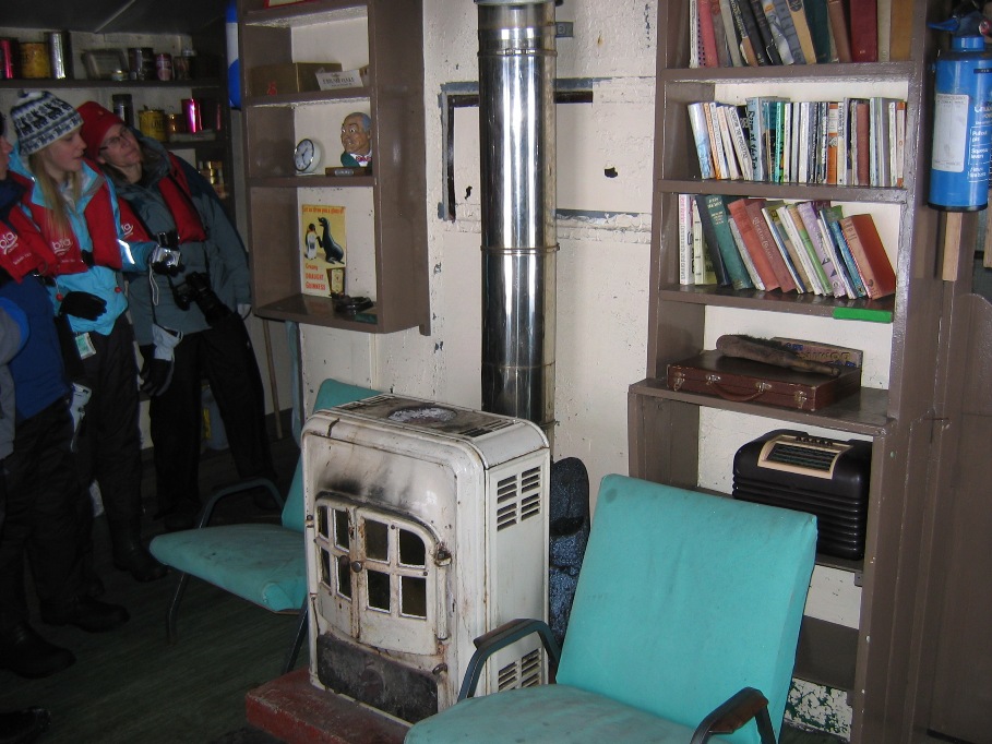
After an hour traipsing around the research station and sampling their homebrew, the zodiacs swept us around to the other side of the island for a peak at an old historic site called "Wordie House." This was an old research station and/or survival hut erected in the 1930's and intermittently manned by the British back in a time when staking out Antarctica claims for sovereignty purposes was a concern for various world powers. The hut has been essentially abandoned but is unlocked and available for emergency purposes should any wayward Antarctic visitor need food and shelter.
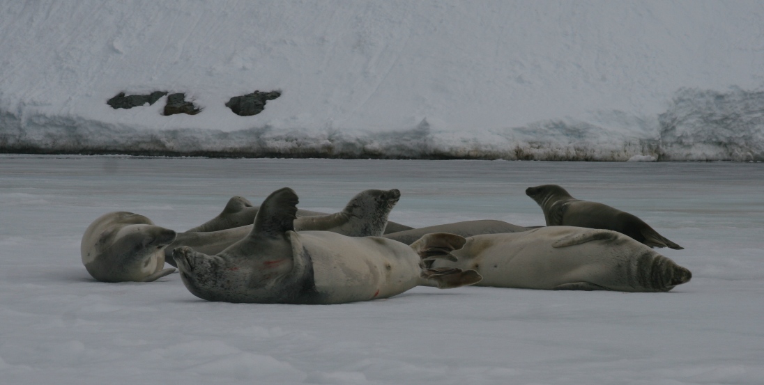
Crabeater seals lounging on the ice sheet in the small harbor in front of "Wordie House."

Commemorative plaque on the door...
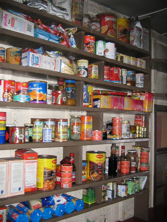
Taking a peek inside - 50 year-old canned goods, yum!
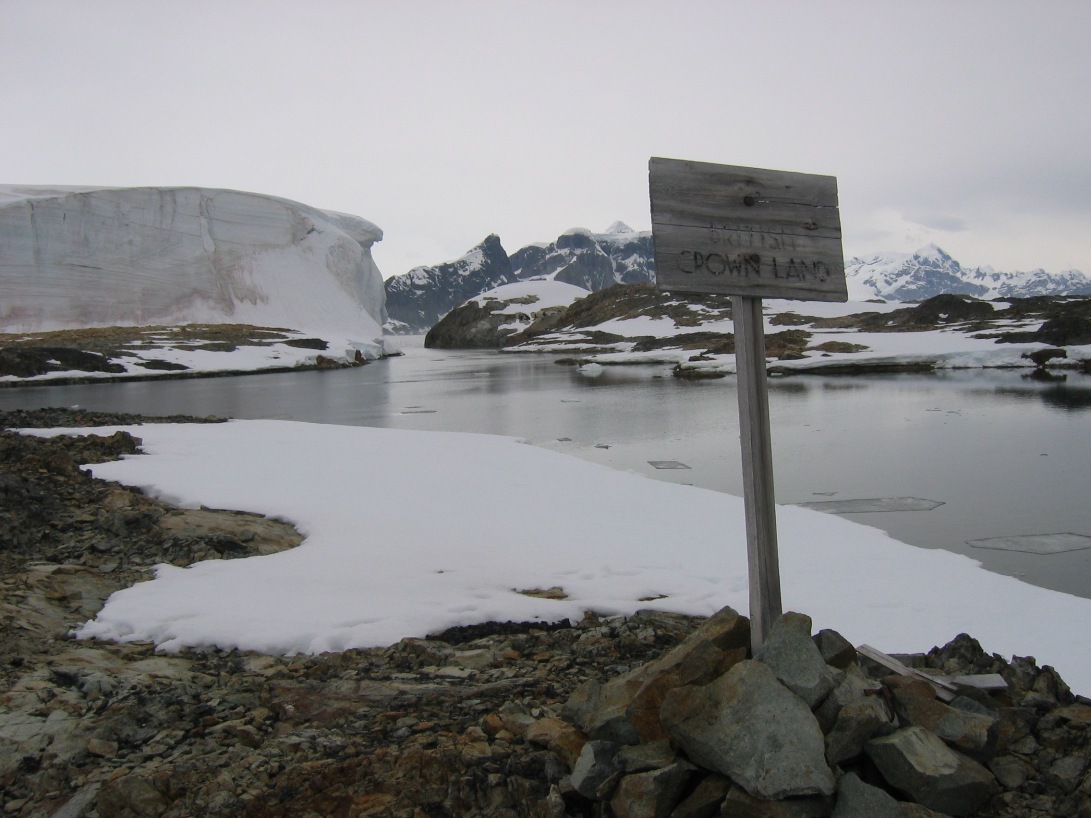
Looking down on Wordie House - and the sign proclaiming the land for the Crown of England.
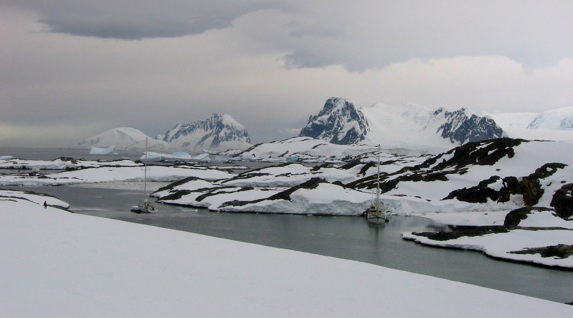
Just who might need to use the shelter? Possibly passengers on tourist yachts that come to visit Antarctica during the summer. These two sailboats were sitting at anchor in a narrow bay just on the other side of the small island.
**********************************************************
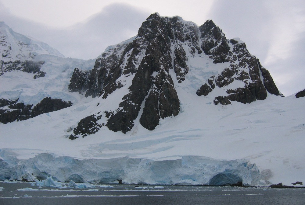
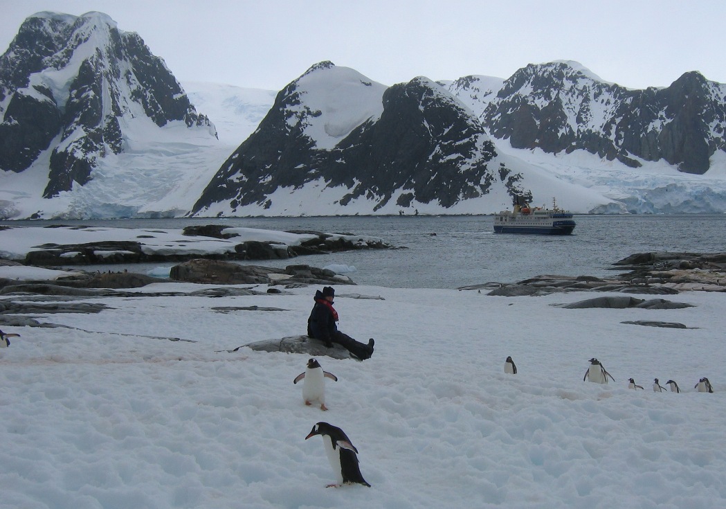
Our shore-visit for Sunday afternoon was on Petermann Island - a one mile long island that lies just below the Lemaire Channel in the Wilhelm Archipelago. The island was discovered by the German expedition in 1873 and named after a German geographer. The zodiacs took us ashore at a cove on the southeast side of the island, the site where French explorer Jean-Baptiste Charcot over-wintered in his wooden ship Porqui Pas? (Why Not?). Our expedition historian, Frenchman Louie, pointed out the rust marks on the rocks that had been made by bolts and chains set in place by Charcot's crew in order to prevent icebergs from drifting into the harbor and damaging his ship. Those marks, a small tide-mark etching, and a rock commemorative cairn are the only remaining remnants of his expedition - and other than the footprints that modern tourists leave in the snow, the only sign of human presence on the island.
These days, it's all about the birds - penguins, Blue-Eyed shags (a type of cormorant), and predatory skua all nest on Petermann.
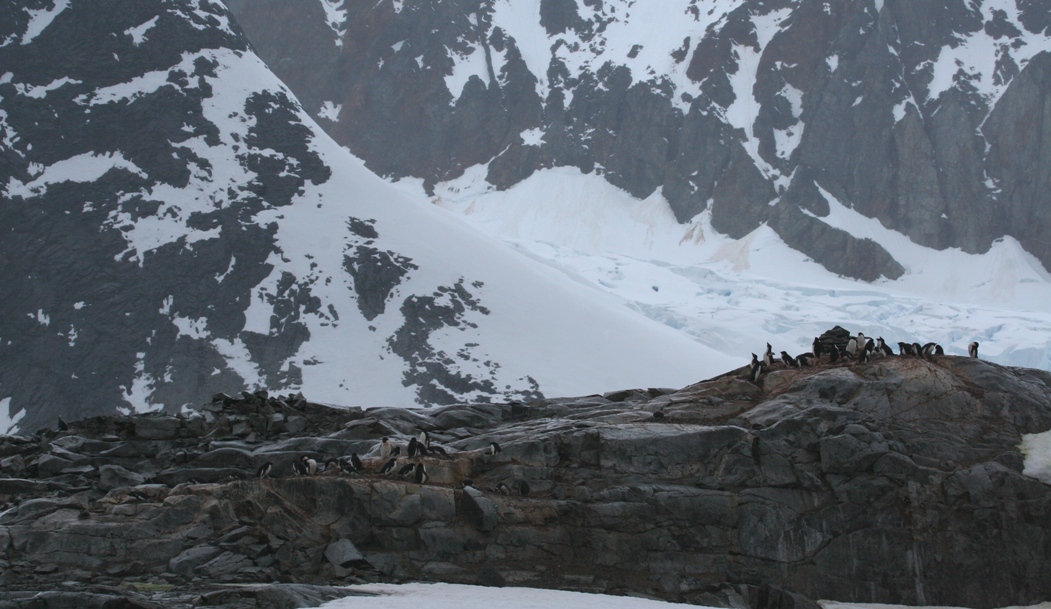
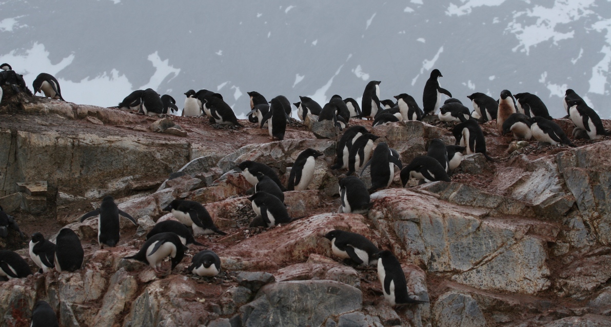
Massive penguin breeding colony covers the exposed rock portions of the island. The species intermingle in a breeding colony, and on the same section of exposed rock you may find...
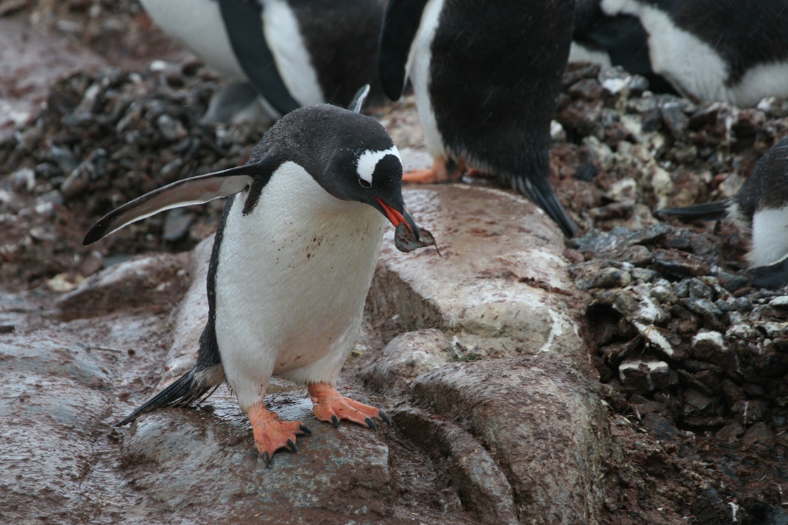
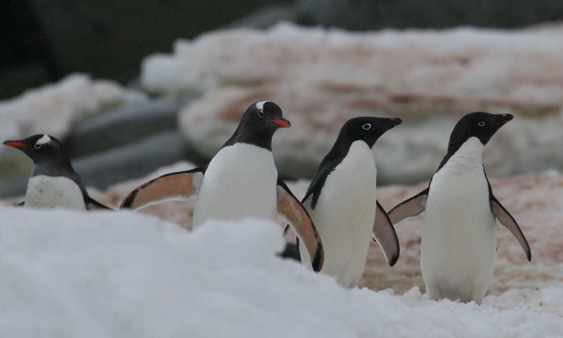
Gentle Gentoo,
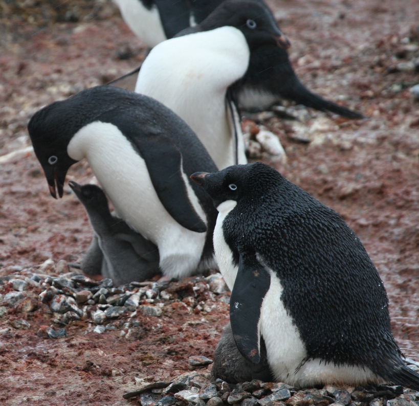
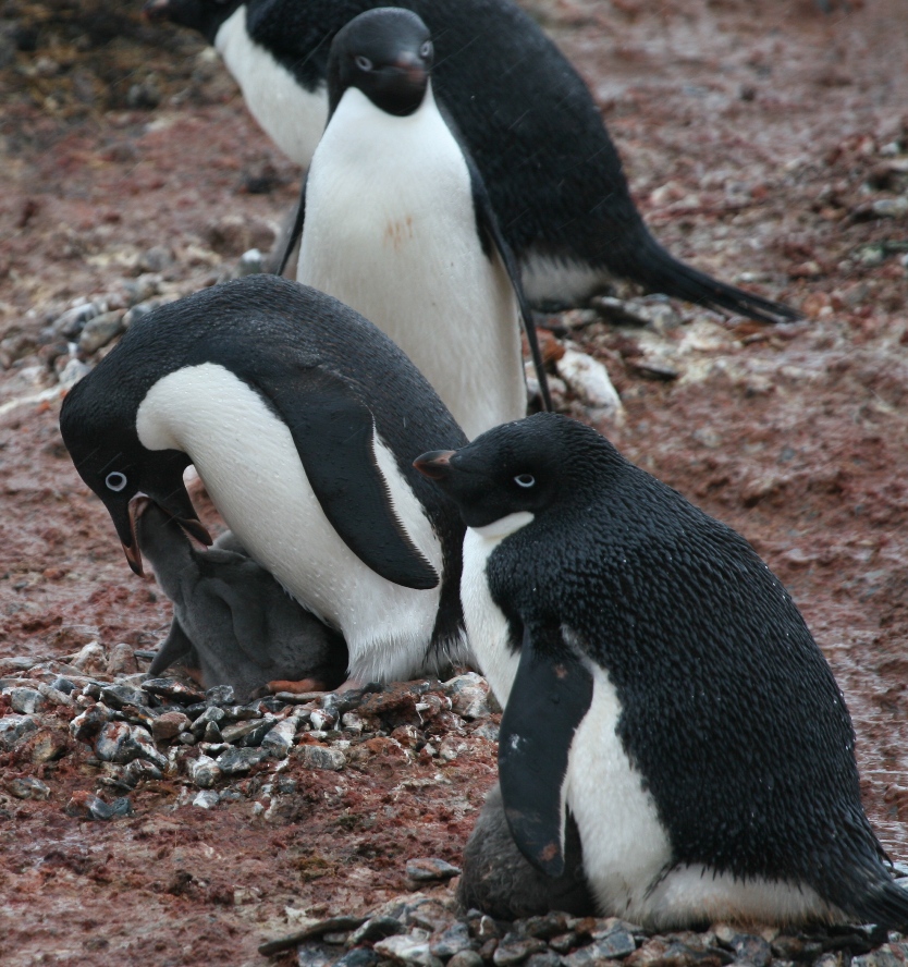
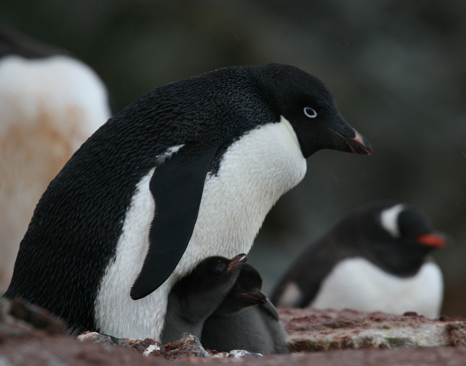
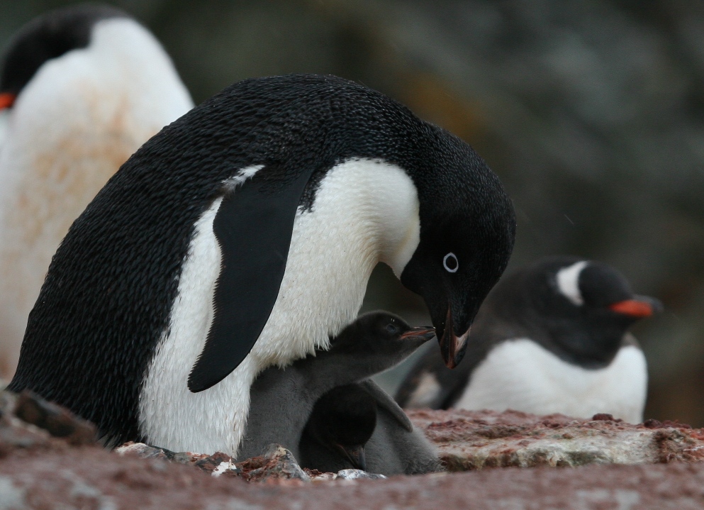
Adelies with chicks,
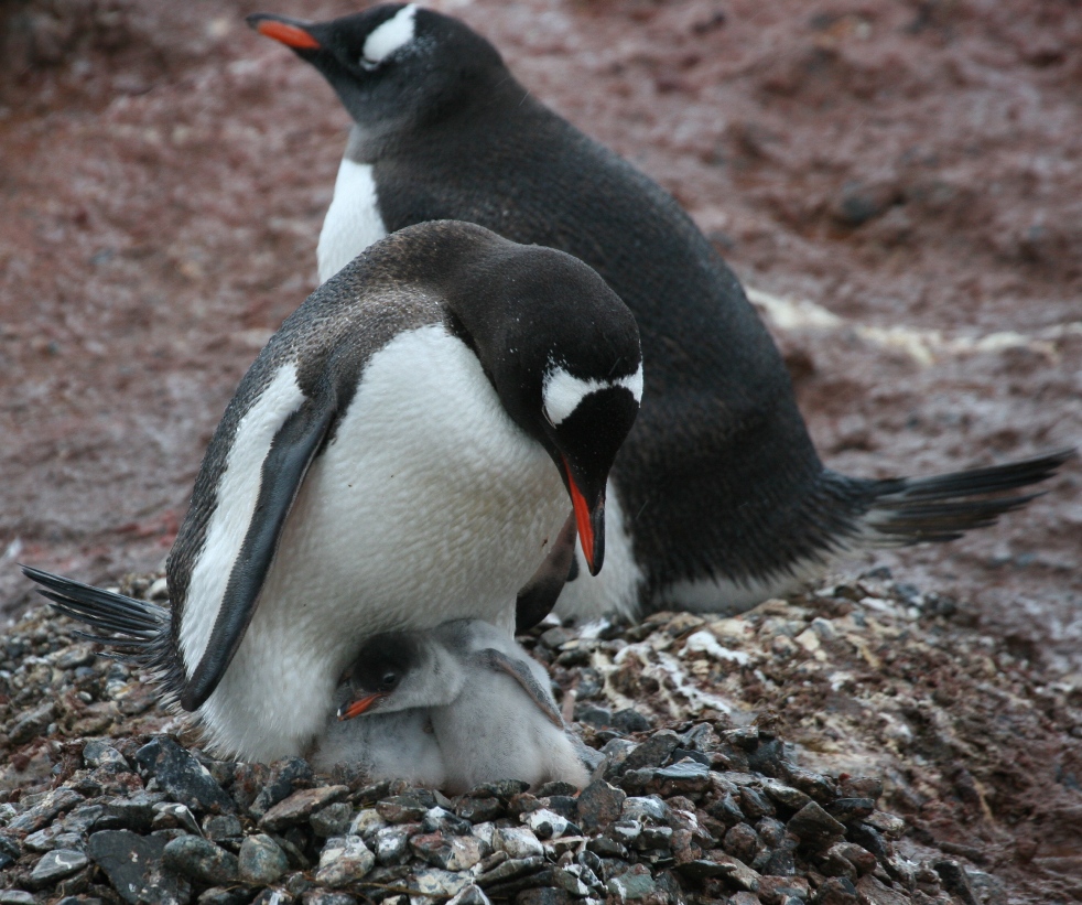
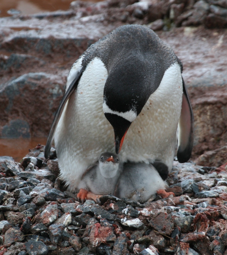
Gentoo with chicks,
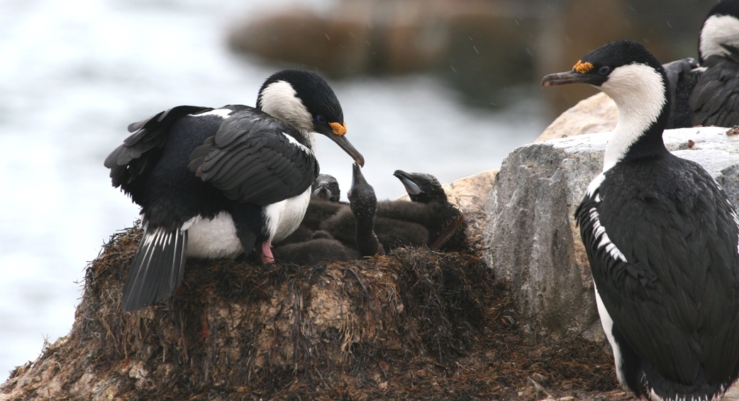
and Blue-eyed shags with chicks.
And after watching penguin shenanigans for an hour or so, we climbed a hill to look down into an icy lagoon.
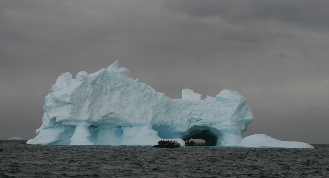
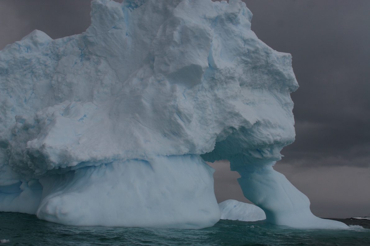
After dinner, the expedition staff took us out for one more brief zodiac cruise, just to clear our heads with fresh cold air and give us some more up-close views of enormous icebergs. The heavily sculpted bergs have obviously been floating around at sea for many months and perhaps even several years.
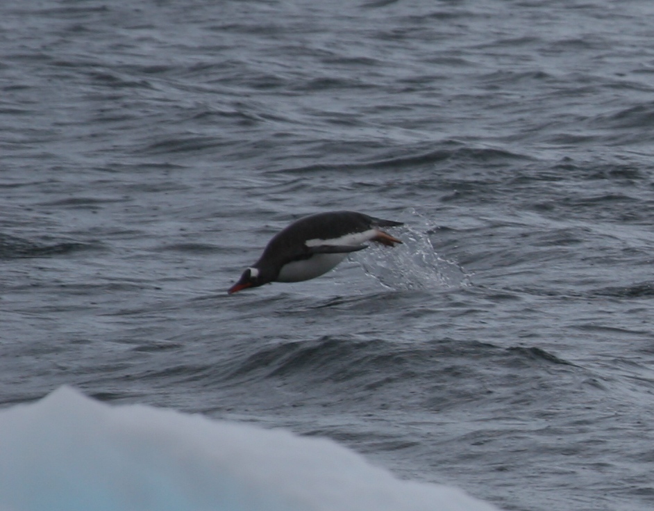
And what else can I say about penguins - we still enjoy watching them for hours on end...
-Rolf