Esquel - Parque de Los Alerces
Riding That Little Old Train, More Big Old Trees , & Outlaws
Sunday March 16, 2008
Since these journal entries generally focus on the highlights of what we did and saw, a lot of detail is left out. But matters of everyday living and interaction define what it's like to be in a place, and certainly to live there, probably more so than spectacular natural beauty, museums, and the details about all the typical tourist destinations.
In other words, I suspect that someone probably wants to know what the price of gas is in Argentina. OK, I know that someone wants to know the price of gas in Argentina. Along that end, and a few others, I decided to write down some more information and observations about the country, but a few short sentences quickly turned into a few medium length paragraphs. How can you describe a country in a sentence or two, especially if you haven't even visited the main cosmopolitan and cultural center of the place? It's like trying to describe France without knowing Paris. Well, we haven't visited Buenos Aires (yet), but still I tried to describe some general history and some other aspects of Argentine culture along a meandering path leading towards the answer to the question that every American surely wants to know. So if you'd like to find out the current price of gas in Argentina, you can find the answer, eventually, here:
A Bit More General Information About Argentina
Now returning to the topic of where we are and what we are doing...
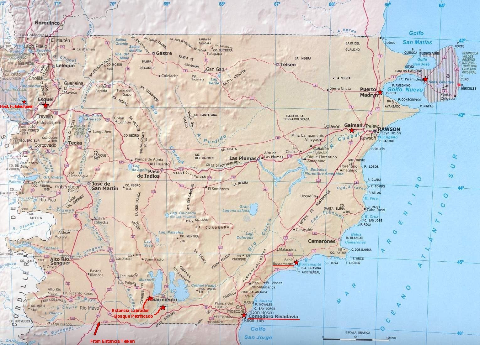
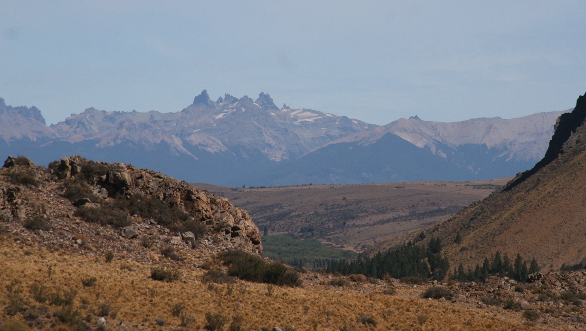
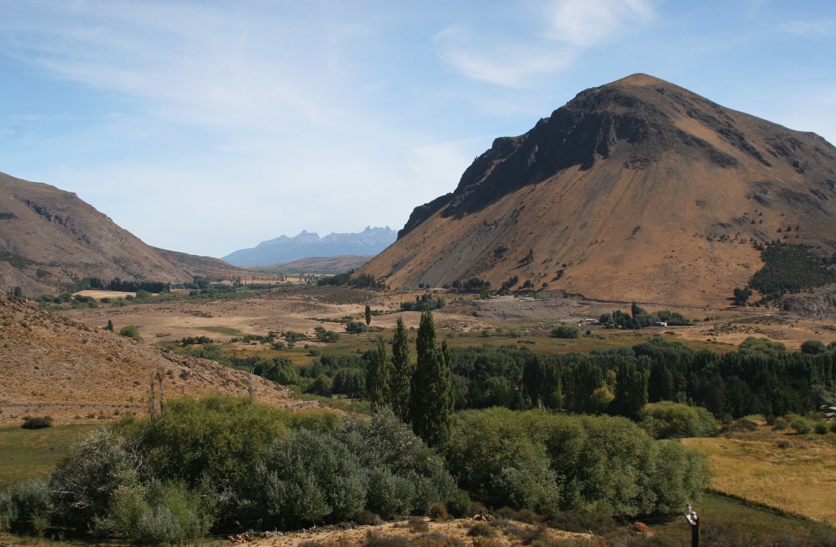
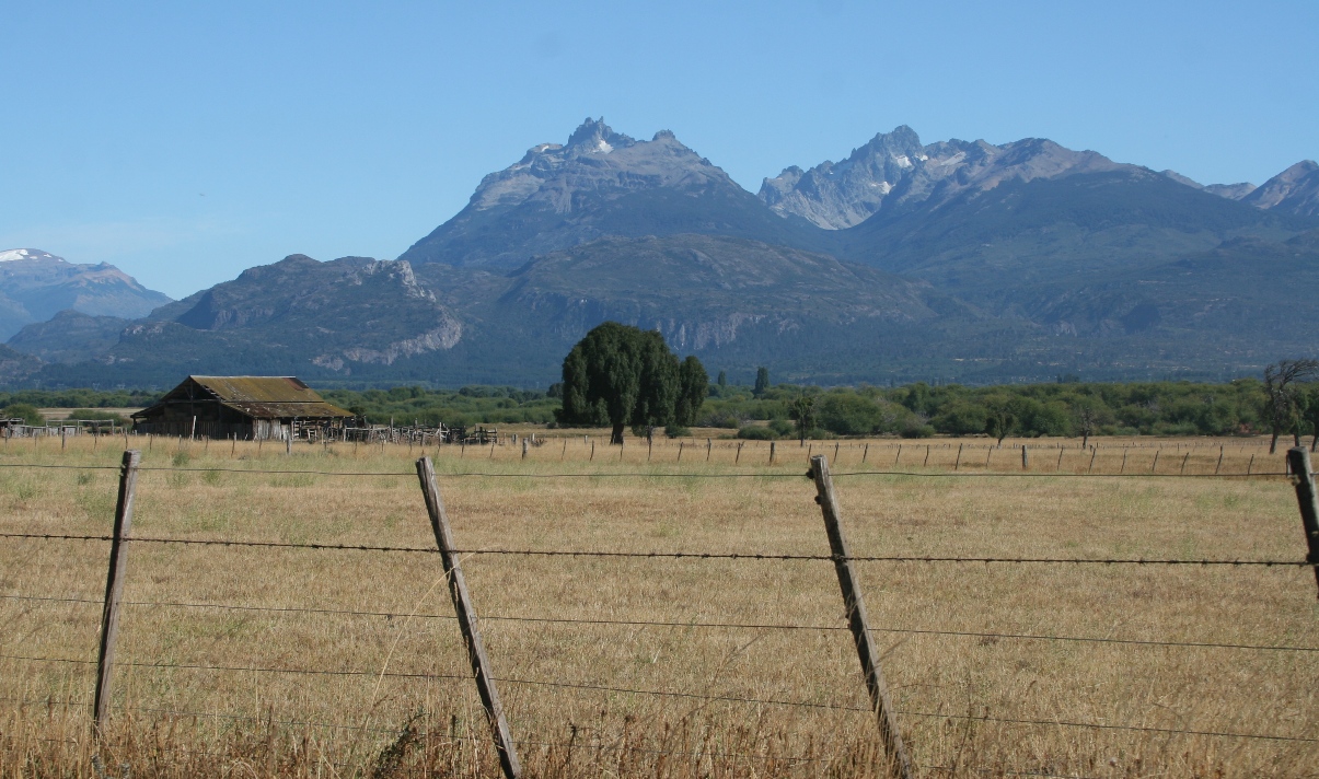
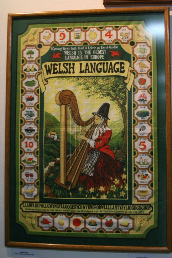
You can see from the map of Chubut province that Esquel can be reached from the east by following the Chubut river and then one of its southern branches towards the mountains. This is exactly what the Welsh settlers did back around the turn of the 20th century. We followed the Chubut river only as long as the paved highway 25 does, and continued along the same road after the river meandered northward and the pavement took a more direct eastward track towards Esquel. Regardless of the exact route taken to arrive here, one will find the heritage in the region at least as strongly Welsh as it is in Gaiman and Trelew.
The nearby village of Trevelin is littered with those Welsh tea houses, and the brick building of a large former grinding mill has been converted into a cultural museum. Esquel is bigger and dustier, and here the Welsh heritage has been well diluted by traffic, concrete, and tourist enterprise having nothing to do with the history of the place. In that sense, Trevelin and Esquel are a pair of neighbors somwhat analogous to Gaiman and Trelew back over by the coast.
We've spent the last four days in Esquel and the nearby Parque Nacional de Los Alerces, both found in the northwest corner of Chubut Province.
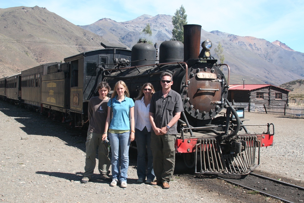
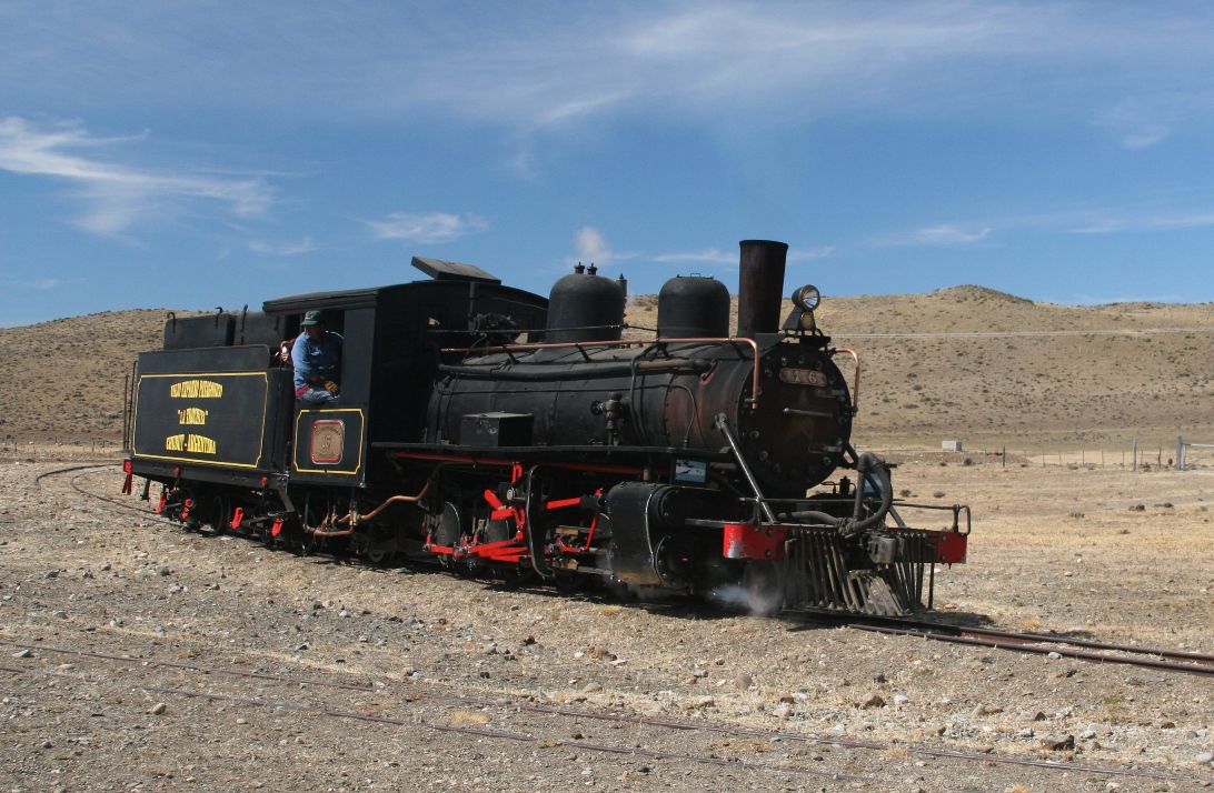
I don't think there are any dinosaur museums in Esquel, but there is a small ski resort (not too useful in late summer), and access to a working section of the old small gauge Patagonian railroad. Without snow on the ground Thursday (it was actually very warm and sunny), the logical thing for us to do after the usual "as-much-as-we-can-whenever-we-can" schoolwork session, was take a ride on that little train.
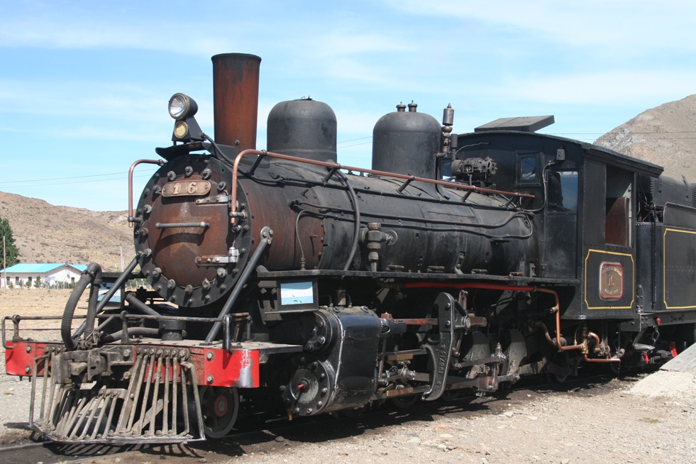
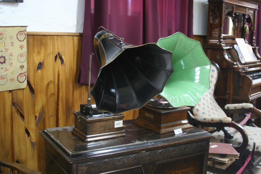
After Paul Thoreau wrote a book and renamed it, most North Americans know this railroad as "The Old Patagonian Express," although I almost hate to include the name because it isn't really the right name, and as one guidebook notes, it is anything but "express." "La Trochita," or "The Little Track," is a Mecca of sorts for train lovers from around the world.
The planning of this railroad began before WWI but construction didn't begin until 1922. The decision for the small gauge used in its construction was made primarily because it was what was used for supply trains during the war and the assumption was that they could pick up army-surplus railroad-building materials on the cheap.
With what we have seen to be typically Argentine (and energetically besmirched by Argentineans) speed at building transportation infrastructure, the train took almost forever to build. Operation on a small stretch began in 1935, but by the time service was provided on the full 400 kilometer line in 1941, the railroad was already a nostalgic throwback. Originally used strictly for freight, and primarily for hauling wool from estancias, passenger service didn't begin until 1950. Then the inevitable happened; even in Argentina better roads eventually get built, and with better roads came trucks and cars and cheaper, faster ways to get people and goods to and from places formerly served by La Trochita.
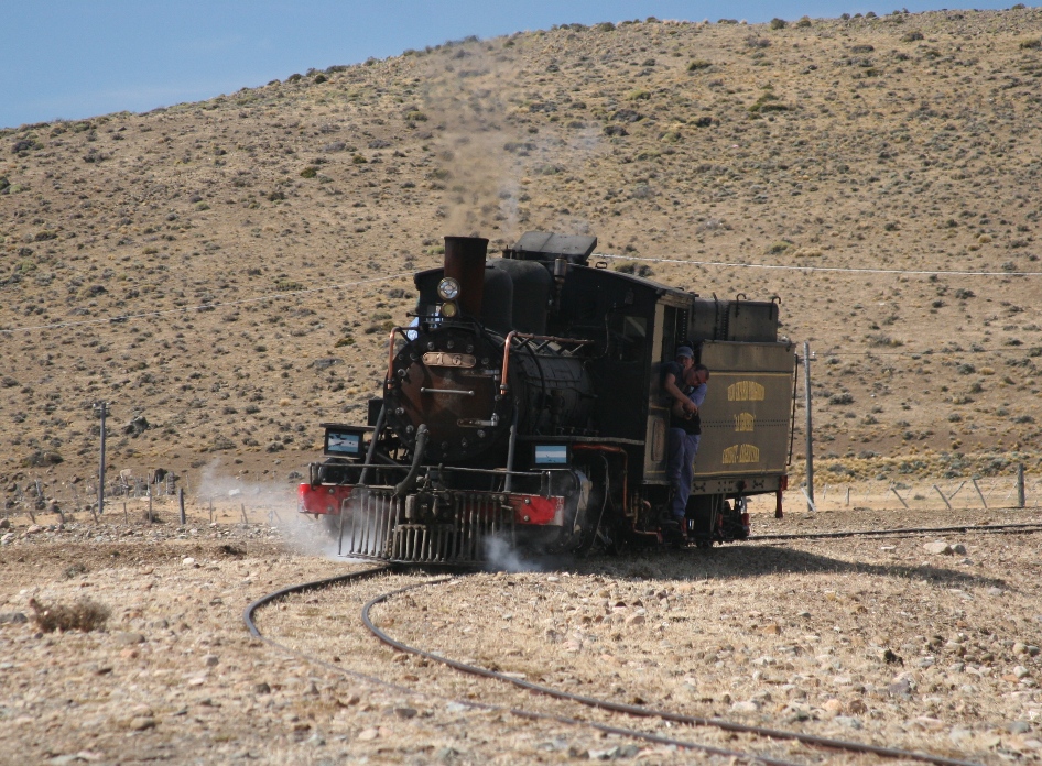
Despite a loving and devoted following of train lovers, the government could neither stomach the cost of continuing service nor find any private investors willing to take over, and they announced plans to shut La Trochita down completely in 1992. After a worldwide public outcry, some devoted, hard-working local people have managed to keep the train functioning on a short stretch of track as a "tourist only" venture. Now people from all over the world, including ourselves, are still able to enjoy a little trip on the little train. One of our guidebooks mentioned that the modern-incarnation of the this tourist excursion used to feature a staged robbery, but they decided to stop doing it after a passenger suffered a heart-attack during the prank.
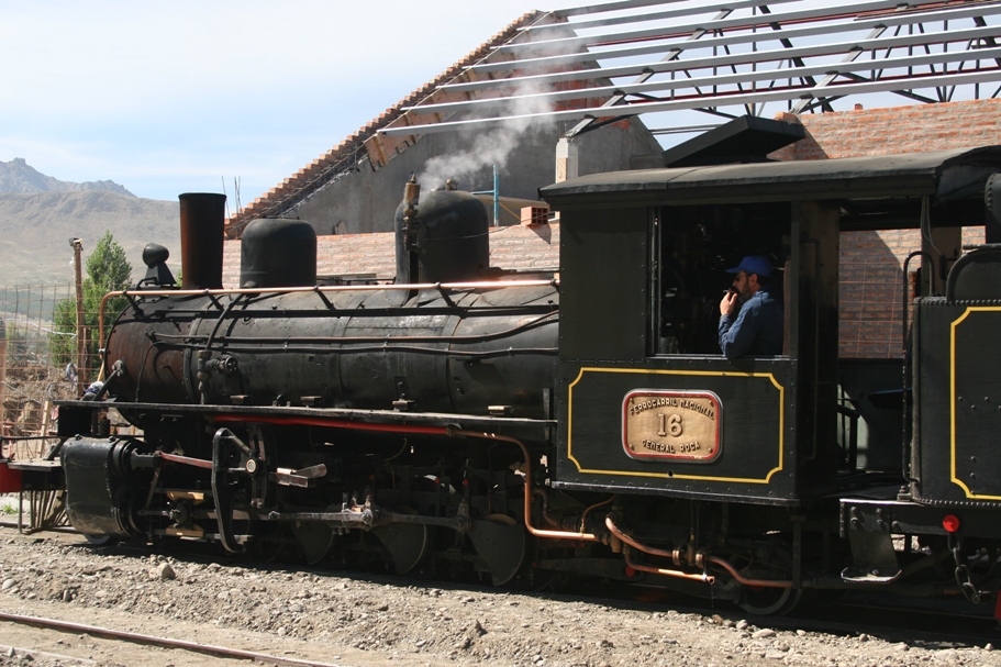
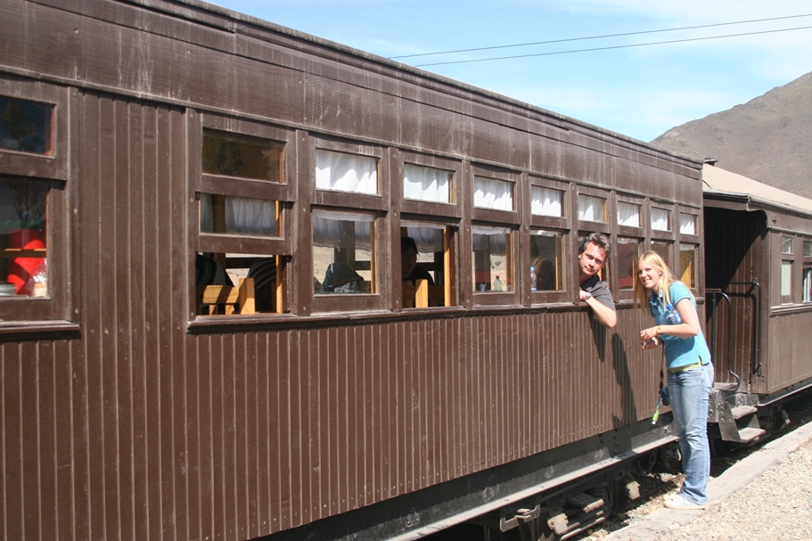
The train sits in the station at Esquel, waiting to depart.
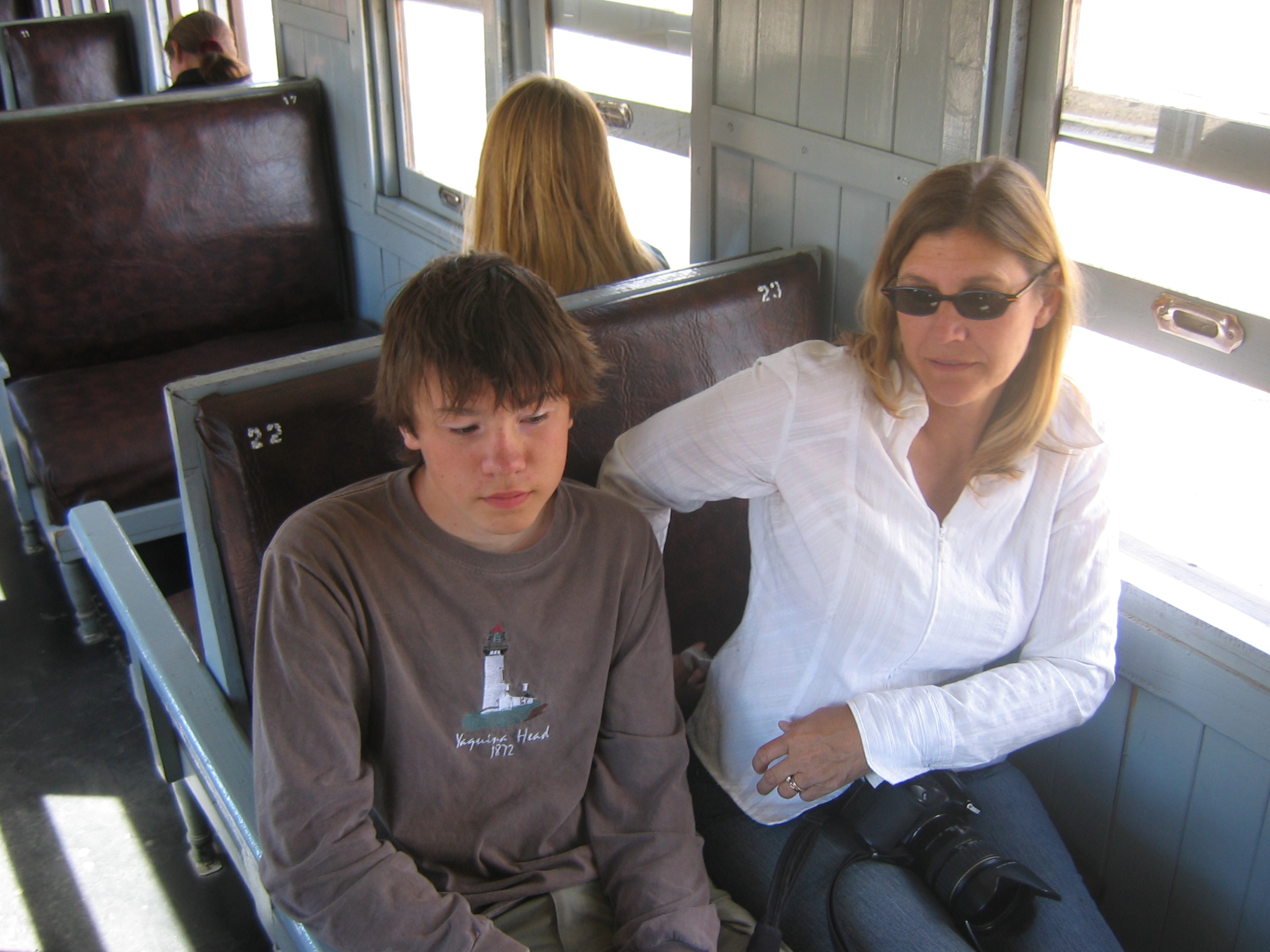
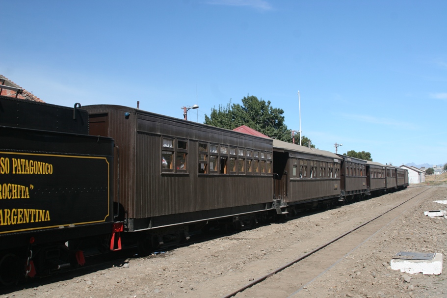
Finding our seats.
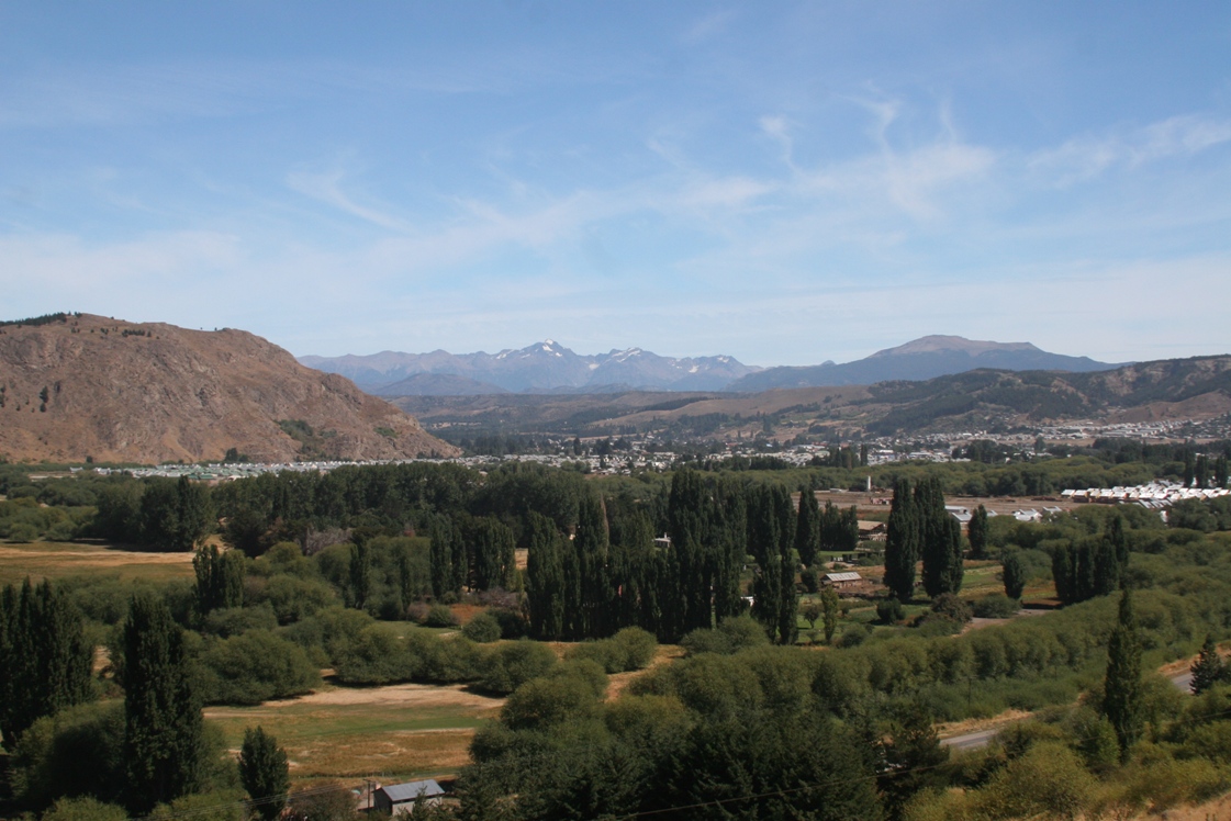
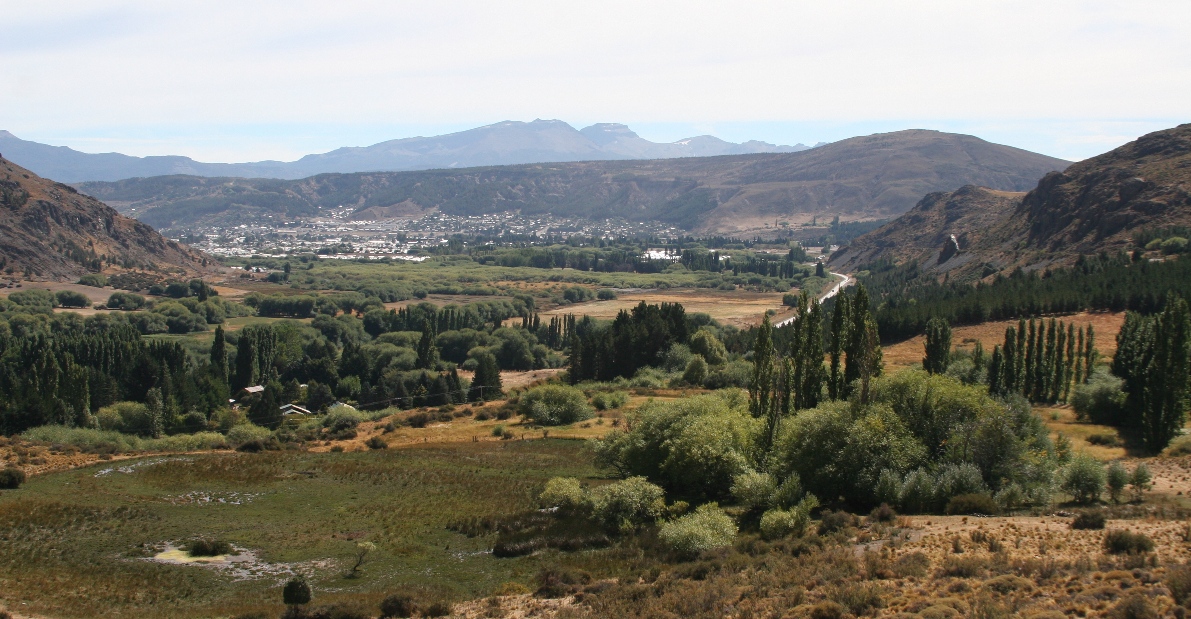
After quickly climbing up along the side of one of those sharp hills surrounding Esquel, the train provides a good view looking back towards the city,
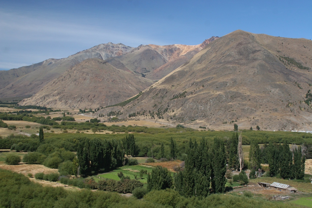
and great views of the valley that the tracks follow towards the north.
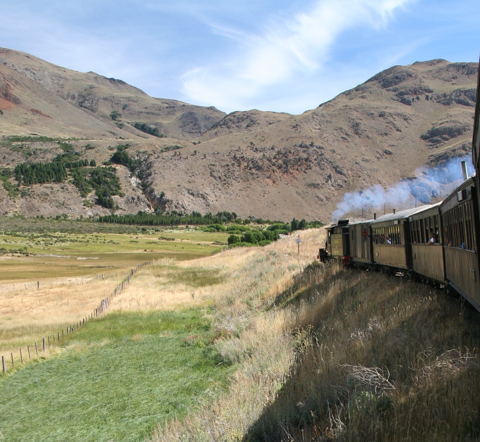
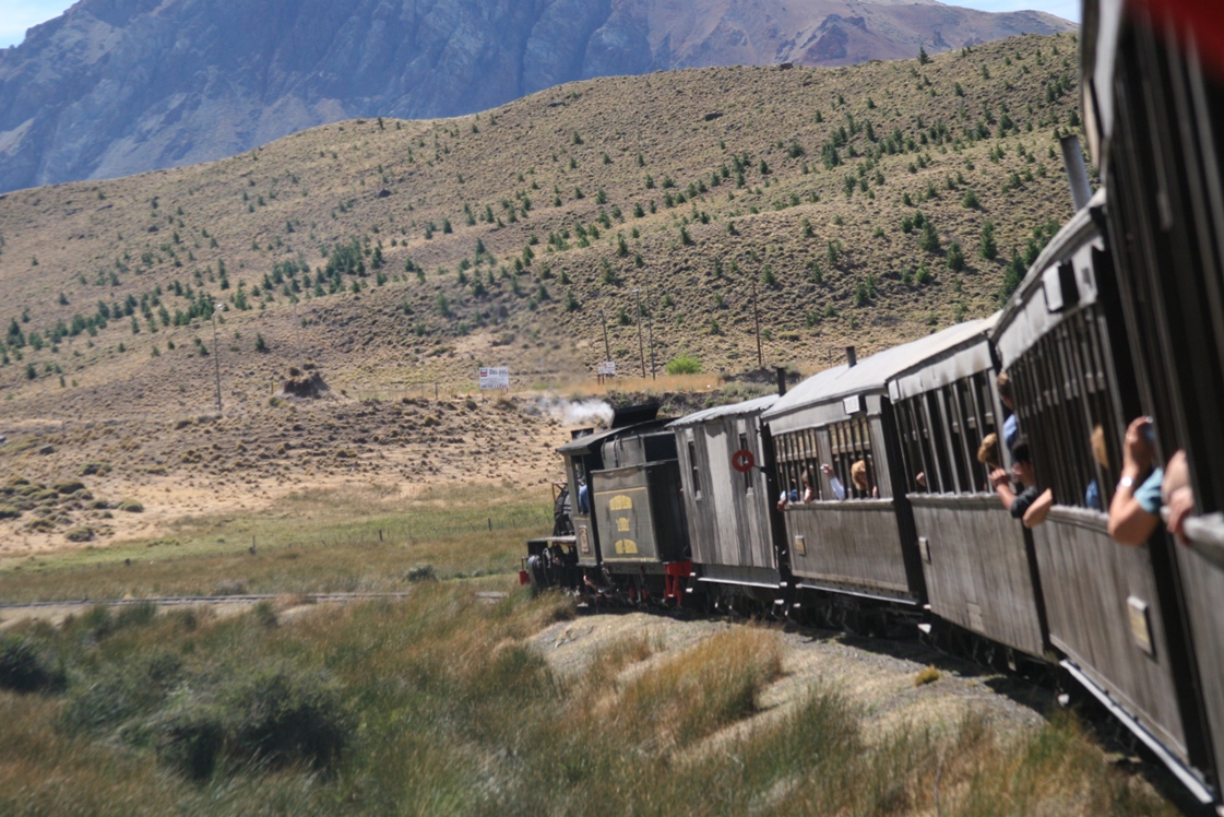
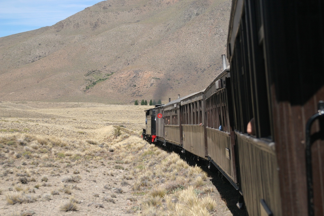
Over 40 turns on the short trip we took - they provide a good opportunity to lean out the window and watch the locomotive.
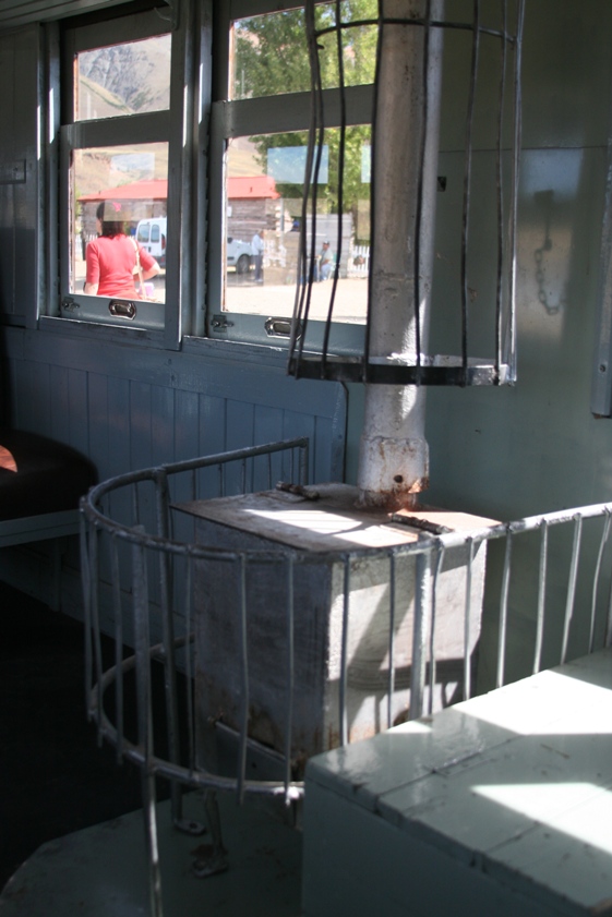
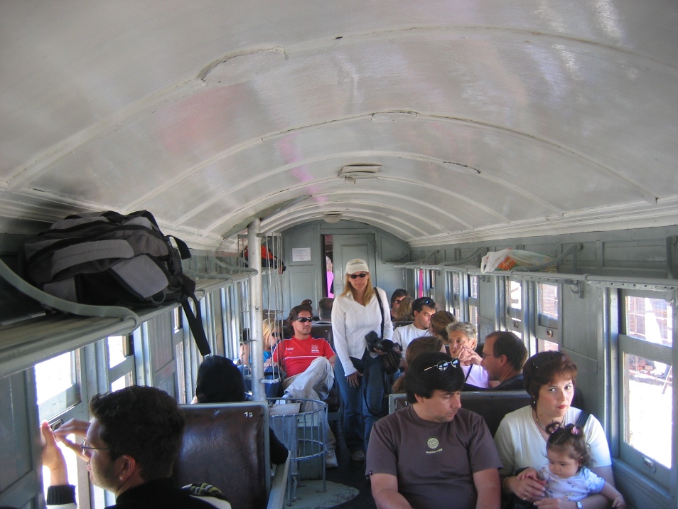
Each passenger car has a little wood-burning stove. Not only did it provide heat during the winter, passengers used it to heat and cook food during the all-day trip along the full 400 Km trip from Esquel to Ingeniero Jacobacci (where they could catch a bigger, "modern" train to Buenos Aires). Our guide mentioned that passengers would have to jump off the moving train (when it was going slow on turns or climbing hills) to gather wood during the long trip.
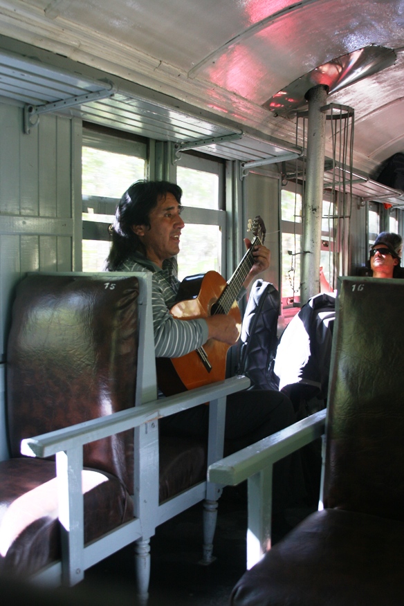
These days, the stove is just a quaint backdrop for the in-trip entertainment.
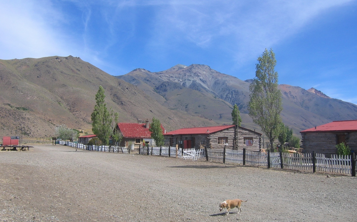
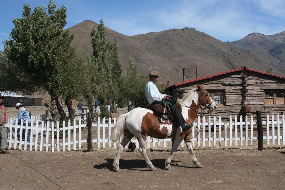
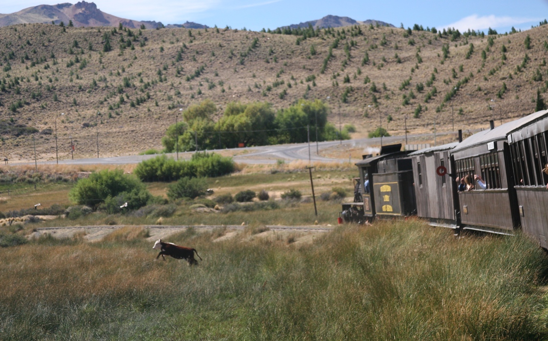
Our 50 peso tickets bought us a round-trip to the first stop north of Esquel, Nahuel Pan, a small station that was used by nearby estancias and indigenous natives of the valley.
The train stopped for about 45 minutes - long enough to allow the riders to buy souvenirs and fresh tortas fritas,
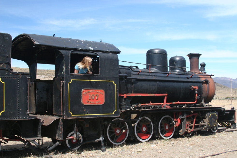
and for the locomotive to decouple, make a tight 180 turn, and re-couple to the other end of the train in order to haul us back to Esquel.
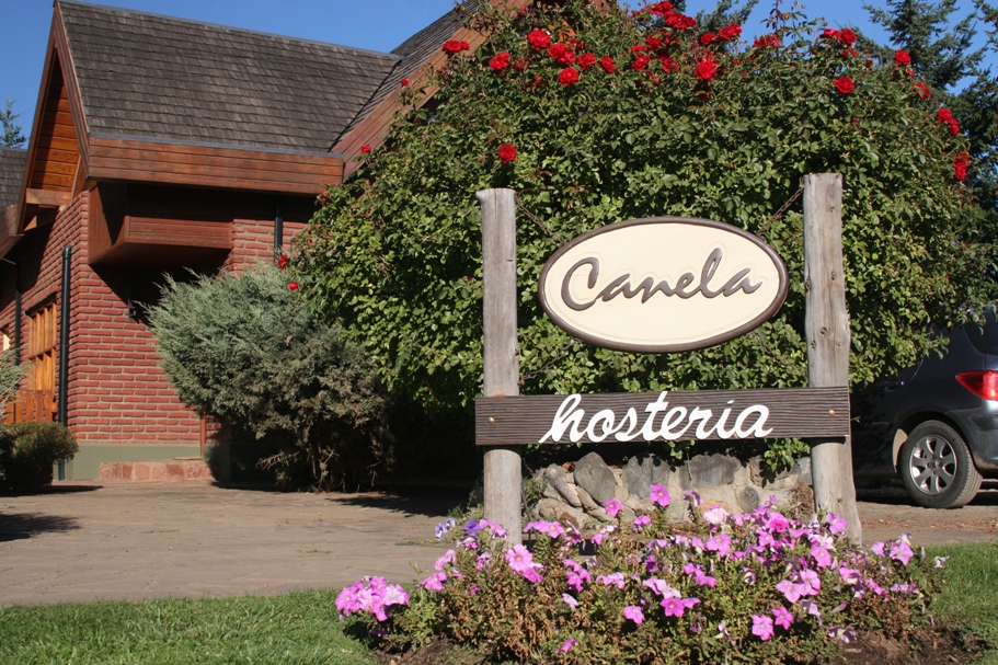
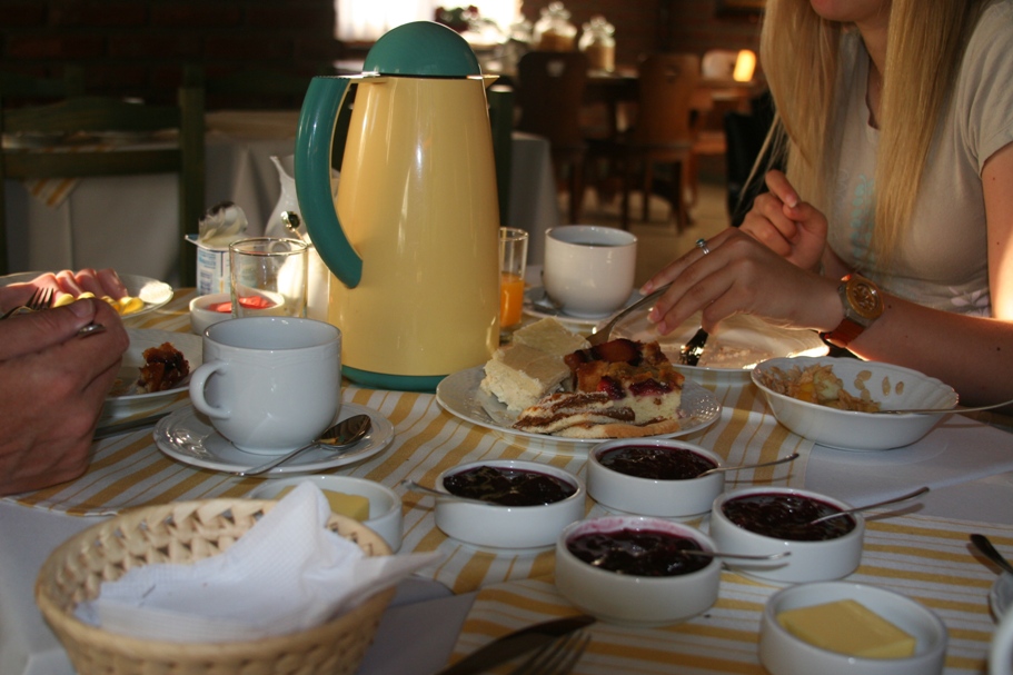
And just in case anyone is curious about where we slept, Nicholas from Hosteria Labrador back in Sarmiento had recommended Hosteria Canela in Esquel - probably because his sister Veronica owns the place along with her husband Jorge (a photographer and author of several pictorial travel books about Patagonia). We were quite happy with our comfortable rooms and even more so with the homemade treats for breakfast. Veronica can cook!
********************************************************
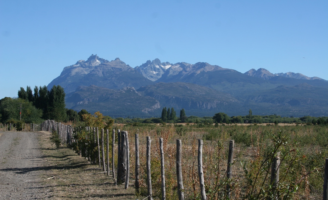
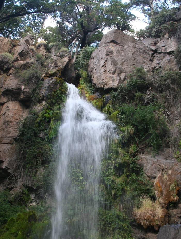
Friday we drove down through Trevelin to visit the museum and take a look at a nearby waterfall. It was too early in the day to stuff ourselves with tea cakes (and the tea houses don't start serving until the mid-afternoon). First we stopped in the town's information center where a helpful young woman gave us directions to the waterfall. Then we drove a few kilometers south of town only to find a gate locked across the tiny access road leading 4 kilometers off the highway to the falls. A crude sign draped over the gate said something like "Closed for Winter." An 8 kilometer round-trip hike on a dusty dirt road with no shade was not in our plans, especially so close to lunchtime. Also, a locked gate with a "Closed for Winter" sign usually means something like "You Shouldn't Enter," and there were no small boys playing in the yard of a nearby police station to show us how to hop the fence (see below), so we simply turned around and went back to visit the museum and have lunch. Then we drove into the national park.
The road to the waterfall was closed, but the drive there was scenic enough...
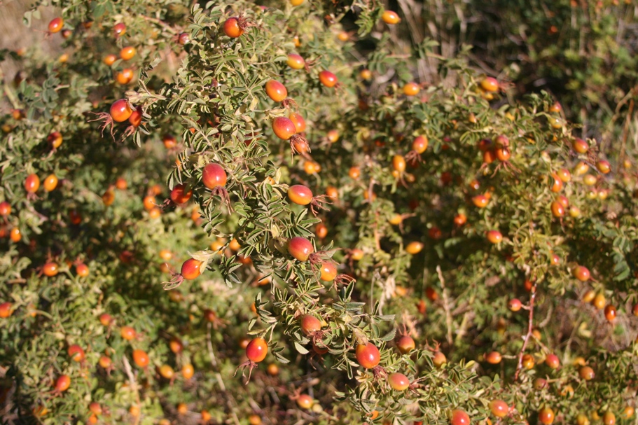
The rosehips of a wild plant (member of the rose family) growing along the side of the road - Laura at Hosteria Las Robinias had called them "musgroves" and she fed us tea and jam made from them.
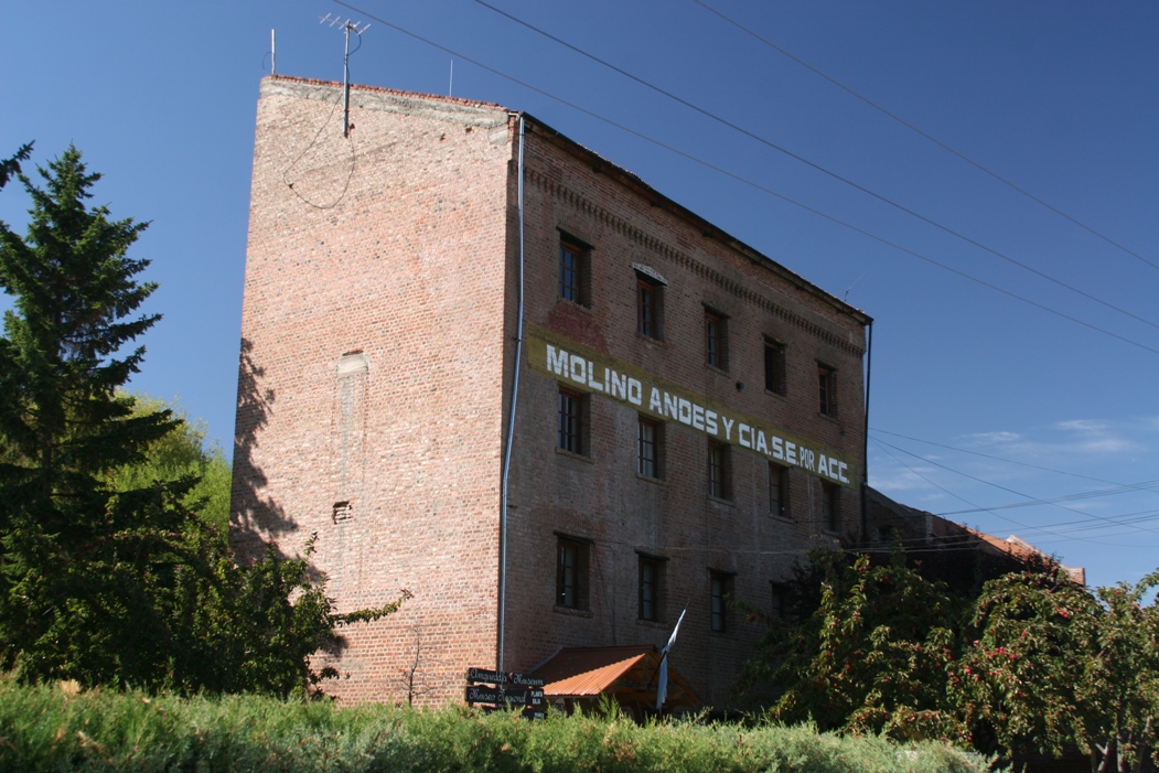
The old mill museum of Trevelin,
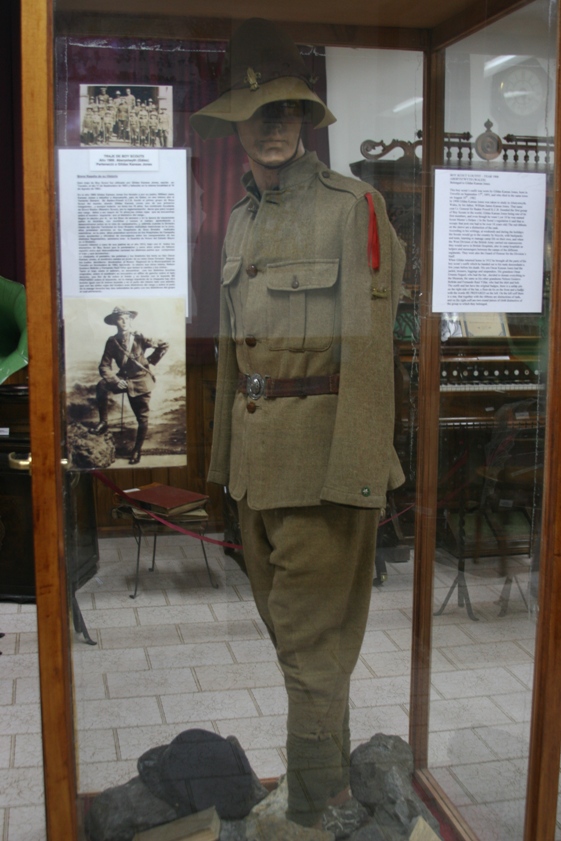
and some of the "memorabilia" types of things on display. The scout uniform was worn by a local man who had visited England as a youth and served with Baden Powel in the original Boy Scouts.
Unfortunately, a bridge on the direct, paved route into the national park was "broken," so as per the instructions from the lady in the information center in Trevelin, we took a slightly out-of-the-way and only partially paved southern-looping route into the park. Fortunately, this time her instructions were sound and we didn't encounter any "Closed For Winter" signs blocking our way.
Parque Nacional de Los Alerces is a huge expanse of real-estate, and all but a small corner of it has been left un-developed and un-disturbed. The primary purpose of the park is to protect (and occasionally study) the last remaining stands of old Alerce trees in Argentina. The park's western boundary is the border of Chile, located almost due east from Chaitén and very near Parque Pumalin - the place we visited back in November and where we saw Alerce trees in Chile.
![]()
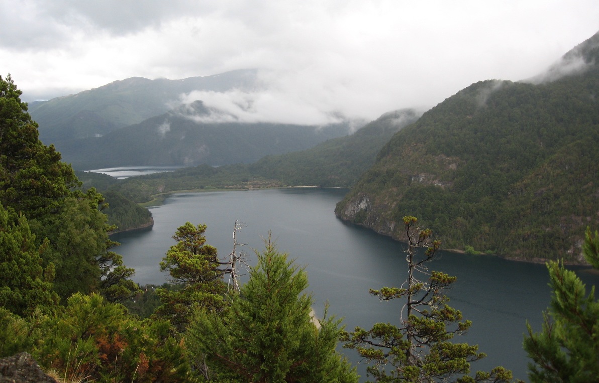
Driving into the park from the southeast, we encountered the first of the park's many lakes. Our trip ended when we found the park's most notable old lodge, Hosteria Futalaufquen. It reminds me of some of the older, elegant lodges in the national parks in the western US, but perhaps a little smaller and less heavily used. The lodge is located near the southern end of the long, narrow, north-south running lake Lago Futalaufquen.
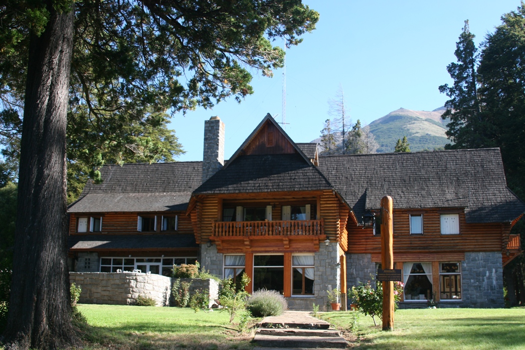
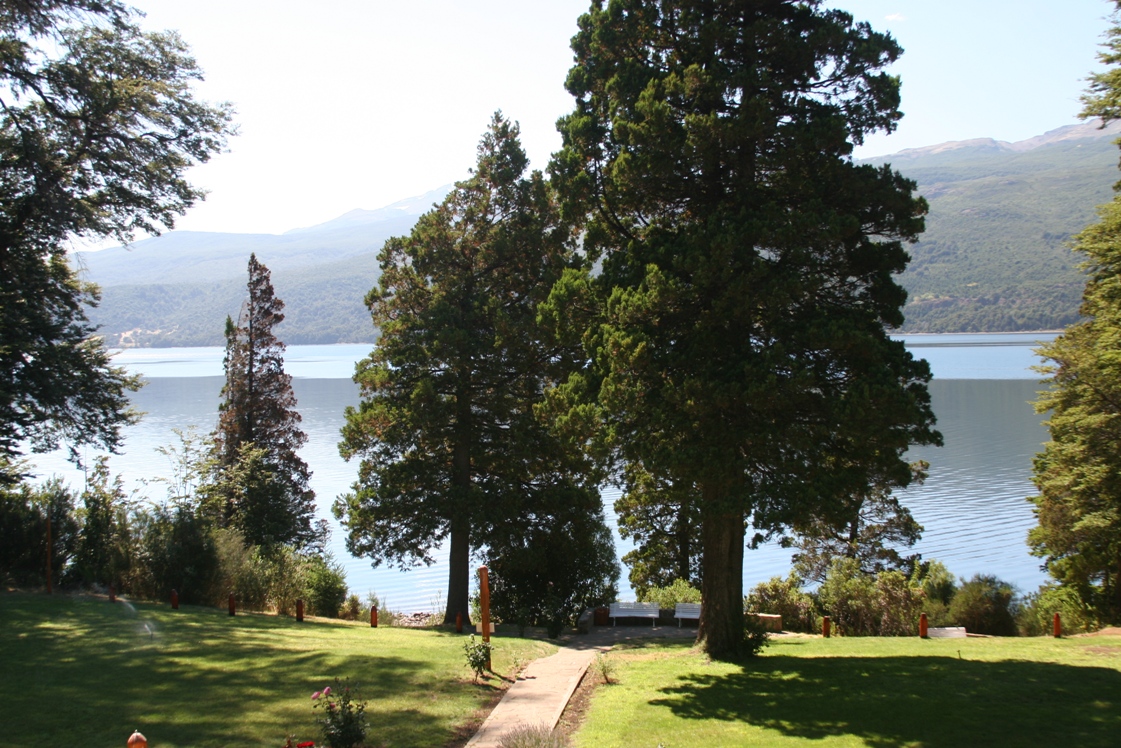
Looking at the lodge, and then looking at the lake from the balcony of our room.
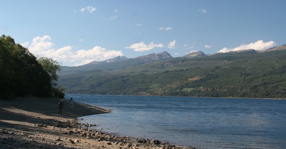
After unpacking at the lodge, we took a hike along the shore of the lake.
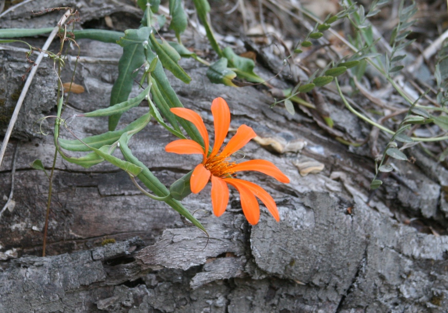
This is an interesting flower, and something we wish we could identify with a name of some sort - it isn't something we often see back home, for sure.
*******************************************************
Yesterday we took an excursion which the operators called a "Safari." It was a 90 minute boat trip (each way) to an undeveloped part of the park. After the boat docked, we took a hike through some Alerce trees and got pretty close to (across the river from) some of the oldest of the old trees in the park.
In search of the source of the excursion (the dock from which the boat departed), we were able to drive north following the eastern shore of Lago Futalaufquen until we passed it completely and reached a parking lot near the southern tip of Lago Menendez. From there, we walked 1500 meters down to the shore and boarded the boat. The guide on the boat explained that the park has three sectors. In the first sector, there are lodges, restaurants, and campsites. In the second sector, people are allowed to enter but only for the day - there are no permanent buildings and you can't cook or even take food on land. The third region comprises the most area of the park, contains the oldest trees and most fragile eco-system, and is completely closed to people other than scientists with special permits to be there.
Walking from the parking lot to the boat dock we enjoyed these views...
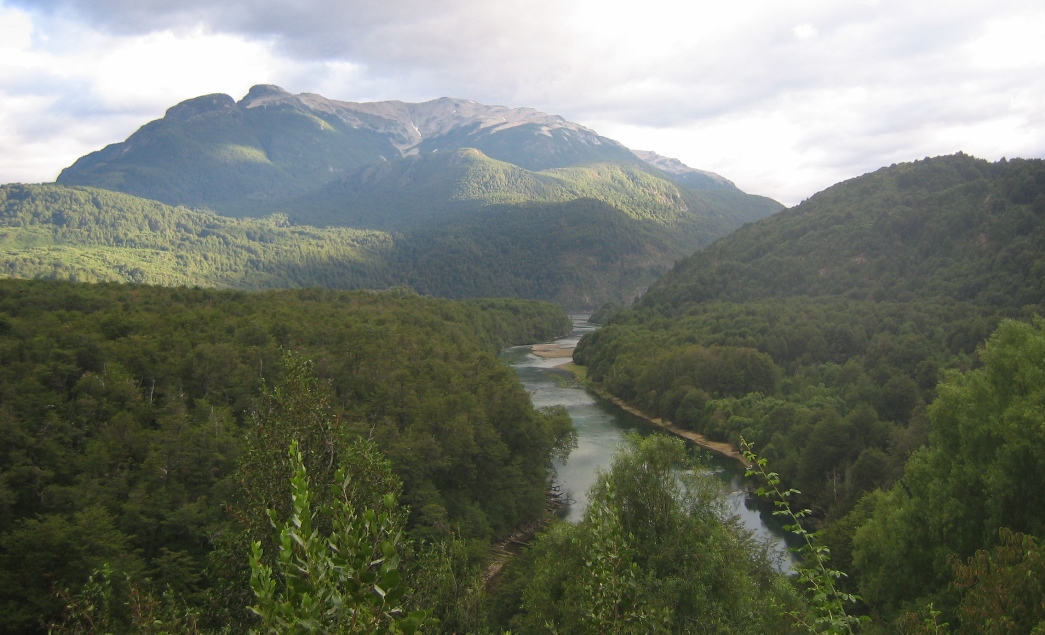
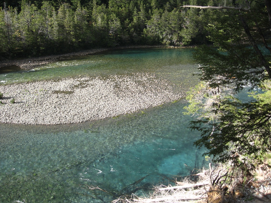
River Arrayanes connects the north end of Lago Futalaufquen to the southern end of Lago Menendez. In the right picture, the river opens up into Lago Menendez.
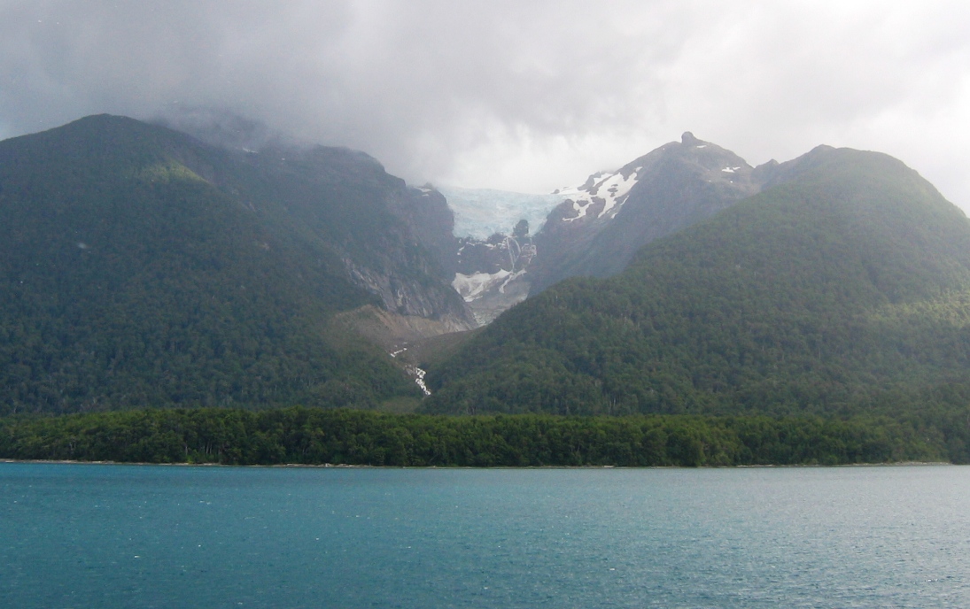
Out on Lago Menendez, the boat took us by a hanging glacier that used to extend all the way down to the water not too long ago. The guide said that it is estimated that the glacier will be gone in 40 to 60 years.
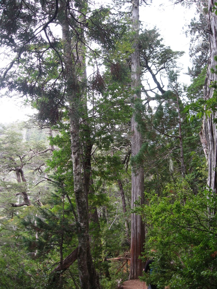
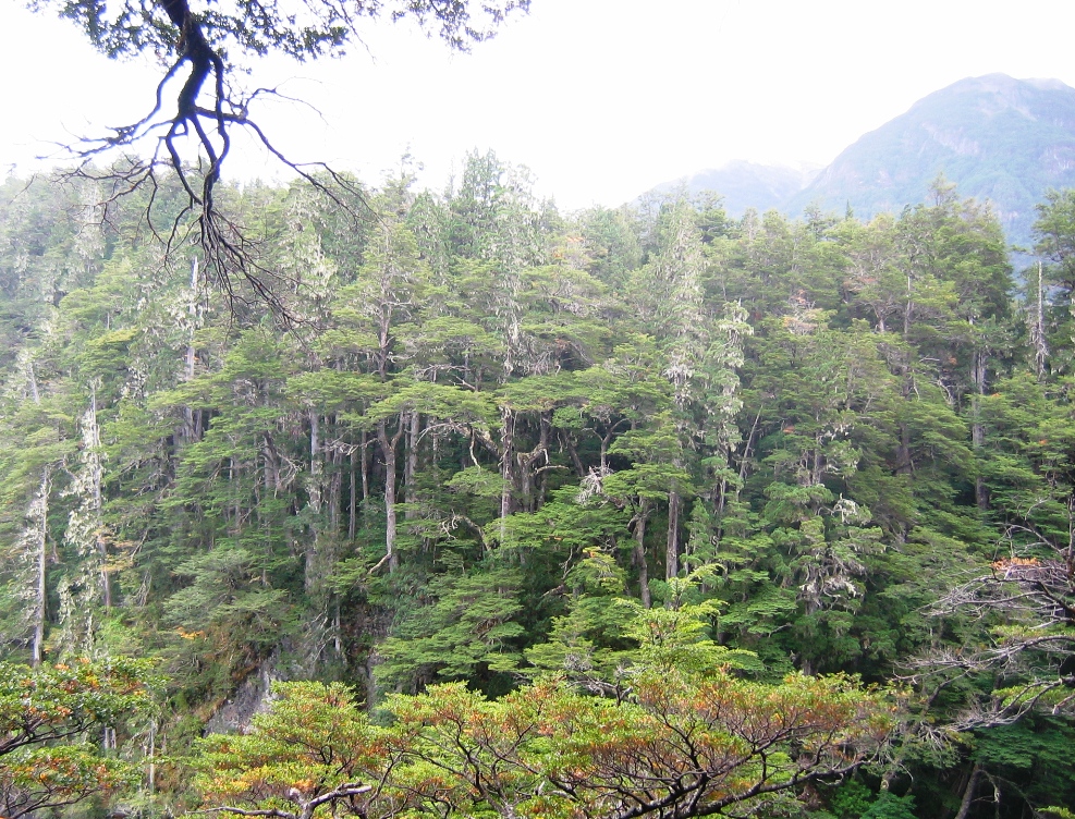
After 90 minutes on the water, the boat reached the northern tip of Lago Menendez and we disembarked (without any food in our pockets or packs) for our walking tour. After walking for thirty minutes through a Valdivian rainforest we arrived at the banks of the river leading from Lago Menendez to Lago Cisne. The forest was similar to what we had seen on the other side of the Andes at this latitude in Chile, but since here on the lee side the rainfall is only 2 meters per year and not 4-5, the vegetation is slightly different and a little less dense.
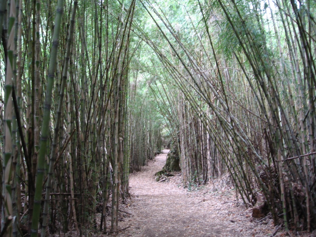
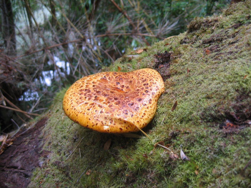
Nonetheless, the cane forest, lichen, mosses, and mushrooms, are impressive and fascinating. The guide pointed out many things along the walk. She explained how the massive deciduous Coihue trees have shallow roots and that many fall over during storms (but never on a tourist), and she showed us how the spiders build horizontal webs so they are less susceptible to wind damage.
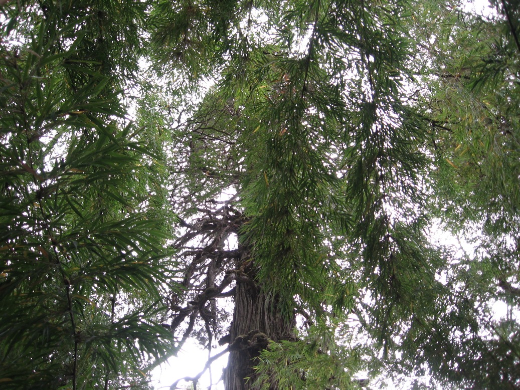
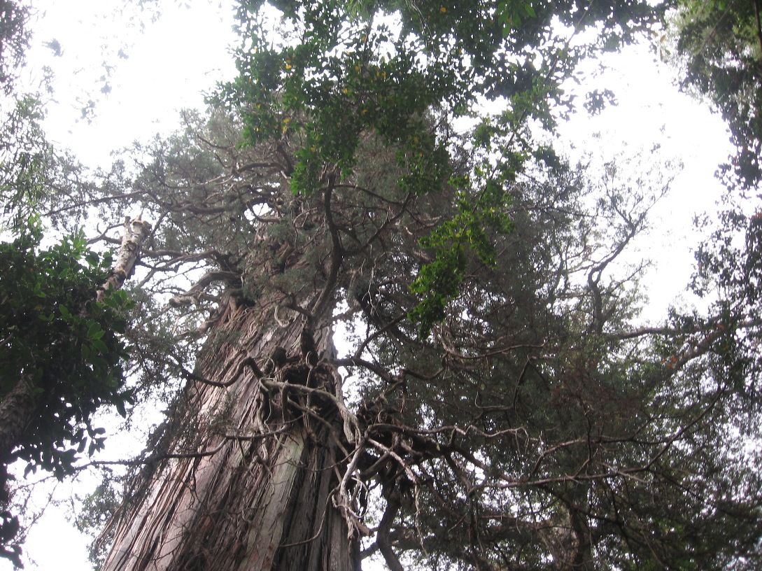
And walking through the Alerces - how can you describe or take pictures of a huge tree?
We reached the river leading to Lago Cisne,
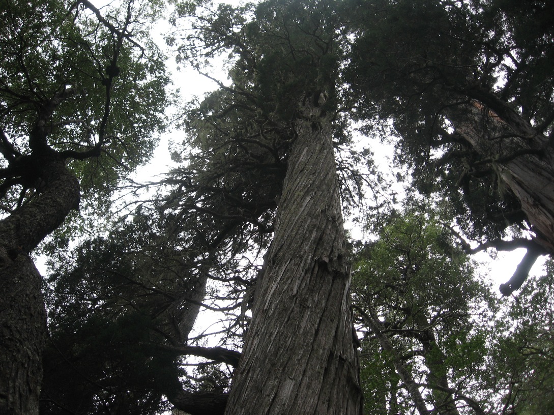
and from a bluff over the river, we could look across into "sector three" at the oldest trees in the park. The guide told us that we could be certain every tree in this stand of Alerces is over one thousand years old. She also told us a few other facts about the Alerce; Due to climate change over the last few millennia, the modern-day climate of this region is no longer suitable to the growth of the Alerce tree. These-days trees may sprout, but after reaching just a few years of age they will only grow a few millimeters per year. In other words, the big old trees are irreplaceable. She also made a big deal about the fact that the oldest known living Alerce specimen - over 3600 years old and located in this park - ranks the Alerce as the second-oldest species of living thing found in the world. Number one is the Bristlecone Pine in Nevada. Giant Sequoias are number three.
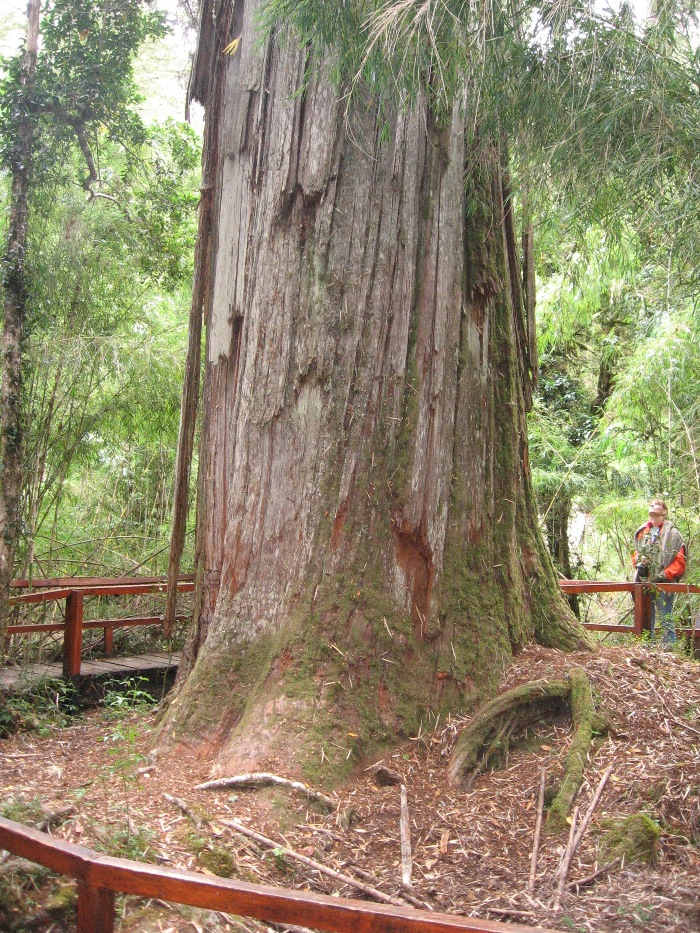
We didn't get to cross the river to walk amongst the oldest of the old, but we did get close to this 2600 year-old tree called (what else?) "The Grandfather Tree."
***********************************************************
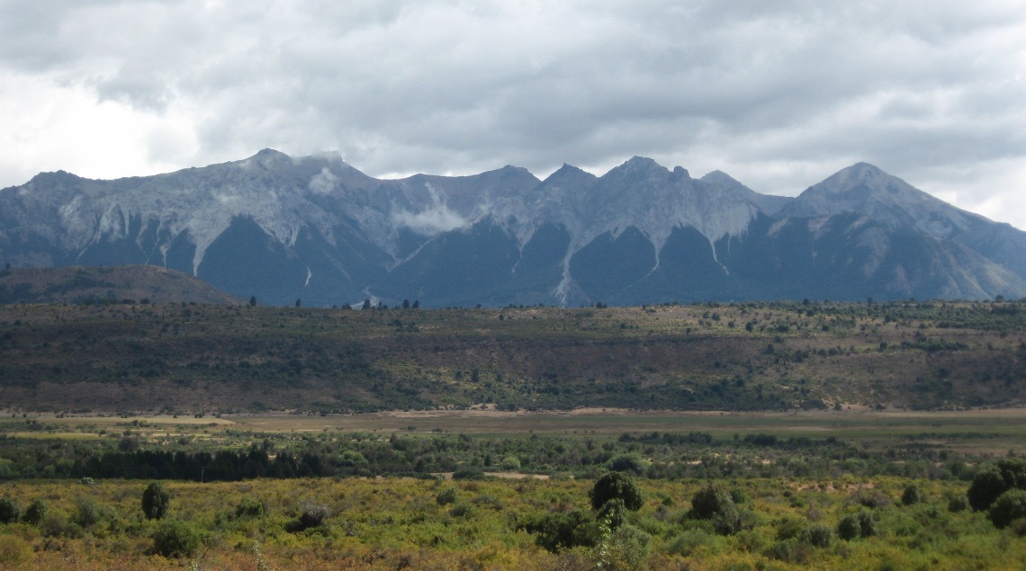
Today we drove north along the lakes and then eventually out of the park. We were headed towards the mountain resort of El Bolsón. El Bolsón is in the next province to the north, and at the very northern edge of what is considered Patagonia - or perhaps the southern end of the Argentinean Lakes District. In either case, I should probably start a new geographical section for the journal for El Bolsón and regions further north.
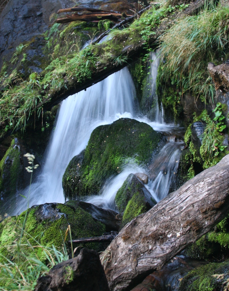
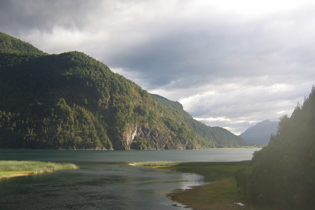
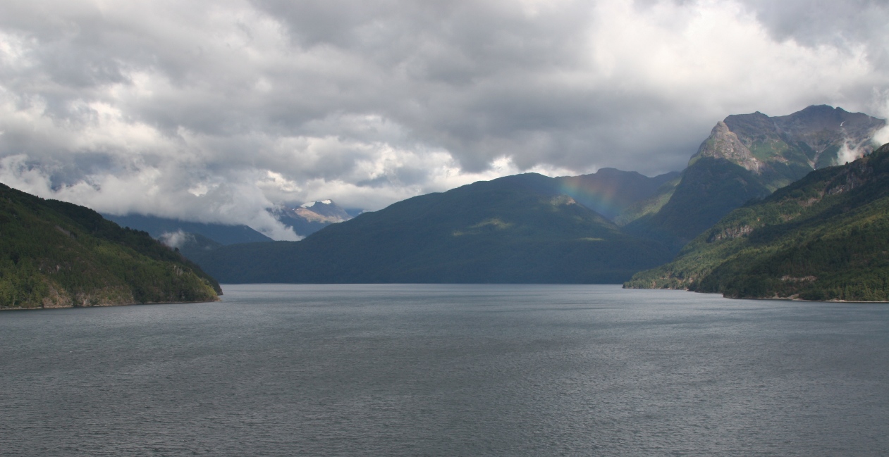
Along our drive, we stopped to see some waterfalls, and there was one place where we could park and take a short hike to a lookout over Lago Verde."
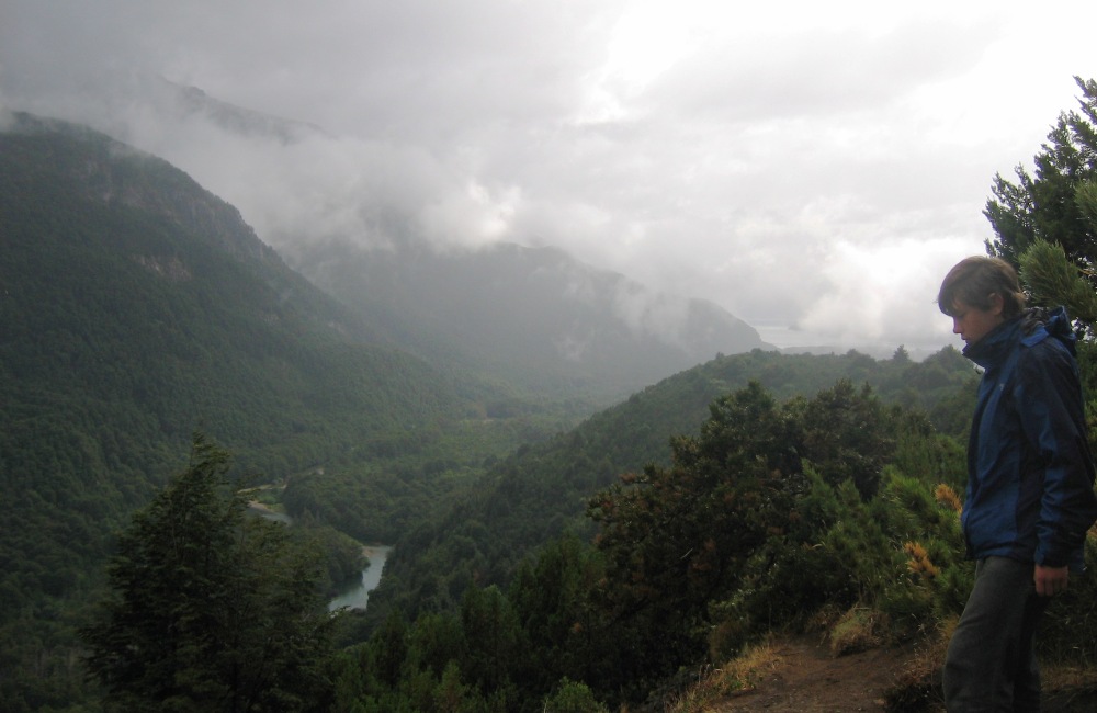
Looking south from the lookout, with Lago Verde in the foreground and the southern tip (it runs north to the right out of the picture) of Lago Menendez. The right picture is looking north along a river that runs from Lago Verde to another large lake, Lago Rivadavia. Lago Rivadavia was just barely visible through the mist, and you can sort of see it just past Tom's nose in the picture.
After we exited the park there was one more thing to stop and look at before we reached El Bolson - the ranch were Butch Cassidy and the Sundance Kid supposedly lived when they first came to South America. It is located a short distance from the town of Cholila. Surprisingly, or perhaps not, this historical sight has no billboards or even signs indicating where it is, and we had to ask directions three times before we found the correct actual place.
Driving along the river valley heading into Cholila.
First we stopped at the "helpful information center..." (quote from guidebook) in Cholila - it was closed. Then I asked directions at a corner store. When we got to right about where he said the old homestead should be, we didn't see anything but a small shack marked by a sign that said "Police Station," and a sign for a tea house 1km further down a narrow gravel driveway (we were driving on a slightly wider gravel "highway" at the time). So we passed this driveway and then asked someone walking down the road with their horse about two kilometers later. They told us they didn't know where the Butch Cassidy house was but that they thought it was near the tea house, so we drove back and asked a lady in the yard of the "police station." She said, "Look behind you," so we did. Lo and behold, right across the road from us, was this shack.
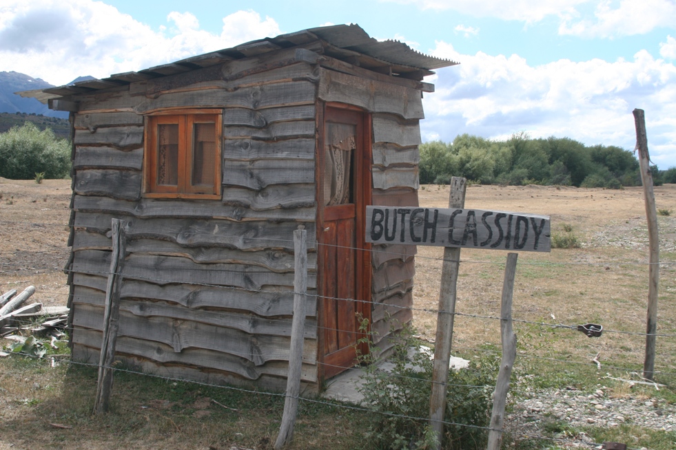
The gate was locked, and the shack (perhaps a ticket booth?) was closed up, so we returned to the police station and asked the lady again... "The gate is locked, what should we do?" She told us to "go around" the gate, and then sent a couple of boys to show us how to hop the fence. I guess if the police (or someone from his family) tells you break into the property, it's OK.
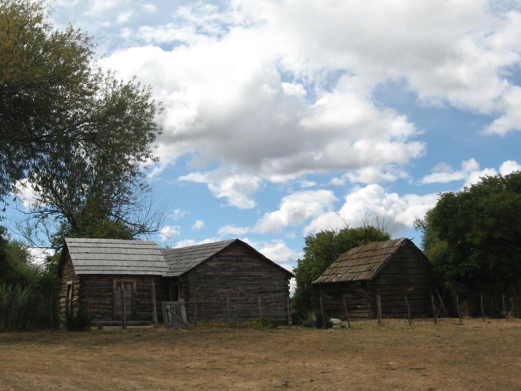
After walking down a long drive, we came upon the former home of those notorious gangsters - pretty ordinary.
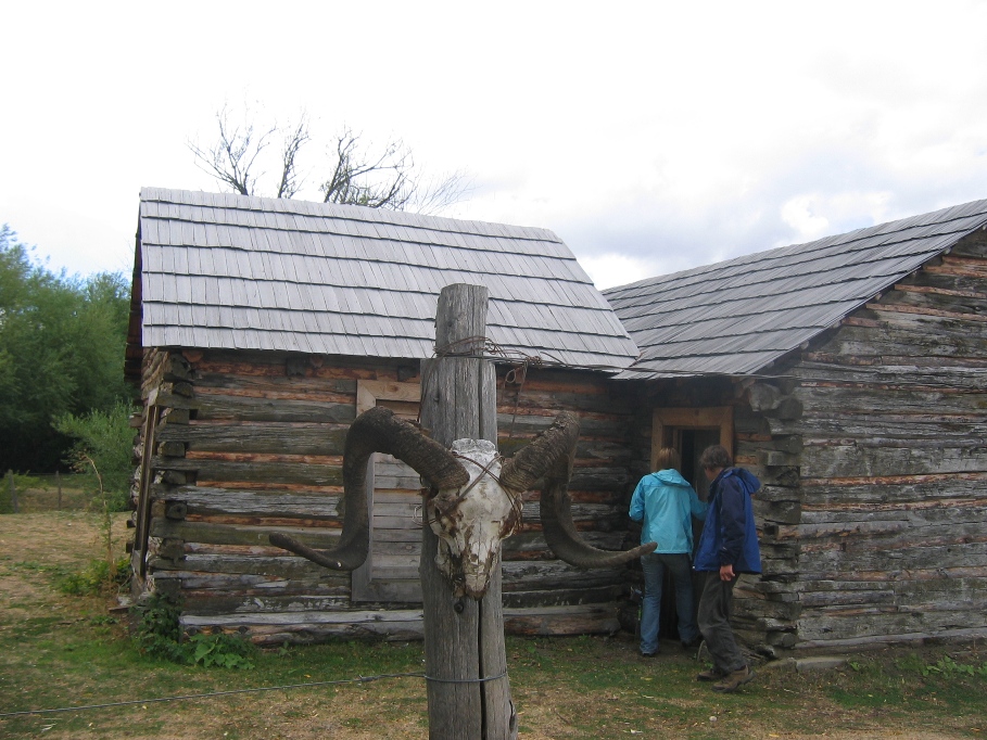
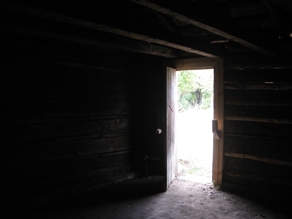
The buildings were unlocked and we could peek inside. What would we find? Boxes of money? Skeletons?
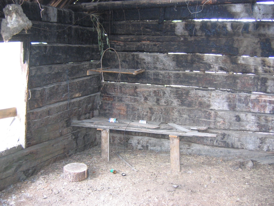
Nope, just some tin cans and a beer bottle.
The brush with the legacy of the outlaws was uneventful and we left unscathed, although I wouldn't go as far as saying we were unimpressed. A half hour past the Butch Cassidy/Sundance Kid/Etta James ranch, the gravel ruta 71 met up with the paved ruta 258 and after another half an hour we left Chubut province to enter Rio Negro, just before arriving in El Bolsón. Does this mean goodbye to Patagonia? Hard to say. There is no dotted line on the map stating the beginning or end of Patagonia, so it's obviously some sort of general region - and bit of a state of mind, as well.
-Rolf