
San Martin de Los Andes
Domestic Life in "Our Town"
Sunday April 21, 2008
Other than our short visa-renewing excursion to Chile, we've stayed put in San Martin de Los Andes for three full weeks. The time passed surprisingly quickly, even without so many trips and excursions on the agenda. We have been pretty busy, figuring out how to stay put and live in one place.
First we had to look for some place to rent on weekly or monthly terms if we were going to be here for awhile - well we didn't really have to but it only seemed sensible since the monthly rate for a spacious 3 bedroom house with room for chemistry experiments would be less than the daily rate for a small tourist cabaña. The process of house hunting took about a week before we finally settled on the "house in town" over a couple of other options - one in a barrio a few kilometers outside of town and the other located a full 20 kilometers away on the grounds of a golf resort (very scenic and tranquil but pretty isolated...). Now we have the convenience of being able to walk or ride bikes just about everywhere, coupled with the annoyance of city noise - the worst of which happens Friday and Saturday nights due to the comings and goings of a varied assortment of slightly(?) inebriated people celebrating the weekend.
The weather was excellent during the first week while we were looking for a house, then turned windy, rainy, and significantly colder the day we moved into our rental. After about 10 more days, when the rain and wind finally took a short break, we celebrated by leaving town for an excellent 4-day trip which included a brief return to nearby Chile (see journal entry dated April 15, 2008 for details).
Regarding our domestic life and circumstances; as of today, we have located Spanish tutors (one for the twins and another for Rolf) a non-smoking bookshop/wi-fi cafe, and we know a small number of restaurants that are either non-smoking or have an adequately smoke-free environment available.
We have located the public indoor pool but haven't used it yet - it's small and oriented towards classes and lap swimming. Sooner or later we might take the plunge. For the time being, the twins ride the two second-hand bikes we bought in order to get a little exercise. I like to jog up the road along the hill on the western edge of town. Lynn takes walks (we all do, sometimes) and has her Pilates mat out of the luggage rack, but I don't think she's actually fired up her Pilates DVD yet. That may not ever be necessary as she just signed up for classes at a Pilates studio a few blocks from our house.
We know about a dozen or more local residents by name and that list grows daily. At first it was mostly the various real estate agents who showed us houses but now we're gradually meeting a more varied circle of people. More than half of them seem to be named Carlos or Laura. It helps that most people in this town seem to know each other already, so when we encounter just about anyone, there's a high probability that someone we already know knows them. Our neighbors seem pretty reclusive, but I've met the father of one of the families living in the apartments next door. His name is Walter (not particularly Latino, but he does his best to pronounce it as if it were), and he has generously offered help and assistance, as does just about everyone, if we "need anything."
Finding some same-age friends for Tom and Anna would be nice. I think that some sort of arranged meeting organized by adults would be rigidly resisted (at least initially) by the adolescents, but I know that my tutor has both a 13 and 14 year-old and I'm already scheming in their direction. She has recommended that Tom and Anna do what all the other young pre-driving age teens do in town, which is cruise "a pie" (on foot) up and down Avenida San Martín and/or hang out in Plaza Sarmiento or the video arcade "Ciber" between 6 and 8pm. I'm not sure if I could convince them to be so brave and forward to just go out and start talking to other kids, but it would probably work if they gave it a try - most of the kids here are studying English in school. Then of course there would be the issue of what sorts of unsupervised extra-curricular activities they might get involved in, but knowing Tom and Anna, that's low on the list of concerns - and especially until they actually start hanging out with other teens.
The Saturday afternoon "family swim" at the pool might be a good opportunity for us to accidentally encounter other young adults on intimate enough terms to start up some sort of halting dialogue. First we'll have to drag ourselves to one of the free lice and athlete's foot checks that are held on the weekday evenings. This is required before we are permitted to dip our feet and heads in the pool.
We're pretty fluent in grocery shopping and other matters of basic survival, and we lived through the great agriculture strike, or at least the first volley of the battle, with the same indifference effused by locals. In-case it went unnoticed in North America, there was a several week strike by Argentinean farm workers in response to new export tax laws. As a result, there were various food shortages around the country. Here in San Martin, there was no butter on the grocery shelf for about a week (eventually even margarine was in short supply) and milk was rationed two liters per family per day (or more practically, per trip through a check-out line staffed by someone who hadn't seen you buying milk yet today). None of this bothered us much until one afternoon when a waitress informed us that there might not be whipped cream for our cocoa. We almost panicked. Then she came back a minute later with a big smile and told us that they still had cream. Whew!
Almost two weeks ago, the farmers decided to postpone the work stoppage for three weeks while they negotiate with the government. We'll have to wait and see what transpires during the stoppage of the work stoppage, and hopefully, they'll arrive at some sort of arrangement before any other items begin to disappear from the grocery shelf.
Now regarding the history and geography of this municipality, the city of San Martín de Los Andes...
The following coordinates give the location of the town Municipal Building, which is home to the offices of Mayor Luz Sapag of the Movimiento Popular Neuguino Party. The coordinates were taken from an electronic topo map and have not been checked using Google Earth. Hopefully they are accurate enough to provide a view of the town center if not the exact roof over the mayor's workweek head.
40o 9.358' S 71o 21.095' W
And here's my well recycled maps...
In addition to those coordinates and maps I can provide the following words: San Martin de Los Andes was founded in 1898 after meetings between a general in the Argentine army and a local indigenous chief. The general was looking to establish an Argentine presence in the region, and the chief agreed to cooperate with the forming of a settlement in a small valley that his people used for winter housing. This valley (and the current city) is located in the far west of the Neuguén province, 45 kilometers from the Chilean border. Nowadays, there are tens of thousands of Argentineans of European descent populating the main town, and a tiny settlement of a few hundred (or less) Mapuche descendents relegated to a peninsula on the lake a few kilometers down the shore.
This modern-day San Martín de Los Andes is a city of about 25,000 residents, sitting in a bowl between two hills at the eastern end of Lago Lácar in the heart of the Argentine Lakes District. It is also located near the boundary of and houses the main administration offices for Lanín National Park. The city supported itself for the better part of a century with farms and mills spread up and down the valley. But with all those nearby lakes and rivers and a decent ski hill center providing both winter and summer fun, it's not surprising that the main economic enterprise has shifted to tourism (in a big way) over the last several decades.
The town borrowed part of it's name from the great general José Francisco de San Martín, although he died about 50 years before the founding of this city. The other part of the name "de Los Andes" either comes from the physical location of this place, or the fact that general San Martín led the "army of the Andes" and crossed the Andes multiple times during his career. General San Martín was the great Argentine libertador - a contemporary and compatriot of both Bernardo O' Higgens (great libertador of Chile) and Simon de Bolivar (same for Peru). One of the two main plazas bears the name "Plaza San Martín" and features a prominent statue of San Martín astride his trusty steed. The plinth under the horse is ringed by various commemorative plaques gifted as tokens of friendship from other towns in both Argentina and Chile.
Walking three blocks east from Plaza San Martín you come to Plaza Sarmiento. There are no statues here, even though I'm pretty sure there was a famous Patagonian guy named Sarmiento. Plaza Sarmiento is bigger and has playgrounds, flower gardens, and a fountain that is never turned on. It is also the favored spot for public demonstrations, celebrations, and gatherings of any sort. The annual national holiday commemorating the Falklands war (Guerra de Las Malvinas) happened the Wednesday after our arrival, and they held a small parade and ceremony in Plaza Sarmiento during early in the morning. The festivities were over before we realized that something special might be going on and asked about it.
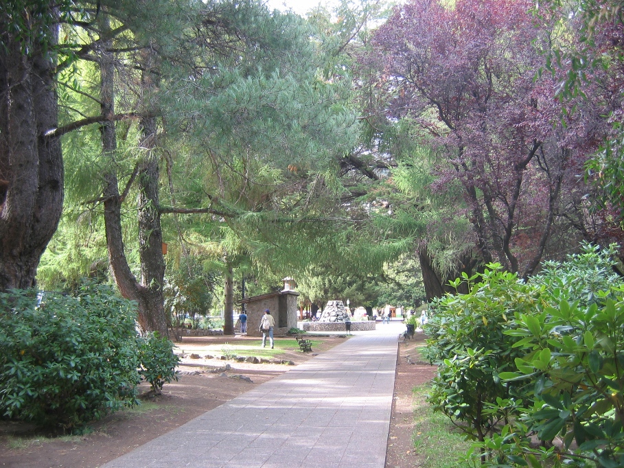
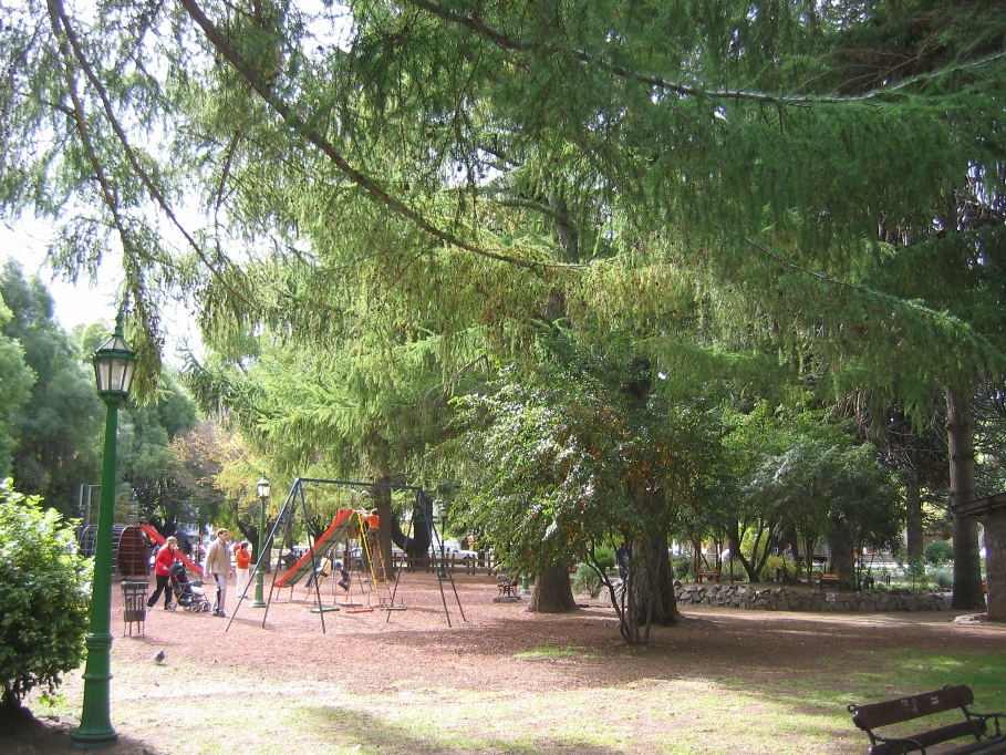
Here are some pictures to augment the words and hopefully give a better feel for San Martín de Los Andes and our living arrangements here...
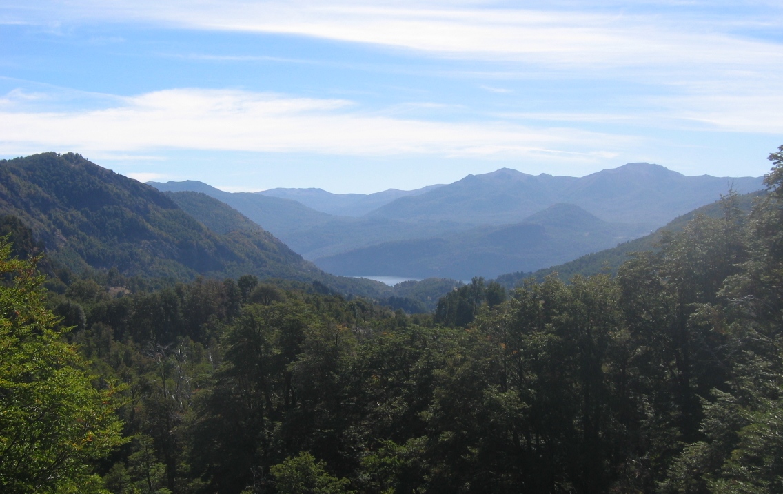
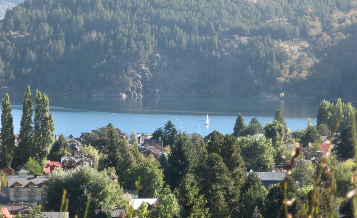
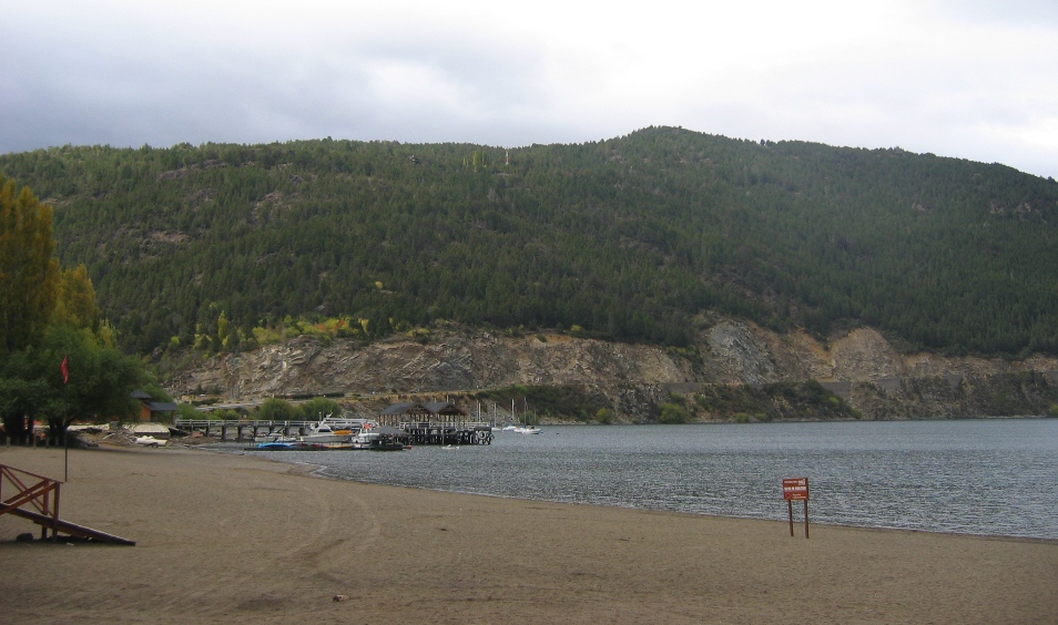
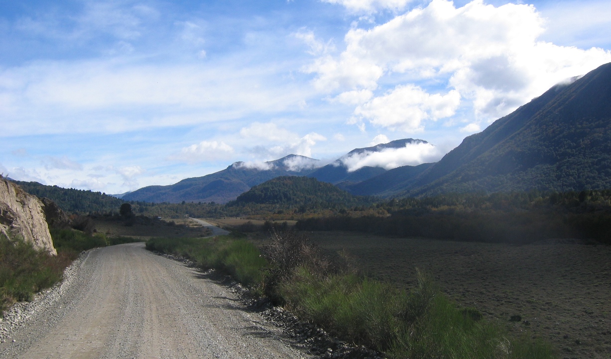
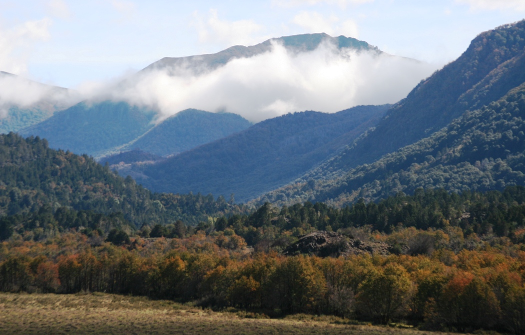
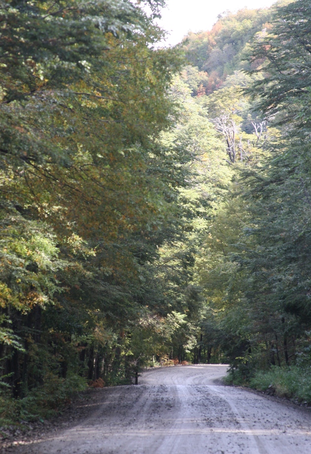
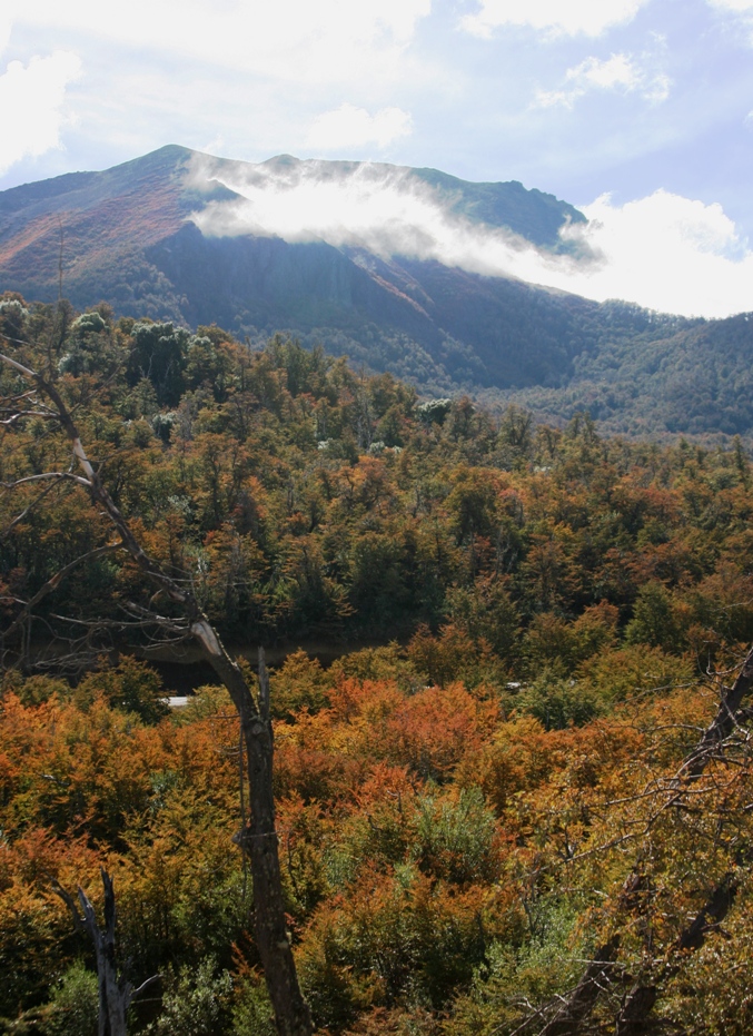
The left most picture is first glimpse of Lago Lácar that you get when you are driving to San Martín on the Seven Lakes road. The two right-hand photos are taken from the dirt road that runs up the hill along the south side of town. This is the view I have when I go jogging.
We took a short break from house hunting the first weekend in town, and drove up to the ski resort to see what it looked like without snow. Unlike in the US, the real estate agents here take Sundays off!
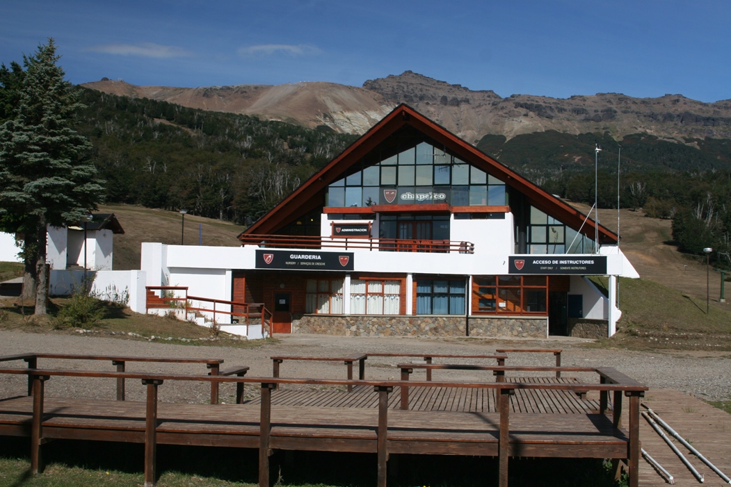
One of the buildings at the base of ski center Cerro Chapelco.
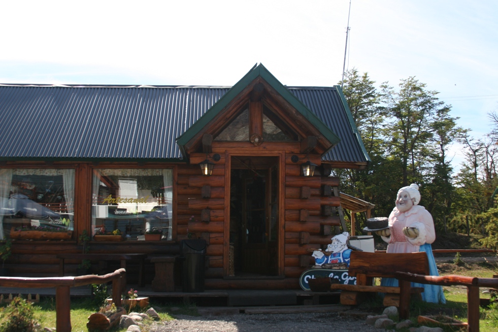
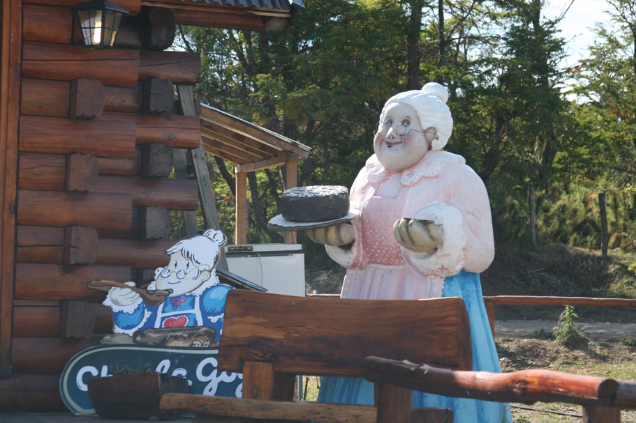
Across the parking lot, the Abuela Goye chocolate/tea/coffee/ice-cream shop was open to serve the trickle of thirsty sight-seers who had driven up for the view and something to do on a sunny Sunday afternoon.
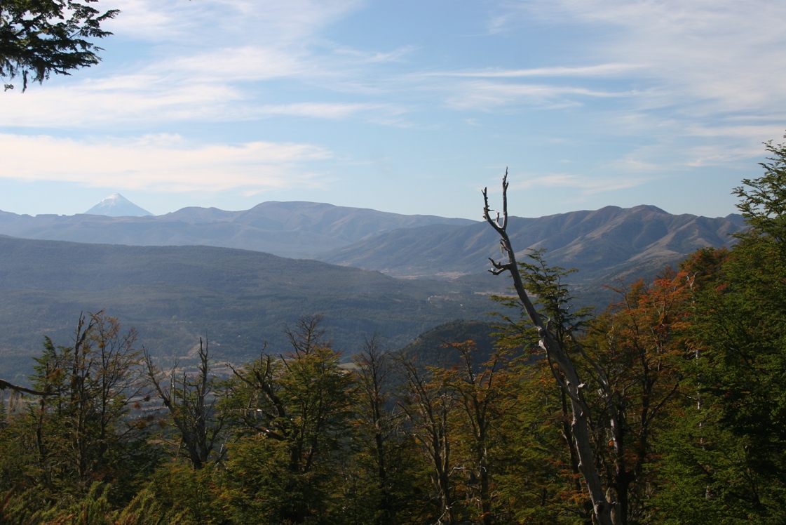
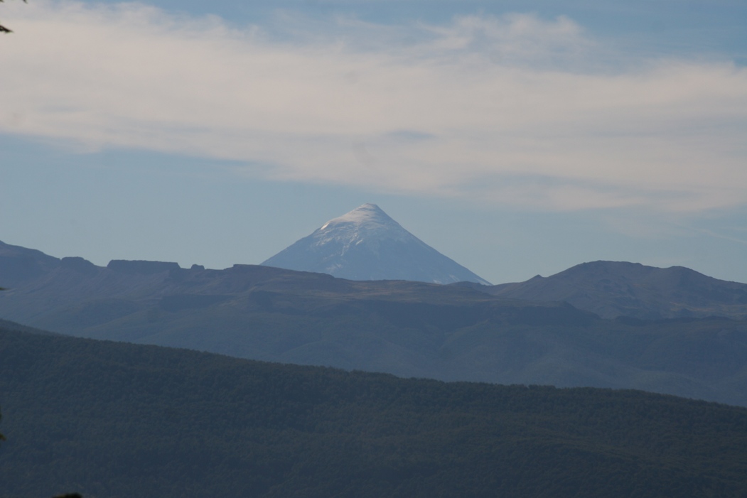
Volcán Lanín is located within the national park at the border with Chile. It is also prominently visible from Cerro Chapelco. Outfitters offer guided climbing excursions that take 2-3 days. I was considering looking into it until the weather changed and it was suddenly much colder and windier - it's clearly a little past the best time of year for climbing, but perhaps I should still give them a call... (and get in better shape regardless!).
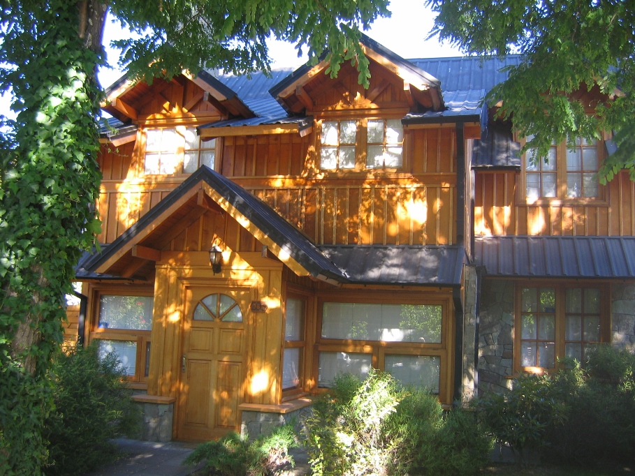
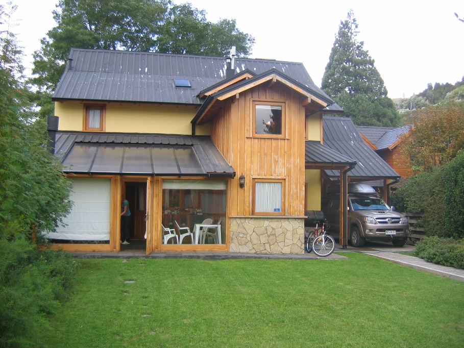
Our rental house is at Avenida Mariano Moreno #938.
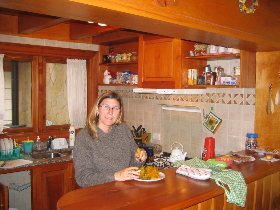
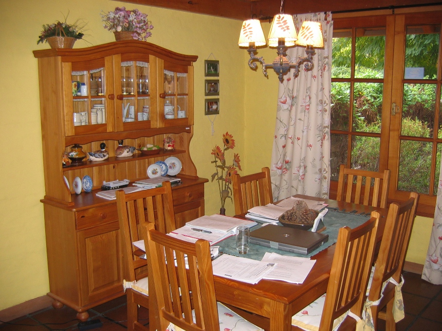
The kitchen and dining/school room.
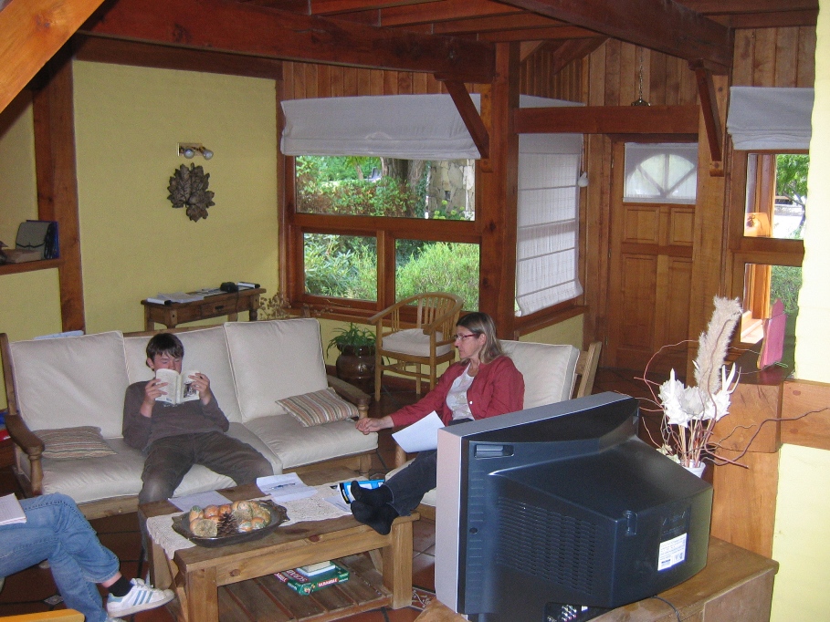
Living room.
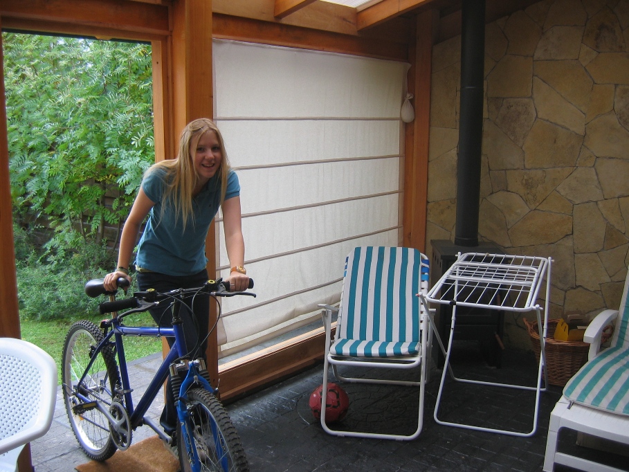
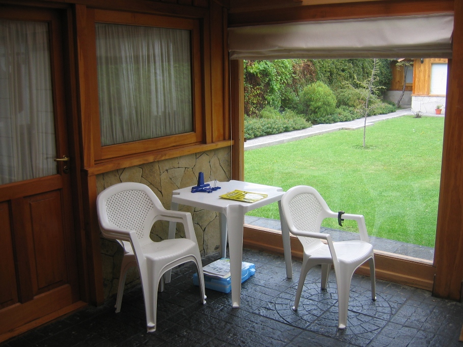
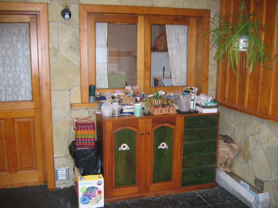
The enclosed patio is a good place to keep the bikes and do chemistry experiments.
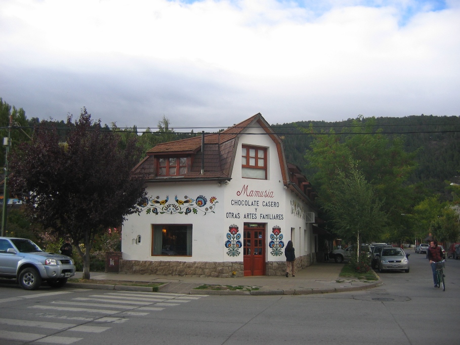
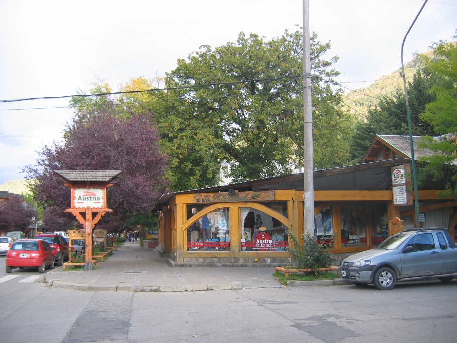
Two of the most common retail enterprises in San Martín, chocolaterias and outdoor clothing/gear/ski/camping/fishing shops. There is also no shortage of restaurants and clothing shops.
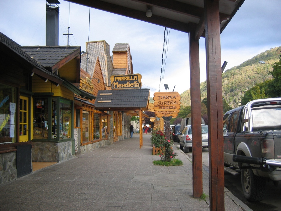
"Parilla" is a common restaurant theme and the word means that the restaurant serves traditional Argentine barbeque. This usually includes assorted cuts and types of beef, lamb, sausage, and chicken. Trout, deer, smoked wild boar, pizza (with any of the afore mentioned items as toppings), and homemade pastas are also commonly featured by local restaurants. And of course the chocolate shops serve homemade alfahores along with brownies, cakes, and ice-cream. Alfahores are the Argentine national sweet treat - two or three cookie-shaped pieces of chocolate cake filled with dulce de leche or fruit preserves and then thinly frosted with dark chocolate.
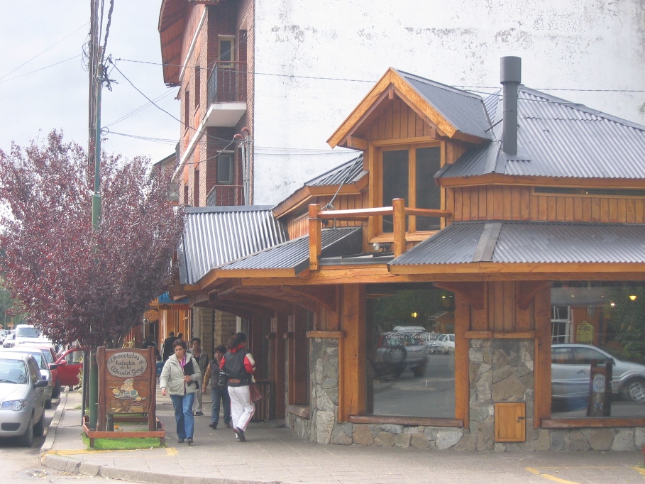
The Abuela Goye shop in town is one of our favorite places - warm drinks and excellent desert delicacies served in a completely non-smoking environment.
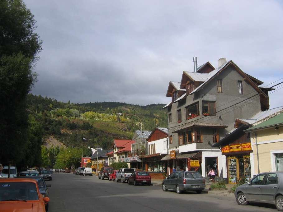
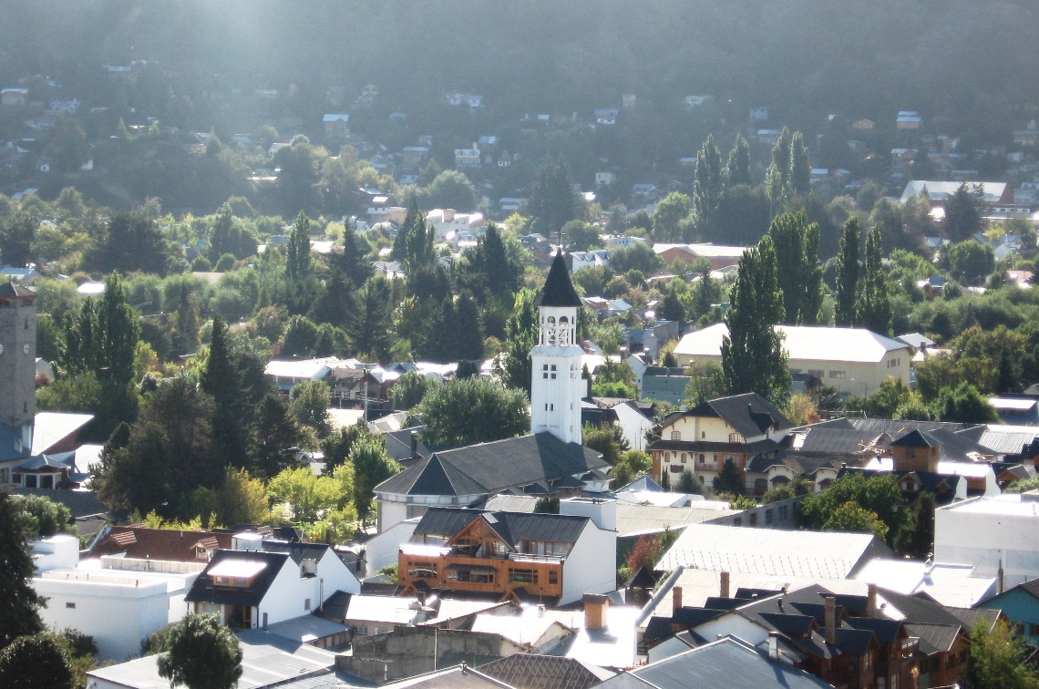
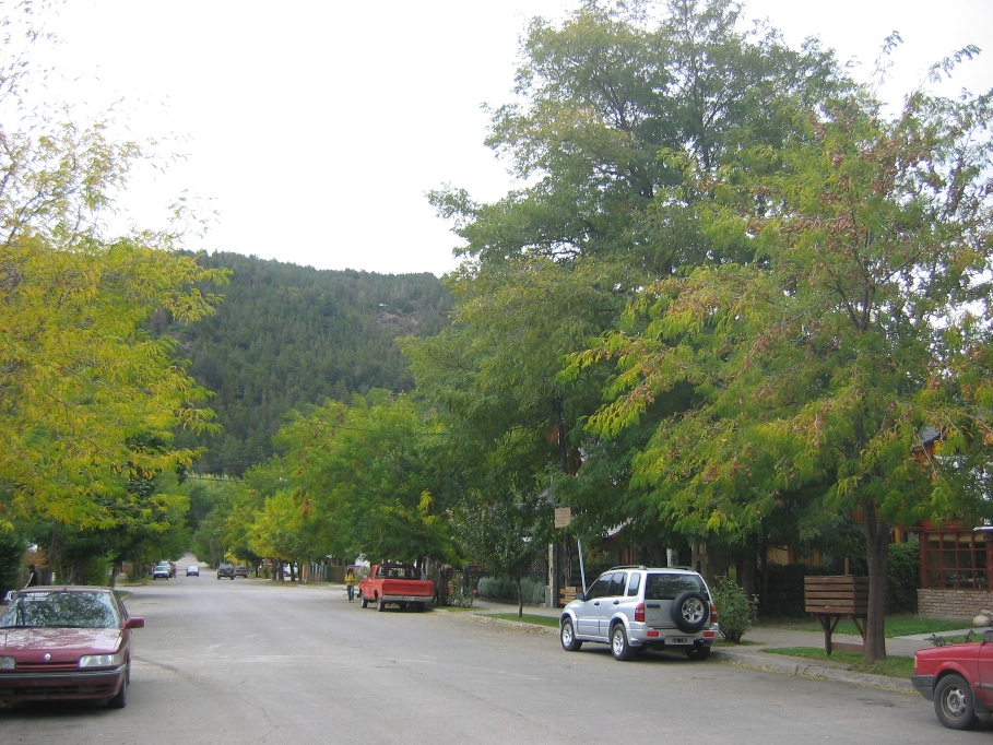
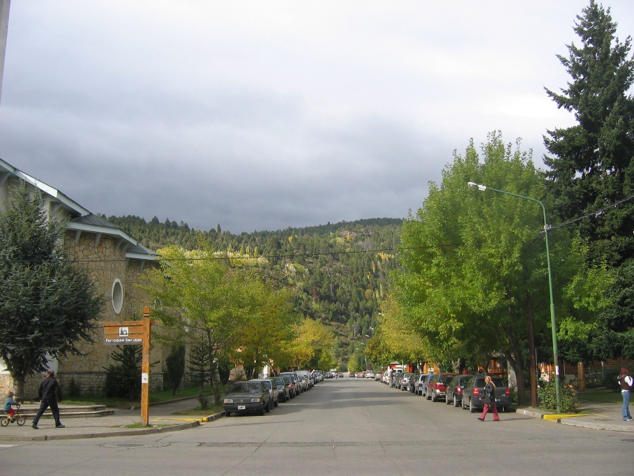
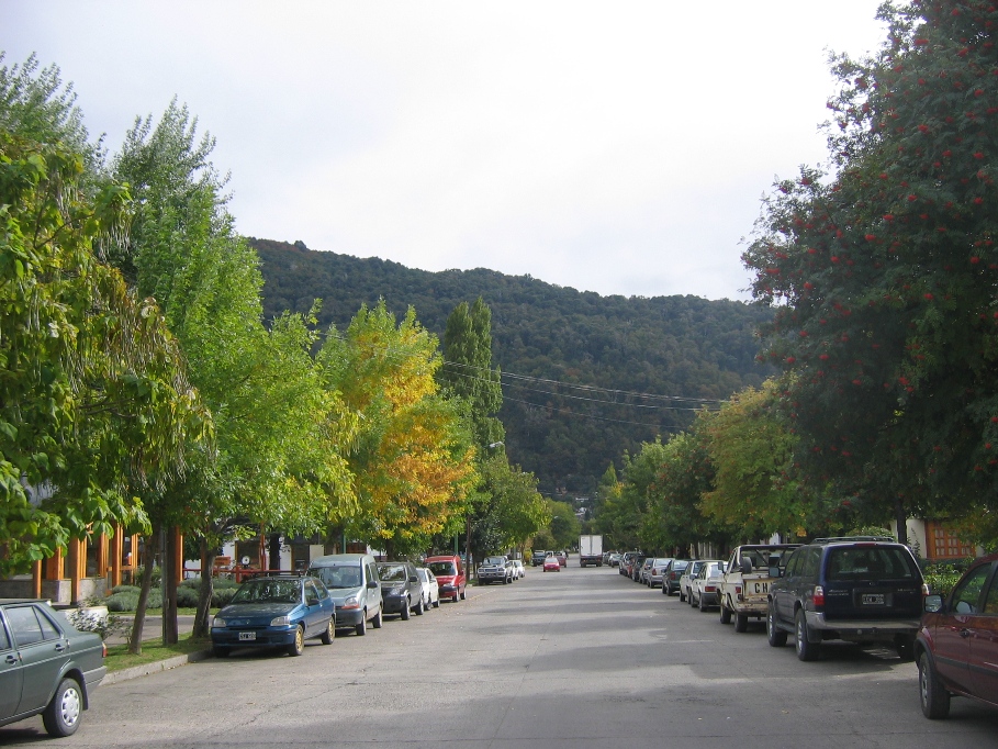
A typical street view.
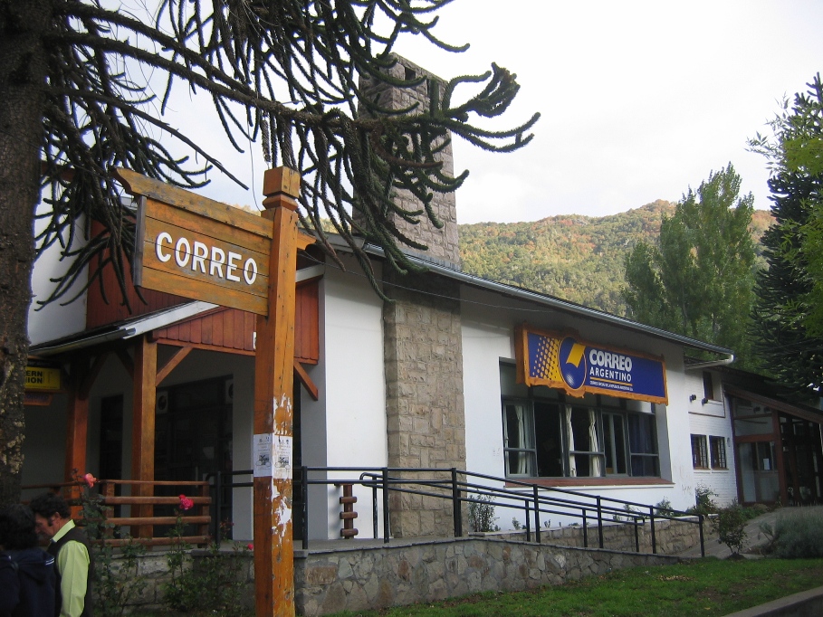
The post office. They have an interesting protocol for mailing international packages here. I have to visit the customs office first, where they inspect the package and its contents. Then I seal the box and they put "approved" labels on it and I am allowed to go to the post office counter to mail the package. In other cities where I've mailed packages, the customs office is in the same building (and usually the same room) as the post office. Here in San Martín the customs office is two blocks away from the post office. After approving and labeling my packages, the customs officer gives me the following instructions with a semi-stern, "I have to act serious now but I really don't care" sort of attitude;
"Go to the post office and mail these right now, and don't mess with the boxes on the way."
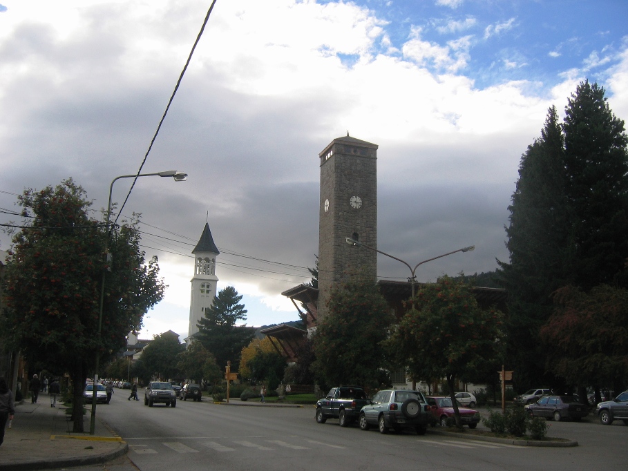
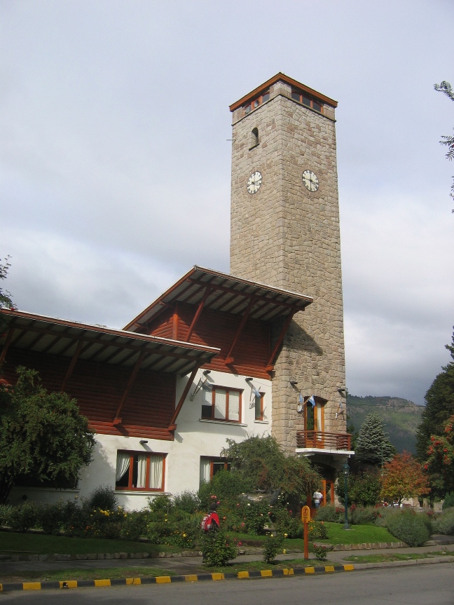
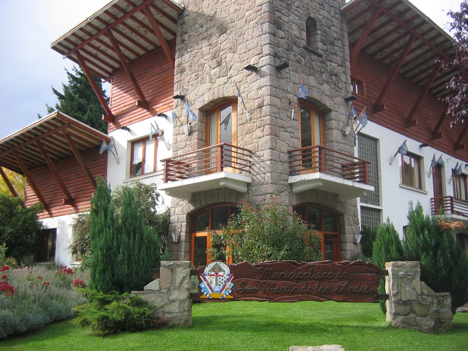
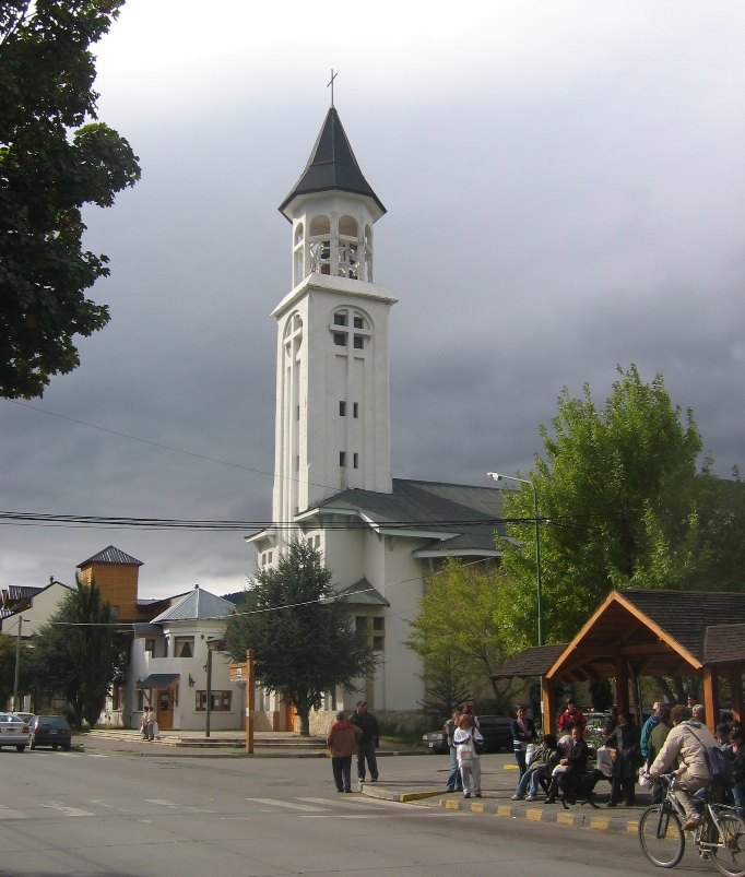
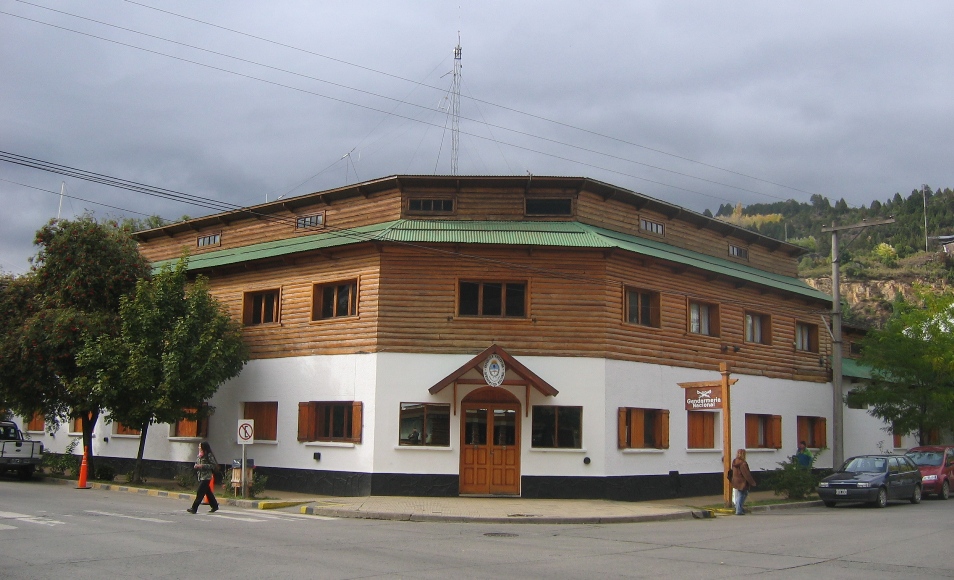
City Hall (Municipal Building) and the Cathedral.
Two hills bracket the town on the south and on the north. I took these two pictures from the middle of the same intersection. The first is looking towards the south, and the second is looking towards the north. The lake borders the west edge of town, and one of two main entrance/escape highways leaves through a valley on eastern side of town. The other is the "Seven Lakes" route which hugs the southern shore of the lake for a bit before turning southward to wend its way down to Villa La Angostura. As east is the only direction that provides much in the way of flat, non-wet terrain, it is along the eastward highway that the city has expanded into a smattering of suburbs.
Both the Policia and Gendarmeria are equally prominent and visible in the cities and on the highways of Argentina. I assume that the Gendarmeria are more of a National Guard type of outfit (and they staff the immigrations counters at border crossings), but whatever the division of power and labor really is, I simply think of both of them as "Police," and try to follow any and all traffic rules I can think of anywhere near a Gendarmeria or Polica office, or officer, or marked vehicle, or checkpoint.
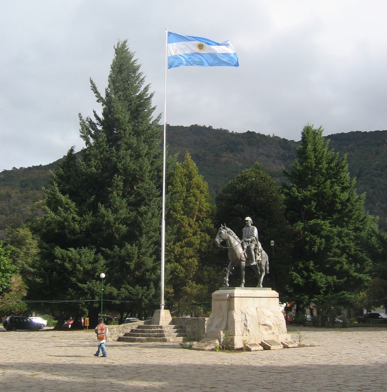
Plaza San Martín, and the statue of General José Francisco de San Martín.
Plaza Sarmiento, with its flowers, trees, and playground. I decided that the dormant fountain wasn't worth a photo. Someday if I catch it spraying, I'll take a picture.
The lakeshore on a dreary autumn day - it's much prettier when the sun shines. I'll try to remember to take my camera down there next time we have good weather.
**********************************************************
After those few nice days of weather roughly coinciding with our short trip to Chile, the weather turned grey and cloudy again. This past Saturday afternoon was exceptionally nice, however. The sky cleared, there was absolutely no wind, and the day warmed up almost to 70 degrees F by mid-afternoon. After a solid week of nothing but homework (and just a little TV and bike riding), we figured the kids could stand an afternoon off so we all got in the truck and drove along the north shore of Lago Lácar towards Chile.
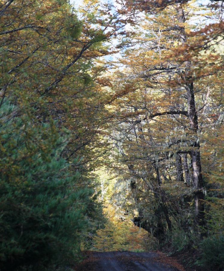
About a kilometer east of city center, we turned left on the road that leads to Paso Hua Hum and Chile. After just a couple of kilometers on this road, we were driving through this small pristine valley, with no sign of human habitation (other than the road itself) in site.
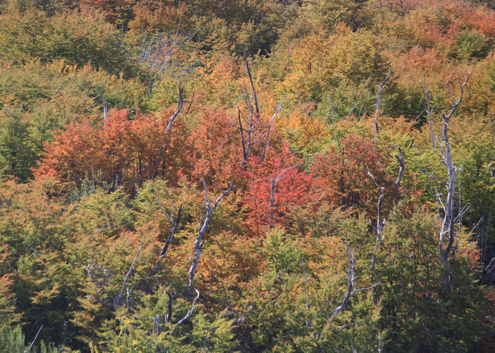
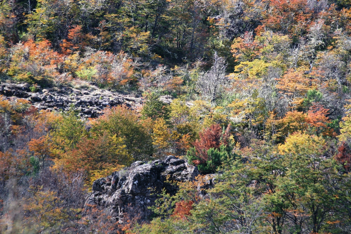
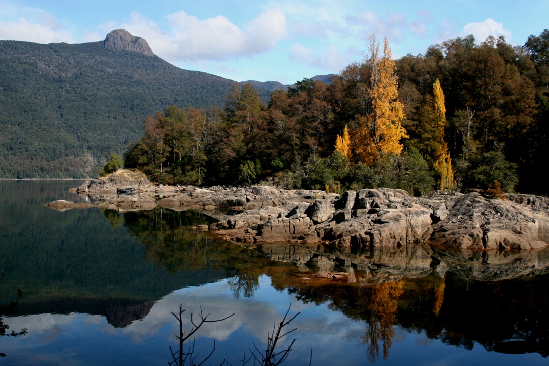
The trees are becoming more colorful day by day.
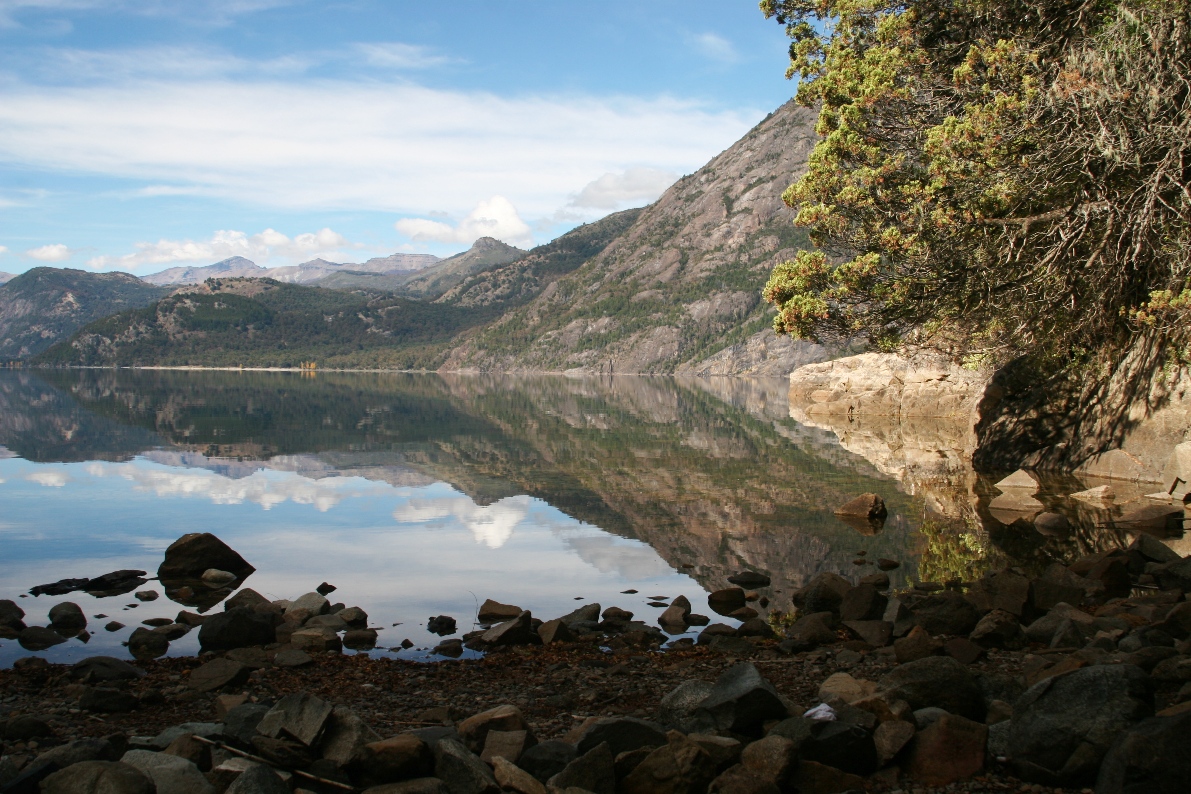
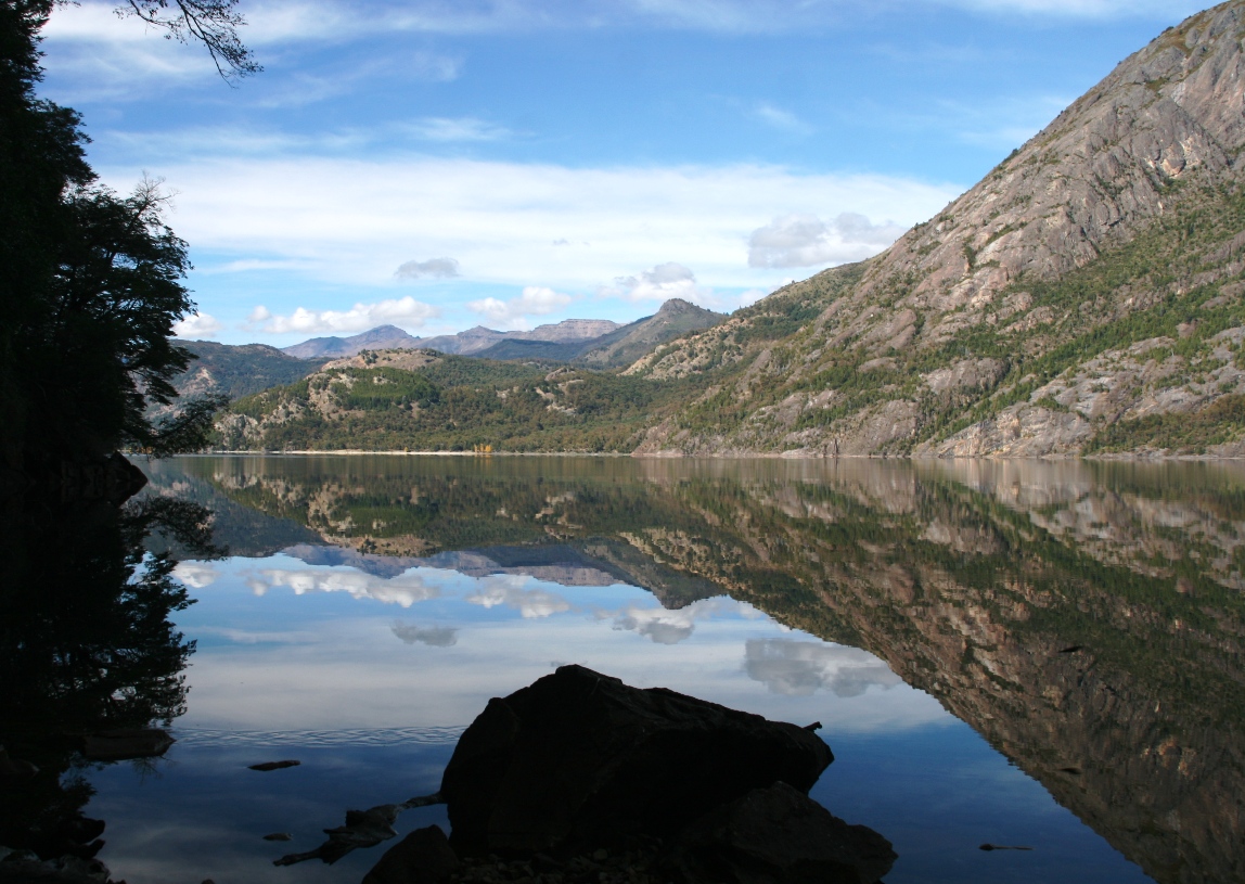
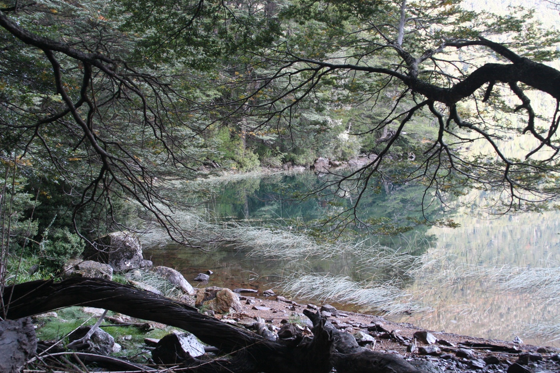
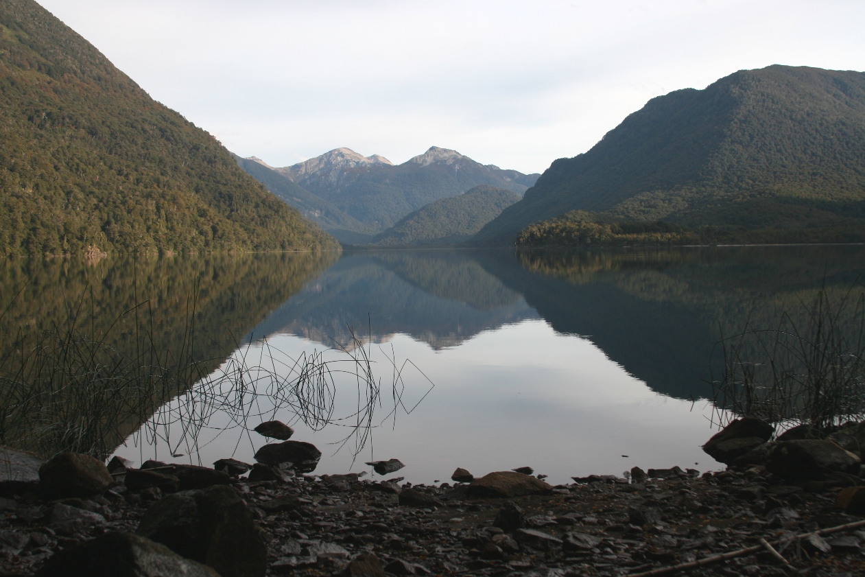
The road soon found the north shore of the lake, and then after another dozen kilometers or so, we stopped to walk along a series of small beaches at peninsula Yuco. The dead calm water reflected the mountains and sky almost perfectly...
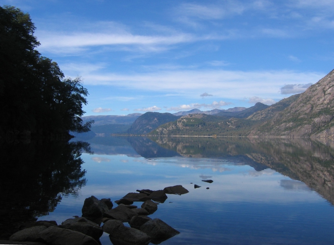
except when a pesky fish hit the surface and created a series of ringed ripples.
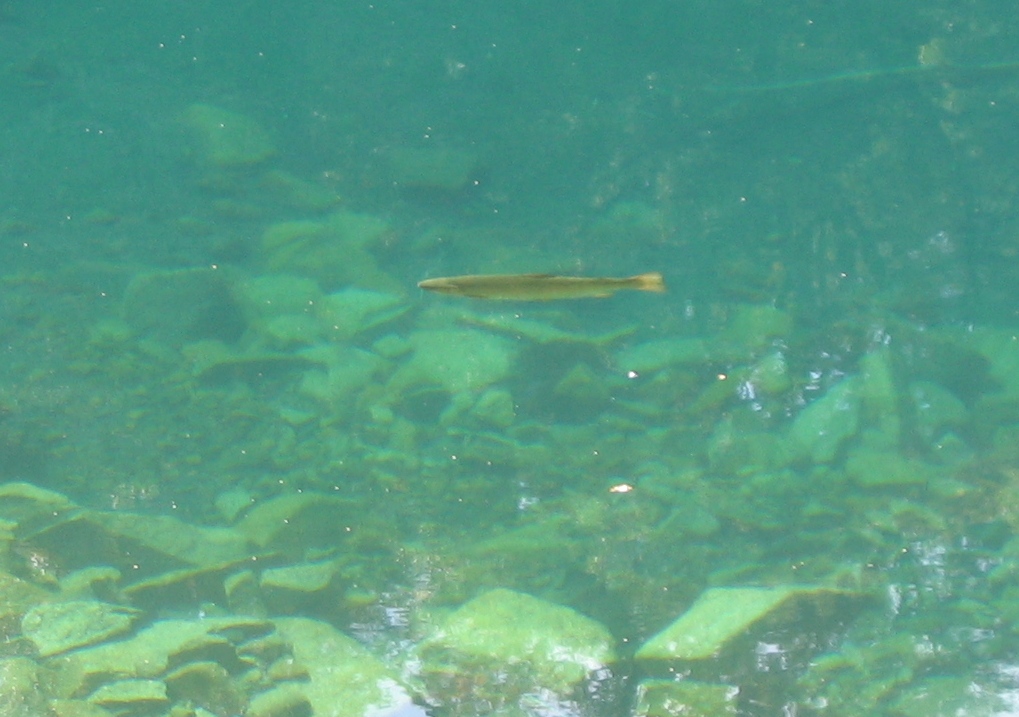
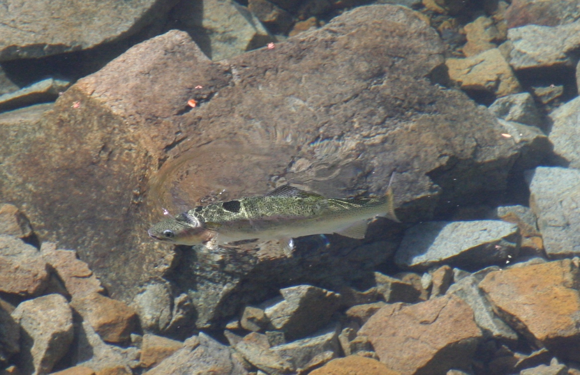
Too bad the legal sport fishing season ended Easter weekend (but this doesn't stop everyone... we saw 3 or 4 people fishing along the shore).
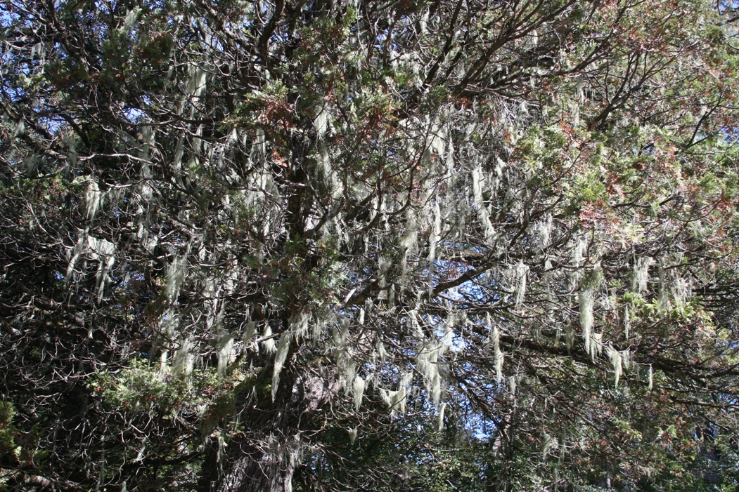
Lichen in the trees.
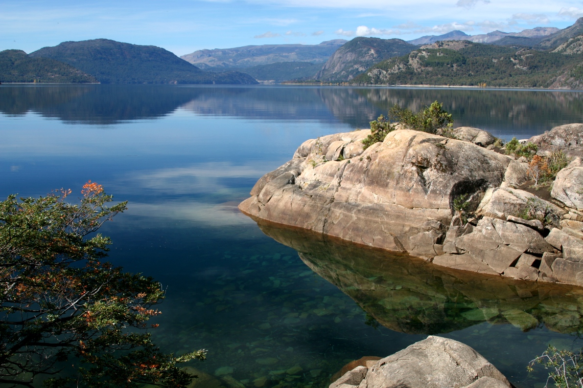
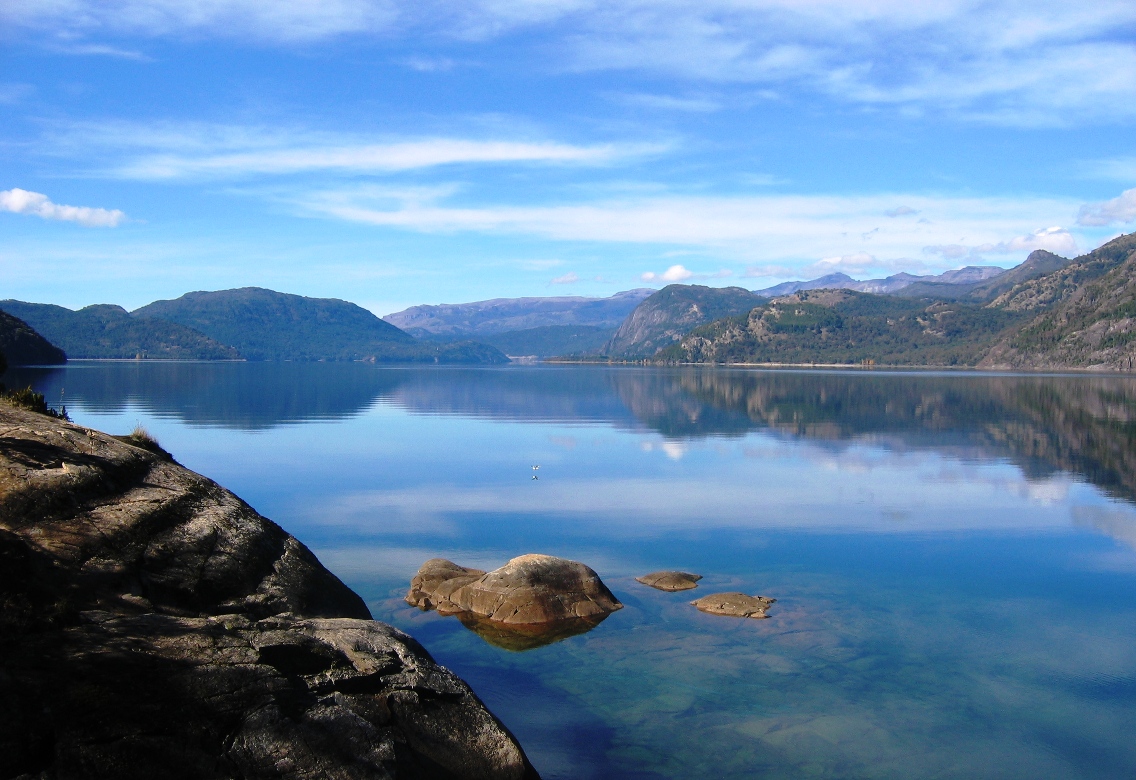

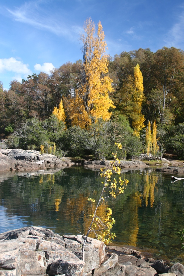

More "reflection" shots.
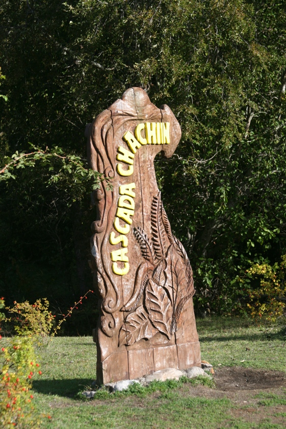
Just two kilometers before the road reached the Chilean border, we stopped at a parking lot from which we could take depart on foot. The trail climbed steeply for about half a kilometer, so we all got a little bit of a workout in the process.
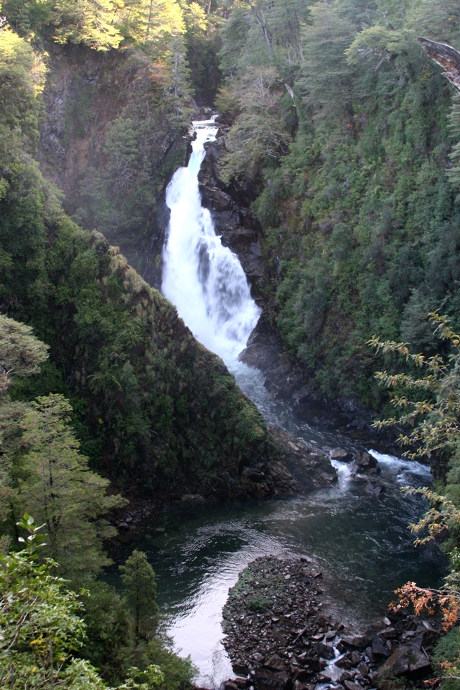
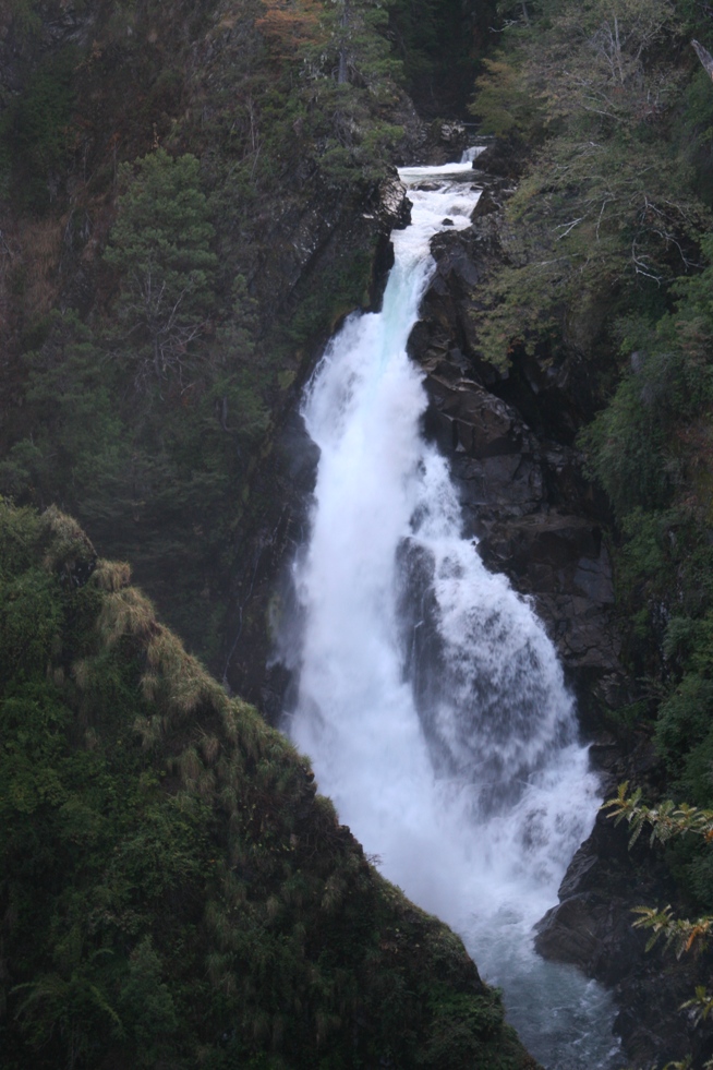
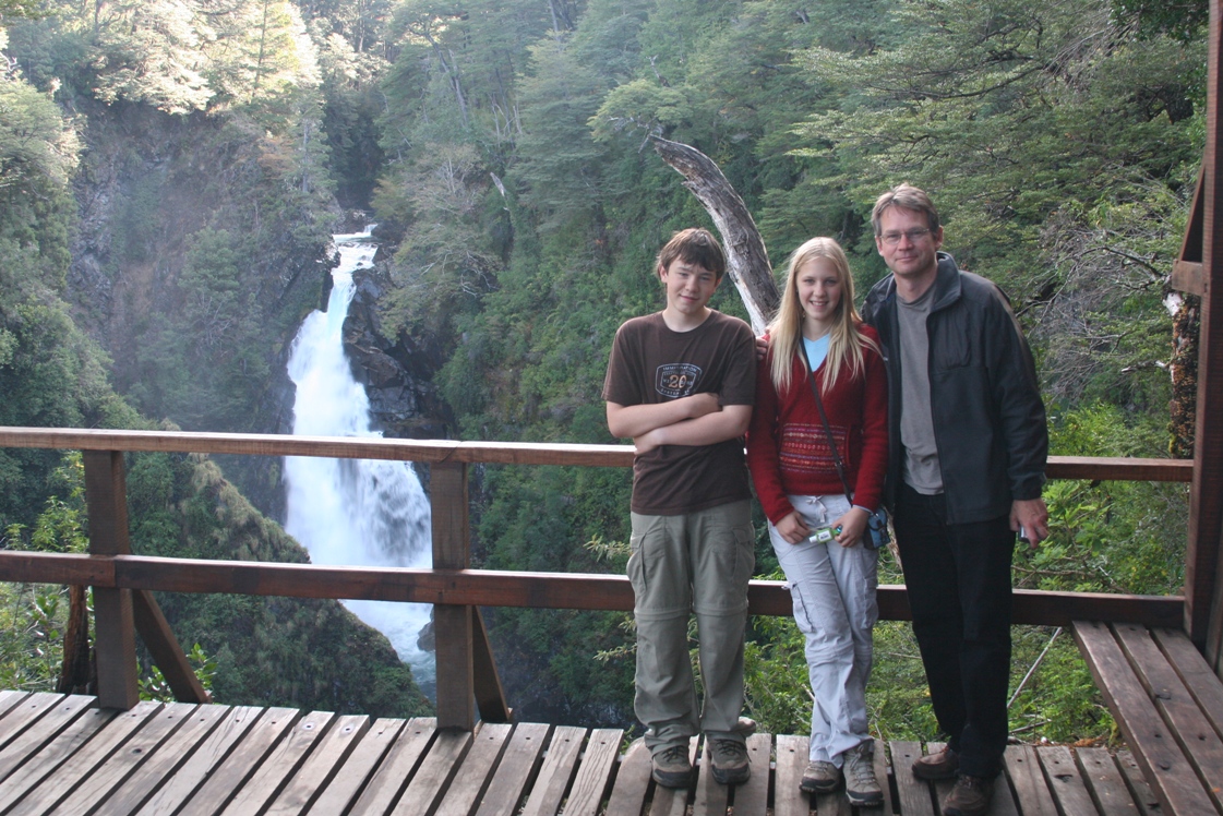
The end of the trail - Cascada Chachin.
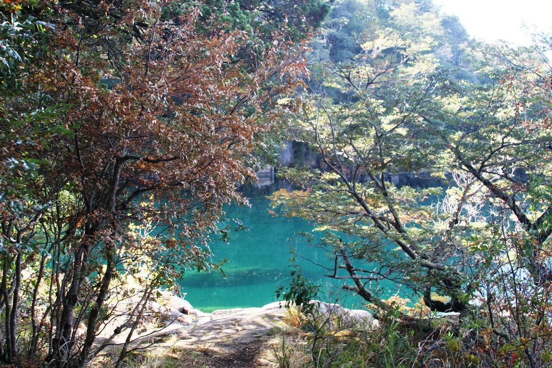
Back in the car and exiting the parking lot, we noticed a turnoff with a little sign indicating that we could drive to another lake 8 kilometers down a rugged-looking and muddy track. We'd come all this way and didn't have any deadline for dinner so we figured - why not? The road was a mucky bog in places and bumpy just about everywhere so those 8 kilometers took over 20 minutes each way.
A drier, flatter section of the road to Lago Queñi.
It may have been muddy and slow, but the reward at the end of the drive was worth the trouble.
This should be an interesting week ahead - we all have a lot to do. And when the weather turns nice again, maybe we'll take the lake ferry over to the Maphuchi village or even all the way to Chile again. As usual, even when we're staying in one place, there are too many things to do and places to see and too little time to do it all.
-Rolf