El Chaltén
The Newest Town in Argentina
Tuesday January 29, 2008
Geoff's college, Middlebury, wedges a one-month mini-term between the fall and spring semesters. Students can skip it once or twice during their undergraduate career (and still graduate on time, we hope). Geoff took the "J (for January?) term" off this year. That's why he's been able to be with us since late December. It worked out that early February was the right time for him to fly back to the US. It also works out that El Calafate has an airport that can send him to Buenos Aires, where he can then catch an international flight back to the states. Regardless of the entertainment value of these details (or lack of it), they are part of reason we are still in the general vicinity of El Calafate.
But as to why we didn't just stay put in El Calafate for another week, well... we had already spent 9 days in El Calafate and surrounds, and there was another tourist destination just a few hours away. The town of El Chaltén is located at the far northern end of the Parque Los Glaciares and as we've found out, provides a notably different experience for its visitors than El Calafate does.
A brief history of the actual town of El Chaltén can indeed be very brief. The city was founded in 1985 after a boarder dispute with Chile, although a smattering of mountain climbers had been coming to the region for almost a half-century prior. Argentina decided to anchor their claim to Mount Fitz Roy with a tangible nearby presence in the form of a thriving, revenue generating, and truly Argentinean frontier town. More than 20 years later, the place still has the aura of helter-skelter development. In the manifestation of El Chaltén, haste appears to have taken a clear priority over planning, but the end result is a quirky funkiness that many people find to be a refreshing antidote to the classic sort of touristy commercialism of El Calafate. The downside (as later pictures will show), is the noise, dust, and confusion associated with constant paving and construction projects that are rapidly building and reshaping the town from the inside out.
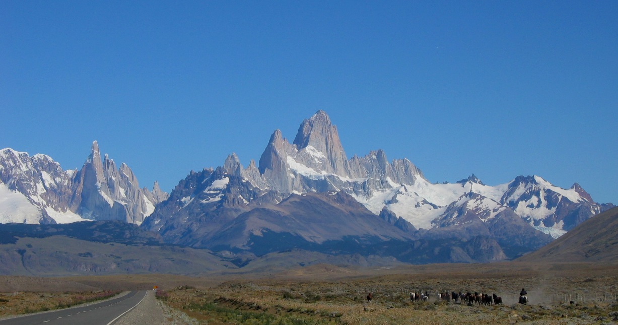
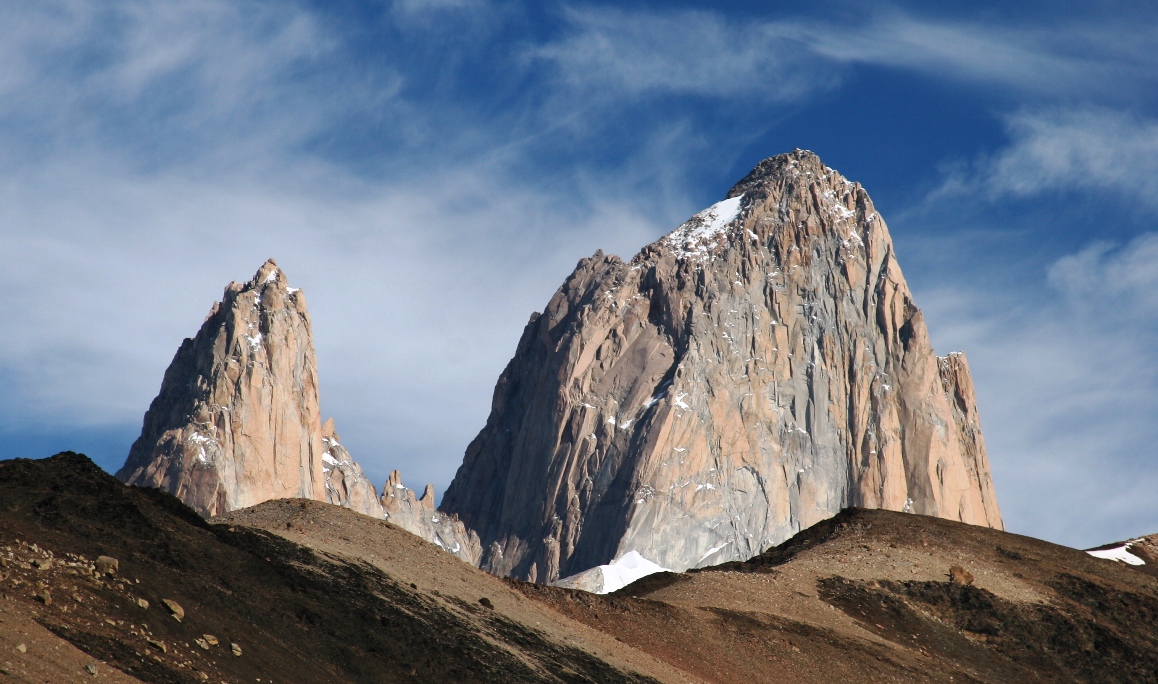
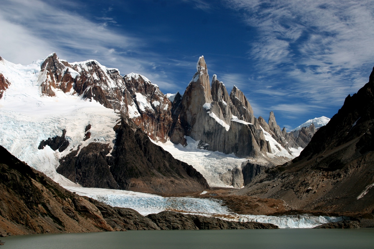
I'm quite sure that the tourists don't come here to see bulldozers and cement mixers. The signature postcard for El Chaltén features the nearby Monte Fitz Roy, a massive spire having a slightly similar look to the granite "Cuernos" in Torres del Paine (minus the black caps), although more solitary and impressive as a singular monolithic eminence. Fitz Roy is also flanked by a ridge-line featuring a handful of shorter but insanely sharp rock peaks, several of which are more challenging to climbers (and were conquered more recently) than the principal peak of Fitz Roy. A few other details about Monte Fitz Roy are as follows: it was named after Roberto Fitz Roy (the captain of The Beagle, ship of Darwin's famous expedition), and has a height of just over 3400 meters. Unlike the Torres del Paine, which are considered to be geologically separate from the Andes range, Fitz Roy lies in the eastern cordillera of the Andes, one of two ridge lines that flank the Southern Patagonia Ice-Field. An interesting summary of the climbing history of Monte Fitz Roy is given in this article...
http://www.infinito-sur.com/information-about-patagonia3.html
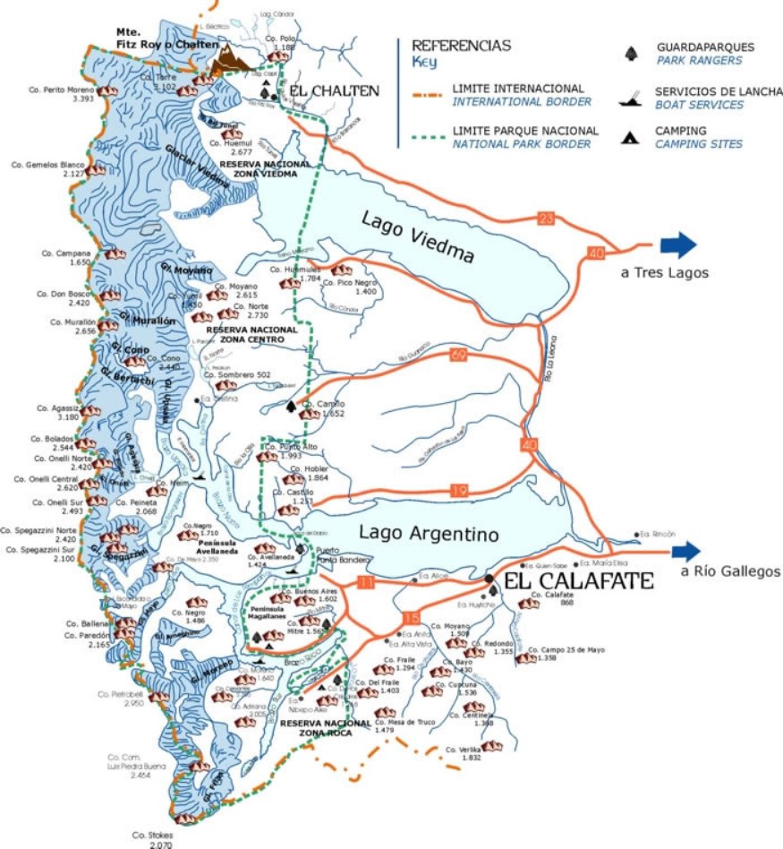
This map shows where El Chaltén is located in relation to El Calafate, and the route we took to drive there. Regarding the Argentina-Chile border dispute, the national park maps printed and sold in Argentina show a sharp narrow finger of Chile extending eastward just far enough to "touch" the summit of Monte Fitz Roy. I think the Chileans must have been (and still are?) claiming that the little peninsula extends far enough to include the whole mountain, perhaps even claiming that it isn't just a little finger and that the whole ridge line belongs in Chile (all the good stuff, at least). I could just imagine it, customs and immigration agents stamping passports and charging a Chilean national park admissions fee to climbers at the base of the mountain...
For a more general view of where this is in South America, you can also click here to download a map of Santa Cruz province, Argentina.
*****************************************************************
So to begin the brief history of Wietelmann's in El Chaltén, we left Hosteria Alta vista and drove there two days ago on Sunday afternoon. As we headed westward on the recently almost-but-not-quite-completely paved route 23, the mountains of the Fitz Roy range grew out of the horizon like a glittering Oz in the distance.
![]()
Heading into El Chalten.
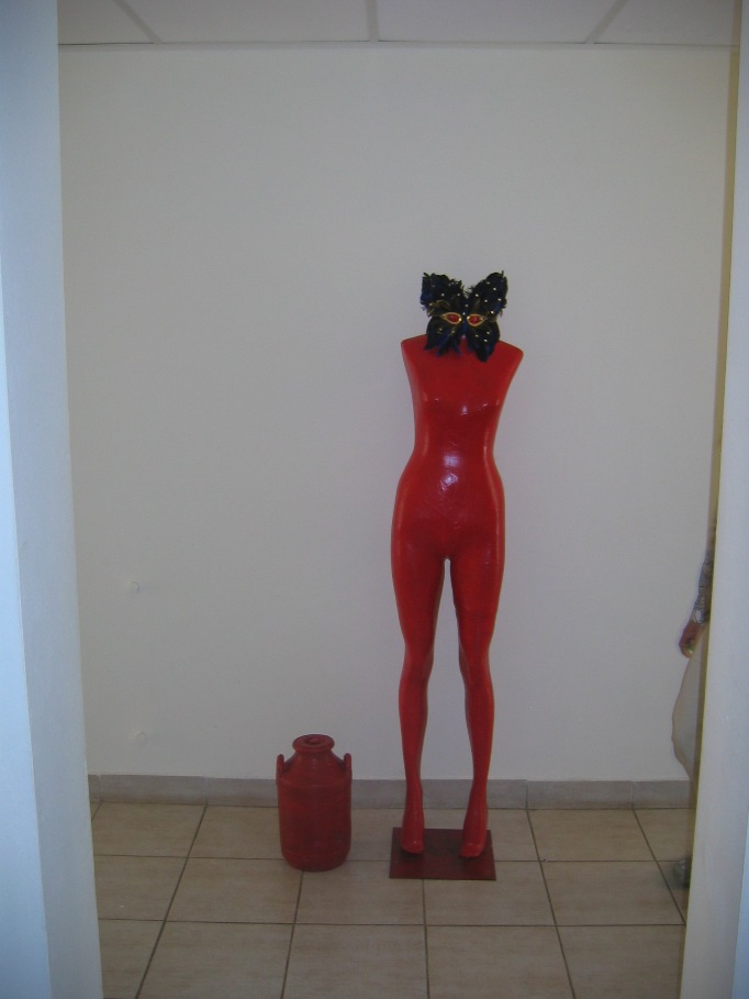
Since we would be here for a week, we decided to devote Monday to schoolwork and basically just hanging out at our hotel, which is an interesting place in its own right. Posada Lunajuim appears to have been recently redecorated, and like almost every other building in El Chaltén, workers are busily tacking additions onto the top and rear. A bright red, armless and naked mannequin wearing a black carnival mask stands sentry in the T intersection of the stark white hallway leading to the guestrooms. In the same hallways, the doorjambs, Dali-influenced modern art paintings, and utilitarian fire extinguishers prominently feature the same bright red.
The dining room and lounge are cozy enough. The original brick walls haven't been plastered over with hard anesthetic whiteness, and the art theme is more diverse and moderated by messy bookshelves, comfortable furniture, and several cats. It would be very comfortable during the day as well as the night if it weren't for that incessant hammering...
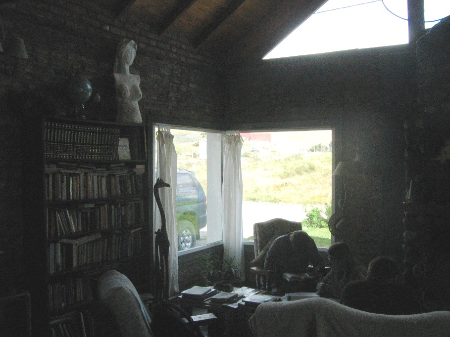
Sitting in the sitting-room doing homework.
The best thing about the hotel is the attentive and helpful staff - in particular Belun, the young receptionist who dotes on all the guests with tireless attentiveness - but all the staff are extremely friendly and helpful. I especially appreciate their willingness to switch between Spanish and English at the whim of the guest. They don't seem to mind helping us practice our Spanish, and listening to tourist after tourist stammer along half-slaughtering their native tongue doesn't seem to annoy them in the least. And when our brains just can't handle it anymore, they don't mind if we switch to English. Belun and the owner both seem pretty good with German, too.
Perhaps to compensate for our lethargic Monday, we had big plans for Tuesday, all of them involving the out of doors and being away from the hammering in the hallway of the hotel. The day started early for Lynn and I, as we drove back a few kilometers out of town on route 23 in order to take some sunrise pictures of the mountains.
![]()
Looking east from our photo shoot spot.
![]()
Finally the sun came up high enough to begin illuminating the mountain ridge,
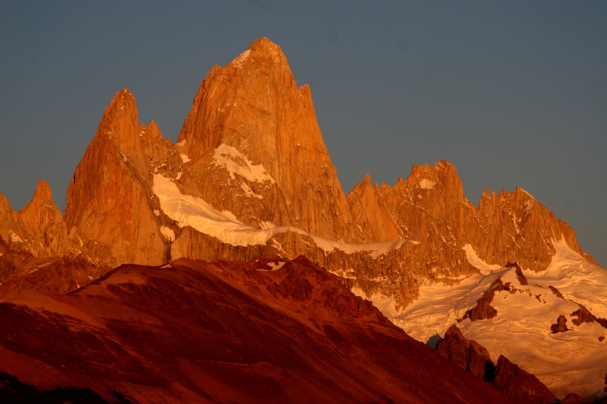
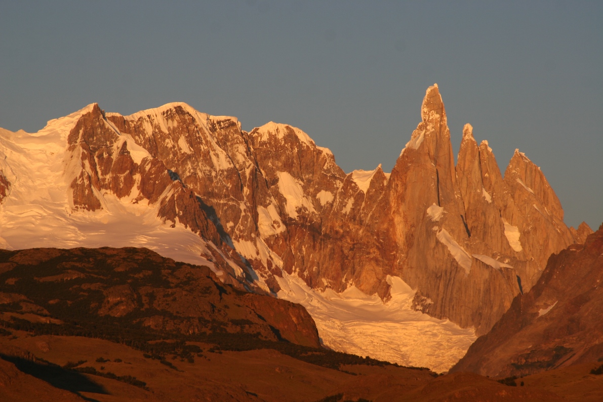
and then Fitz Roy and the Torres began glowing.
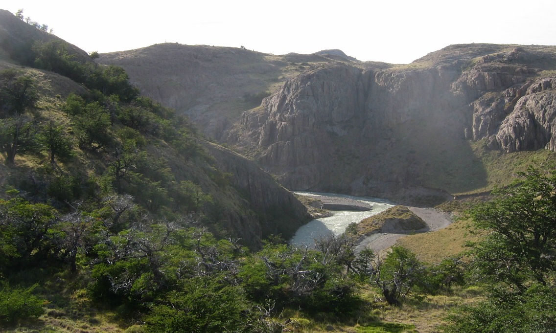
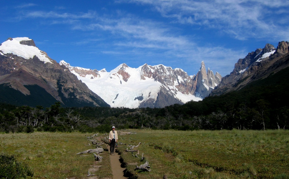
After a brief break to wake up the kids and eat some breakfast, we started out on a long hike into those mountains. El Chaltén is located at the confluence of two rivers, and our hike followed Rio Fitz Roy westward to the glacier lagoon where it is born.
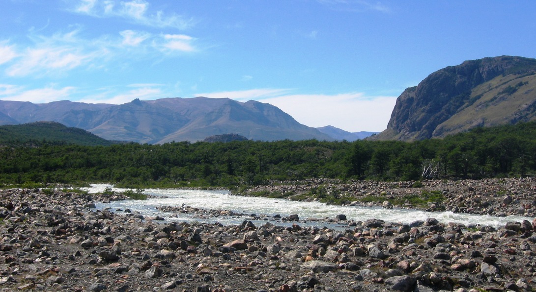
The Rio Fitz Roy just a short distance west of El Chaltén town.

And then looking further west the river gorge narrows, eventually flattens out into a wide valley, and finally leads to its source, the glacier just visible in the far distance of this picture.
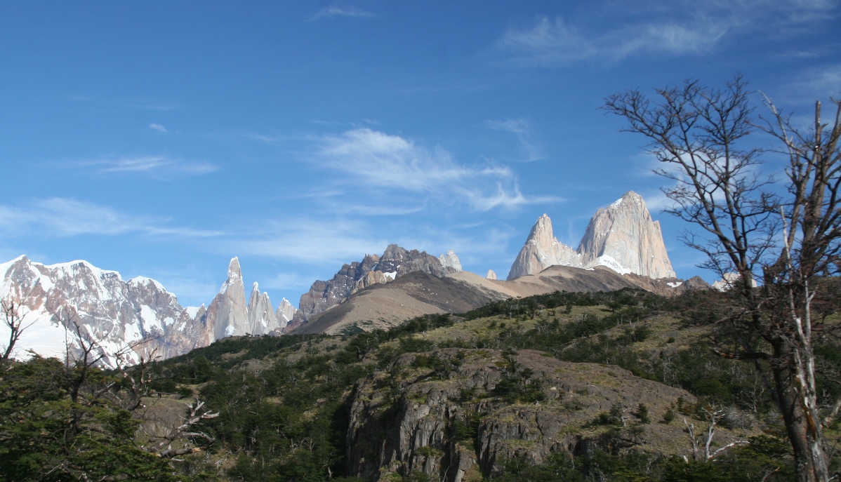
Before we descended completely down into the river valley, we could still see Fitz Roy over the right hand ridge of the valley.

But eventually, we were down in the valley, with only the Torres (and not Monte Fitz Roy) visible directly in front of us.
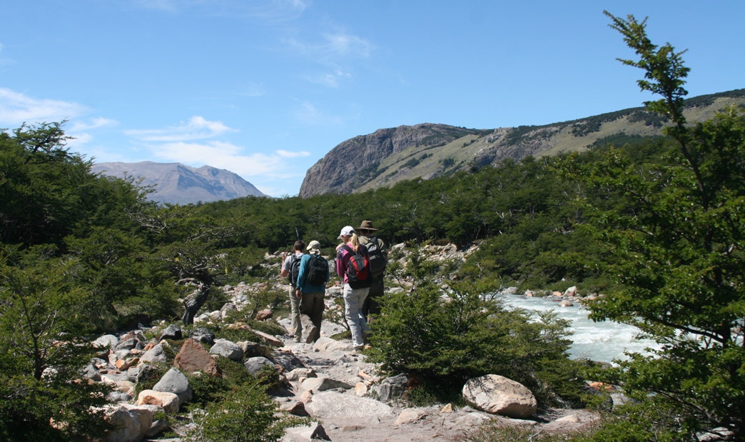
Walking along the river not far from the glacier.
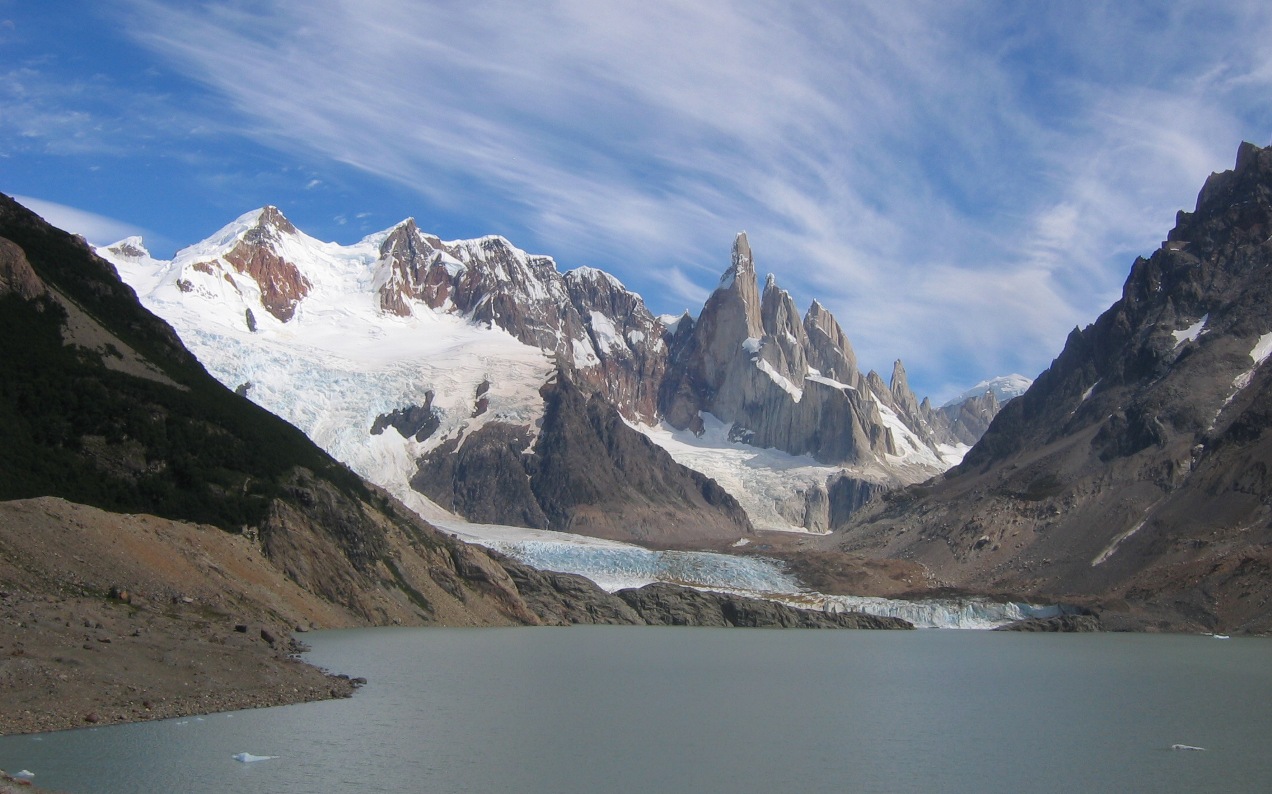
After three hours, more than ten kilometers, and a few thousand feet of up and down, we finally arrived at the lagoon. This was a good spot to eat lunch,
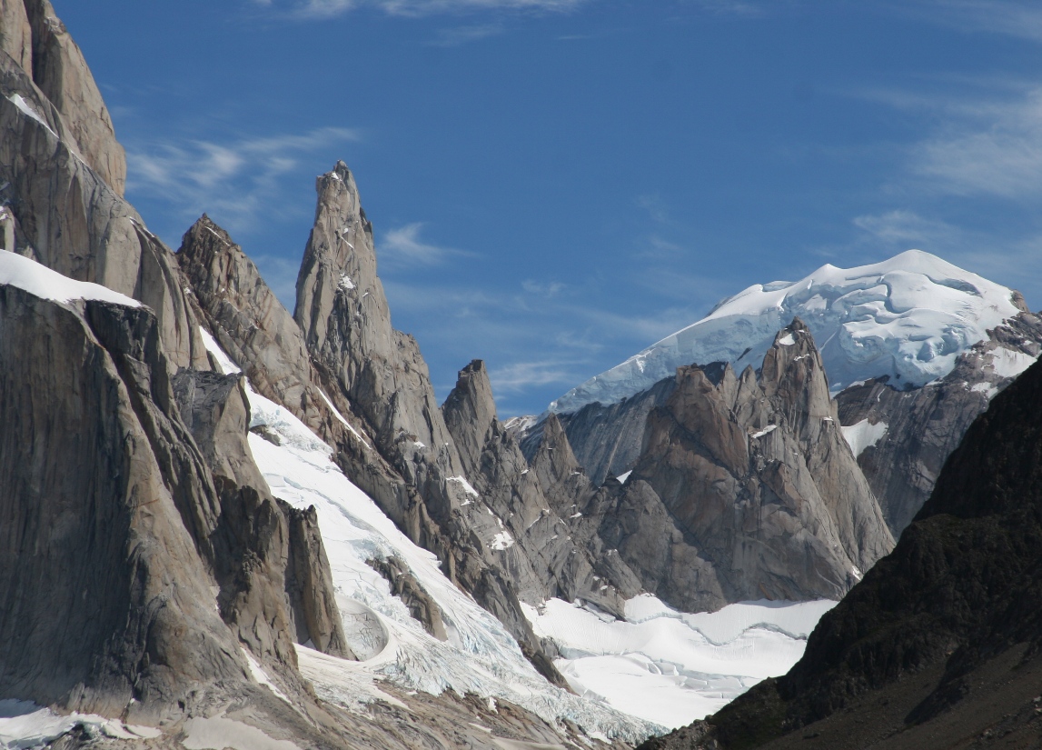
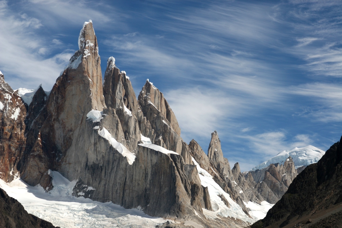
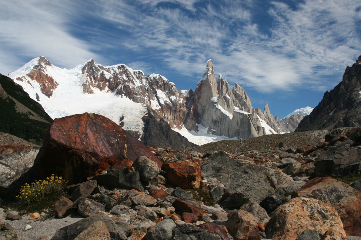
and take more close-ups of the Torres.
The tallest peak of these torres, called "Cerro Torre," is much less tall than Monte Fitz Roy, but a bigger challenge to mountain climbers. Why? Just take a look at the top! It's amazing to consider how anyone could possibly make it to the top of that thing without a helicopter. On one of the first serious assaults, the climbers dragged a 200 kilo air-hammer up the slope with them in order to help pound nails into the granite. Is that cheating? The following link provides an interesting summary of the history of climbing this incredibly sharp peak: http://www.infinito-sur.com/information-about-patagonia2.html .
![]()
While the rest of us relaxed and enjoyed the view, the boys played with rocks.
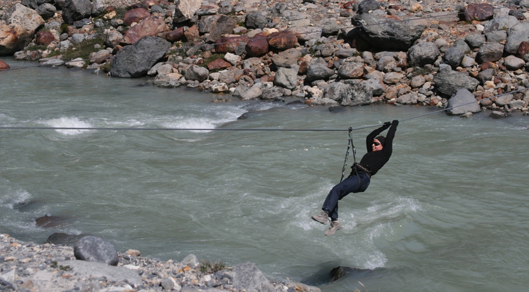
The only way to cross the river is via this self-propulsion zip-line, located near the head of the river where it spills out of the lagoon. It looks like it takes a fair amount of work to pull yourself all the way across, especially the "uphill" second half. After crossing the river, the trail continues towards and onto the glacier. The park maps mark this section of the trail as "Guide Required!" Having neither guide nor zip-line harnesses with us, we turned around and hiked back to town after eating our lunch.
Here are a few pictures of El Chaltén, hopefully helping to illuminate the written description I tried to present earlier.
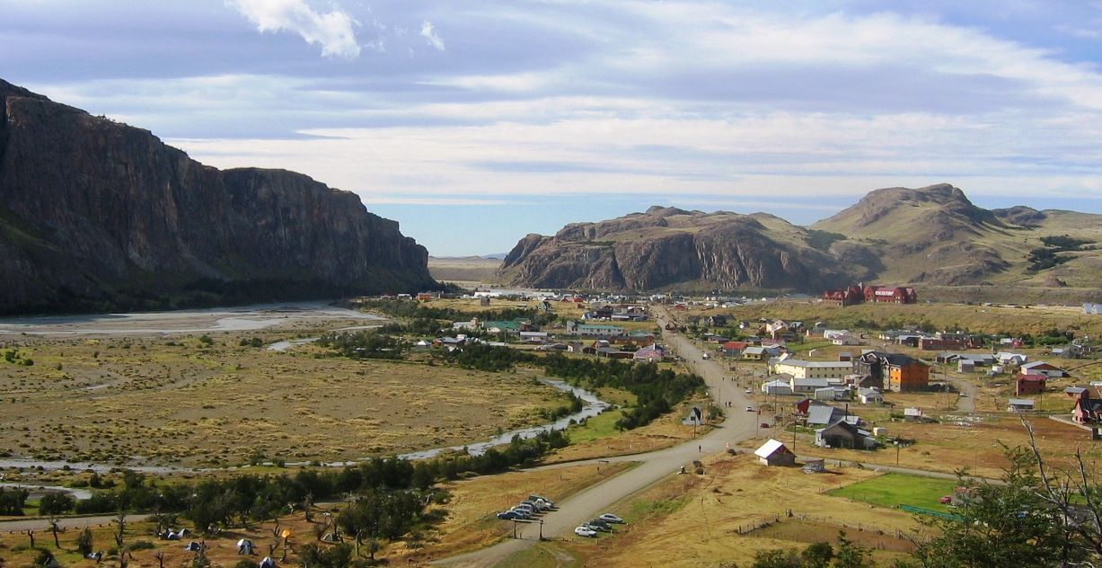
Looking down from a hiking trail at the north end of town.
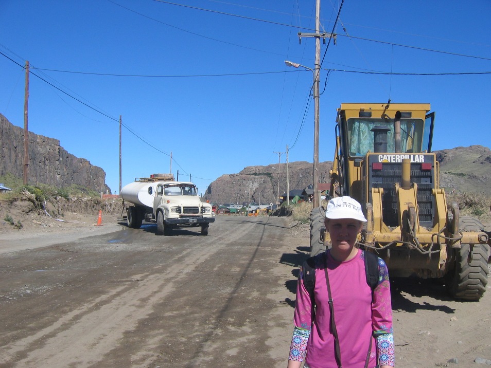
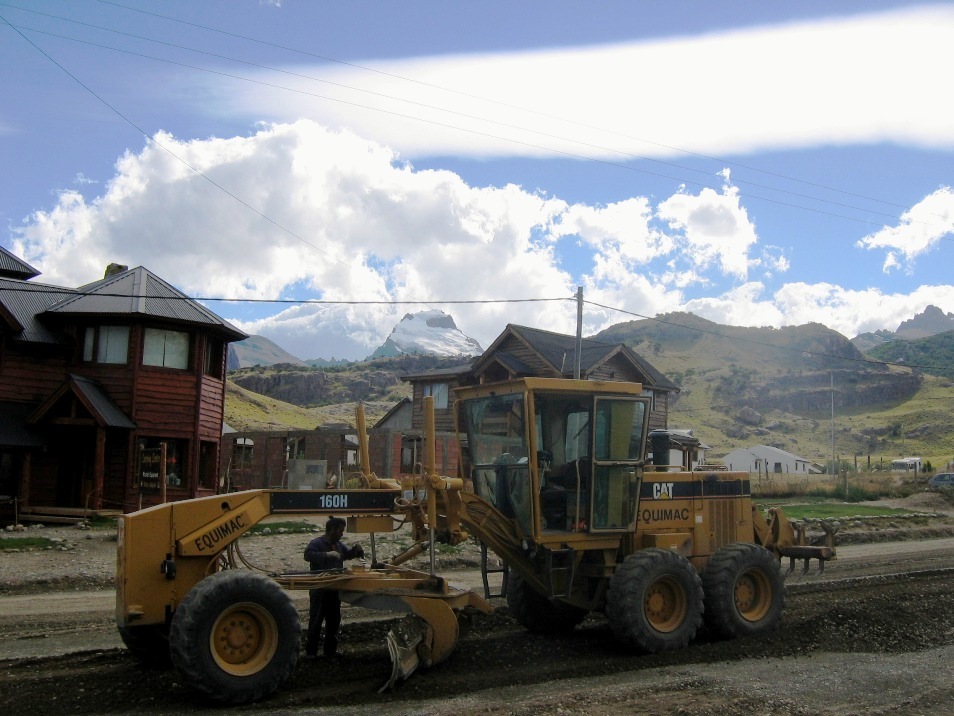
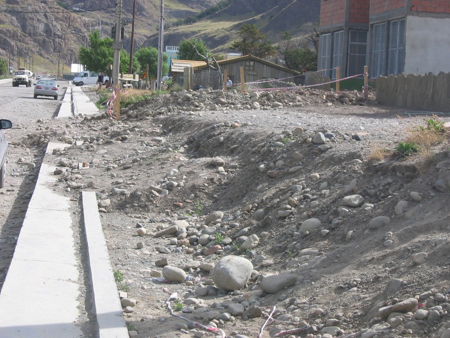
It seems like they are trying to pave everything at once. When the wind kicks up (every day, sooner or later...), the dust flies in thick, choking clouds. Walking or driving is a drunken slalom around construction crews, dirt piles, strangely parked vehicles, other moving cars and/or pedestrians, street dogs, loose horses, and random debris.
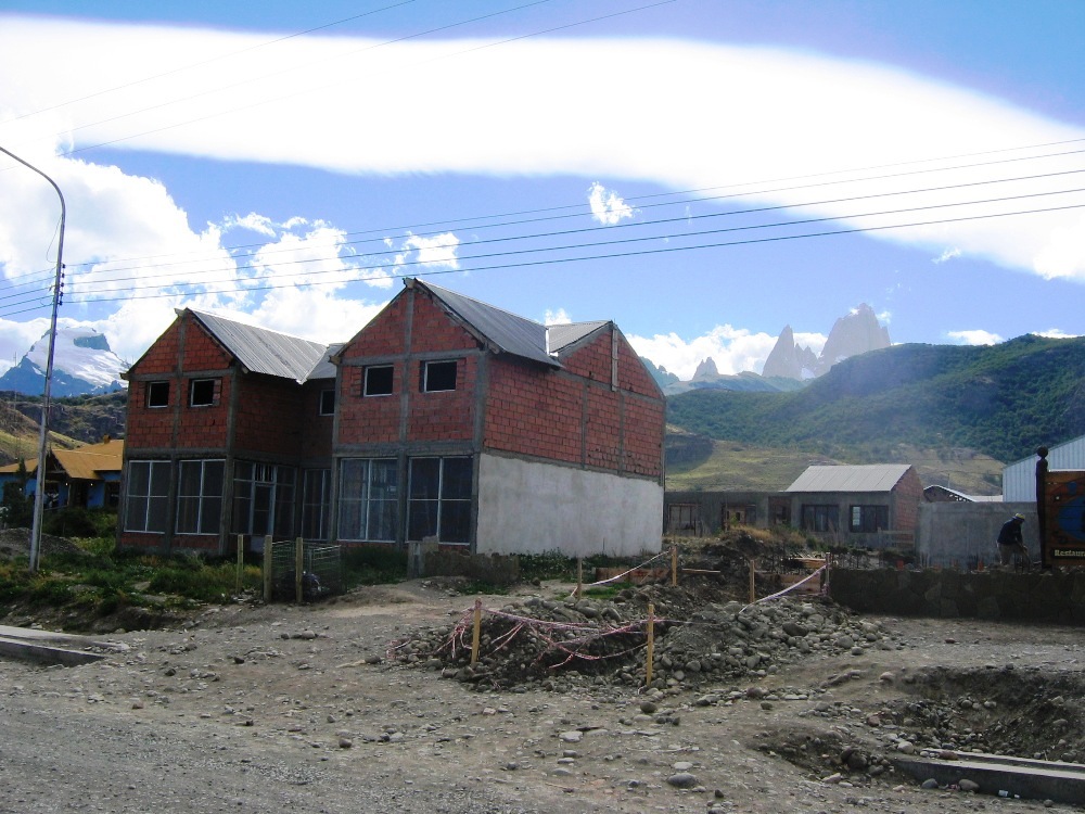
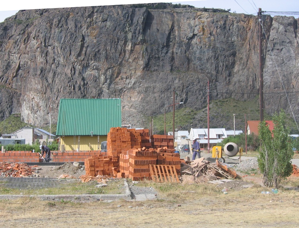
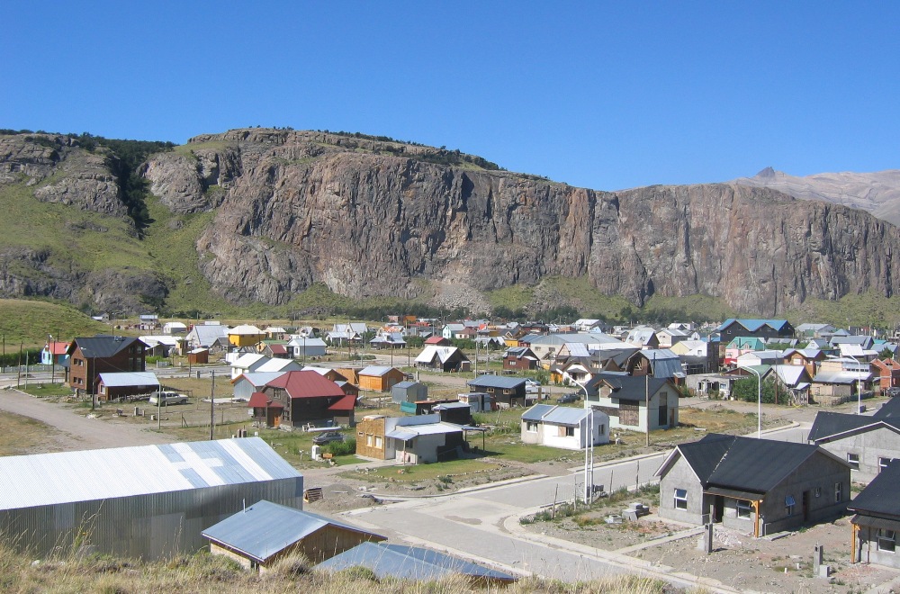
There are brick skeletons all over the place. It looks like the government gave away free or very cheap land to whoever would build on it - then a bunch of people built the beginnings of something to stake their claim (the essence El Chaltén), and now many of them are sitting around in construction limbo. But I suppose they can only build and pave so much at one time...
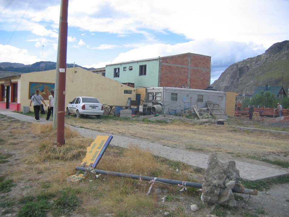
I thought there were absolutely no street signs in town, until Lynn pointed this one out to me as we were walking around at lunch time on Monday.
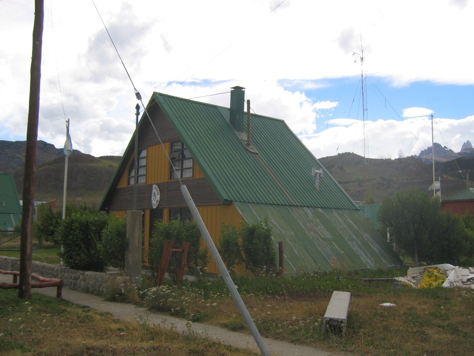
Here's one of the government buildings. The courthouse, jail, and police station are all located on the same block and all are similar little A-frame cabins with the same green metal roof. It doesn't appear that anyone bothers with the annoying nonsense of zoning or building permits, but the good news is, no one spends that much time in town other than to sleep and/or revive themselves with a hot meal and a few cold beers. The real activity is out on the trails, which are all fairly busy with happy hikers, but fantastically beautiful none-the-less. For sure we'll have to do some more hiking before we leave...
-Rolf