Chaitén - Parque Pumalin
Wet and Wild
Sunday December 2, 2007
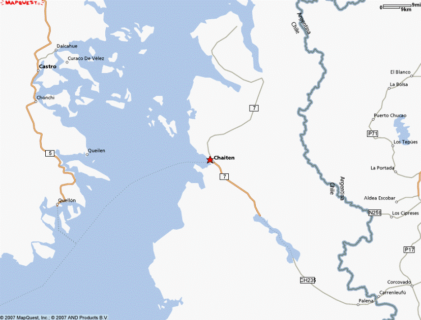
Click the map if you want to zoom or pan the Mapquest map of Chaitén, Chile...
Our ferryboat escape from Chiloé to the mainland proceeded smoothly and without problem on the land or over the water. Carlos got up early on Wednesday to feed us breakfast a half hour earlier than he normally serves breakfast to anyone - a clear sign that we had earned his good graces (and run up a larger than usual tab) by staying 5 full nights and taking advantage of his guiding advice to visit some of the prettiest and most interesting parts of the island. But we were looking forward to something different, and we would find it soon enough to be sure.
Our ferry left from the town of Quellón, where the Panamerican highway ruta 5 meets the gulf of Corcovado and finally stops heading further south, and where a twice-a-week (Nov-March "high season") ferry crossing interlude is inserted into the path of highway travelers wishing to continue further southward in wheeled vehicles. The road resumes with a new name and number at small town called Chaitén, where the ferry arrives in late afternoon after a 5 hour crossing. The road passing through Chaitén is shown as "ruta 7" on the maps but is always referred to by name as the "Carretera Austral." Sections of the road actually began 250 kilometers north of here on the mainland city of Puerto Montt, not far from the north end of Chiloé. The problem with trying to drive down from Puerto Montt is that you can't, since the northern most portion of the Carretera Austral is interrupted by at least three wide fjord crossings that are not served by any regularly -scheduled commercial ferry service that would transport your car. From Chaitén south, the mostly gravel, occasionally paved, and sporadically dreadful road leads another 750 kilometers southward through the wettest, greenest, wildest, and narrowest part of Chile. It stops this colossal journey at the tiny settlement of Villa O'Higgens, literally at the end of the road and, for almost all practical human purposes, at the end of the earth.
The vast majority of the road lies in the 11th region of Aisén, Chiles "last frontier" which was settled and opened up to the rest of the country (somewhat) beginning only in the early part of the 20th century, when the government created three massive agricultural companies and gave them exclusive rights to the land and resources. These estancias were broken up in the mid 20th century when free land was promised to anyone who would clear and claim it, and this created environmental havoc when enormous swaths of forest were burnt and/or clear-cut to clear far more land than the small populace could even attempt to farm or ranch on.
Up until the mid-1970's, there were only bits and pieces of road, and the connection of all the pieces into one contiguous stretch (still mostly un-paved) was a project promoted by and undertaken under the direction of Pinochet. Perhaps this is the sort of development that only a non-democratic authoritarian government could (or would bother to) pull off. This region's relatively tiny population would generally earn no more than the disinterested neglect of vote-conscious politicians - and the residents of Aisén generally feel that that's just how they've been treated before and after Pinochet. So Pinochet was and still remains very popular locally, and even now there are civic tributes to the man and his road proudly displayed along its passage.
We're not planning on taking the road all the way to Villa O'Higgens, because if we did, we'd either have to settle down and live there, or turn around and drive back north for a few hundred kilometers. Our plan is to drive south just to where the road passes the western shore of the giant Lago General Carrera (or Lago Buenos Aires to the Argentineans), then turn east to follow the southern shore of that lake to a border crossing where we'll enter Argentina. In Argentina, we'll be able to continue driving all the way down to Tierra del Fuego. In Chile, South of Villa O'Higgens, there is no more road of any name or number, and the Chilean side of the narrowing continent consists of a speckled archipelago of thousands of primarily uninhabited islands flanking a monumentally massive ice-field. There are two other notable Chilean cities and perhaps its most spectacular national park located much further to the south (very close to Tierra del Fuego), but these are accessed strictly by airplane, surface roads from Argentina, or a 4-5 day ferry passage from Puerto Montt.
***************************************************************
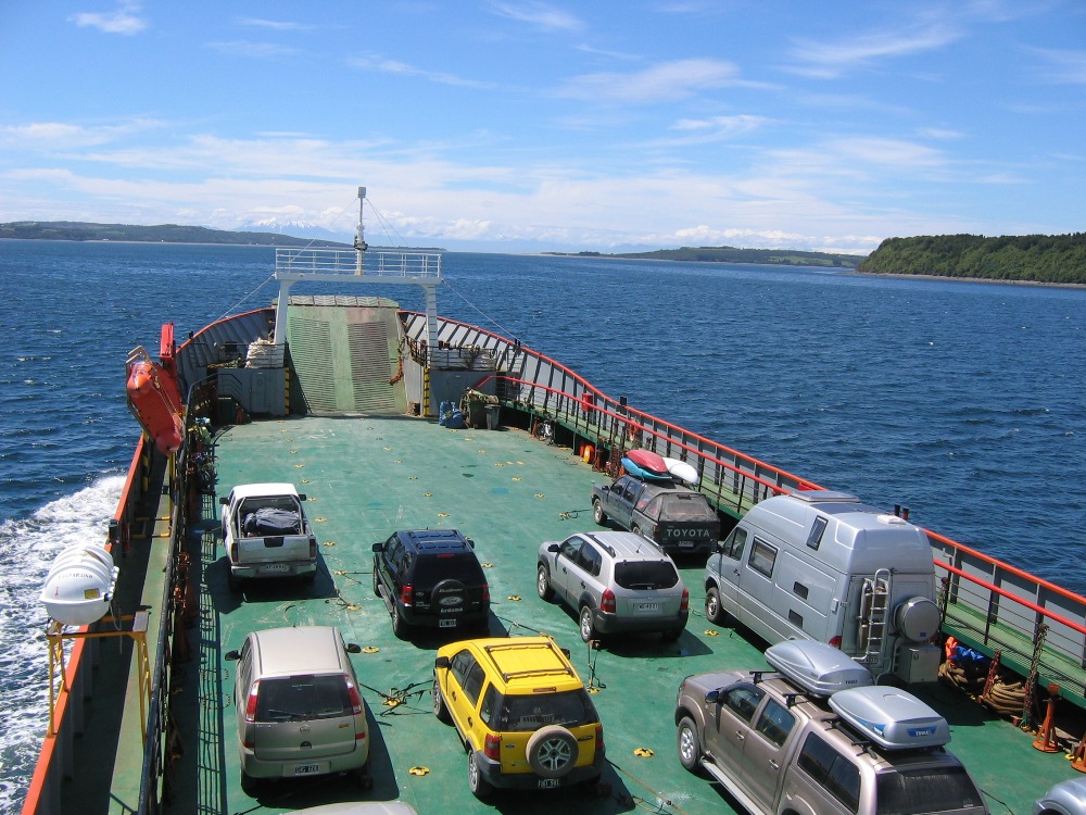
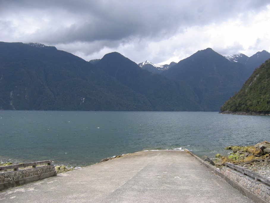
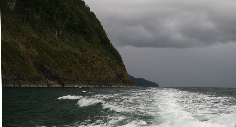
We enjoyed good weather for the ferry crossing across the Gulf of Corcovado...
![]()
![]()
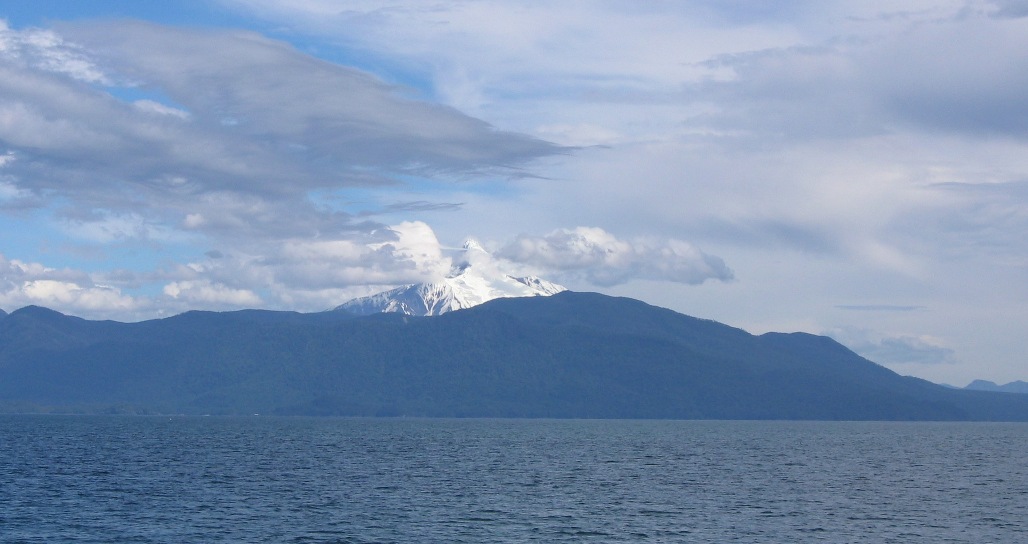
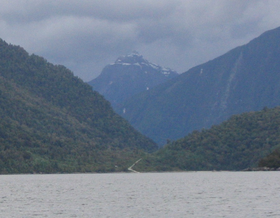
along with some nice views of the mainland. The mountain in the right picture is Volcan Corcovado.
This would be the last time we saw the sun for who knows how many days (and counting)...
The remoteness and isolation of this region of Chile became apparent soon after we drove off the ferry ramp and rounded the bend into Chaitén. For a Chilean city, Chaitén is uncharacteristically spread out and green. The few small stores give evidence to the fact that most typical commercial goods arrive only once or twice a week on a supply ferry, having on the shelves only a very small supply of meat, dairy products and produce of little variety. A short walking tour of town confirmed that the three restaurants open for business were all serving basically the same limited menu of salmon, merlusa (a white fish like cod), or beefsteak. We had a reservation for a pretty nice Hosteria and after 5 nights in Chonchi, we enjoyed its clean sheets, comfortable beds, clean bathrooms with clean towels and hot, hot water tremendously.
Thursday morning we drove back past the ferry landing and continued northward on the carretera into Parque Pumalin. After about 50 kilometers, the road ran down a launch into one of those large fjords that interrupt its passage between here and Puerto Montt, so we had to stop and park. We had arrived at Caleta Gonzalo, the sight of the most developed tourist facilities within Pumalin. In addition to having what is probably the nicest campground in Chile, there is a cluster of 6 very small cabañas located very near the shore of the fjord. The last three nights, we slept in two of these cute little hovels.
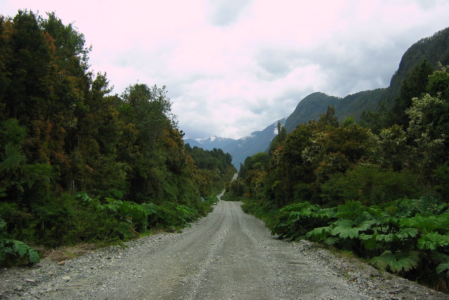
Finally, our truck sets tire on the real "Carretera Austral."
But we had to stop when the road ran into the water at Fjordo Reñihue. In the above map, this is where the little grey finger of road heading north from Chaitén stops at the blue finger of water protruding inland from the gulf. The picture on the right shows where the road takes up on the other side. Our truck has four wheel drive and a pretty high ground clearance, but I don't think it can handle that water crossing.
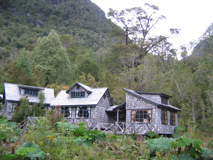
Our cabañas (the two right-most) at Caleta Gonzalo.
Parque Pumalin is not a national park. It isn't even a public park. This is the large privately-owned and controlled nature reserve that was started by the efforts of Douglas Tompkins, the North American businessman and former owner of the clothing company Esprit. He personally bought a large chunk of land here in 1991 and moved to live (or spend a lot of time) locally in Chile. Then inspired by a desire to create a private reserve committed to the environmental protection of the region, he added more and more adjoining pieces of land to his original purchase, typically disguising his identity (behind the name of some foundation or organization), which was supposedly to keep prices low and allay suspicions. But when it became general knowledge that a "foreigner" had obtained a massive portion of real estate extending all the way from the Pacific coast to the Argentinean border, the nationalistic back-lash was fierce and brutal. Some political groups even went as far as to accuse him of intending to creat a Zionist enclave where Israelis would escape to when things went completely downhill in the Middle East.
Convincing the government of Chile (and the public as well) that Tompkins' intentions were simply motivated by a genuine desire to protect the local environment and create a private nature reserve - this has been a slow and difficult process. It took three years of negotiation before the lands could be turned over to the private Chilean "Pumalin Foundation" (established, controlled, and regulated under the laws of the country of Chile), and Parque Pumalin could be created, operated, and maintained in a manner agreeable to both Tompkins and the government.
Twelve years after the original public outcry, the park now receives over 10,000 visitors per year from all over the world, mostly in the slightly less rainy and marginally warmer South American summer holiday months of January and February. That may sound like a large number, but this park is HUGE, and has access points and camping facilities (none of which are very large) scattered throughout. I also think that enough Chileans are coming here to "see for themselves" to prove that the Chilean public is gradually accepting the situation and the existence of this park as perhaps not such a bad thing after all. I would have to say, after seeing the park and its facilities, that it's almost impossible to fathom that the Pumalin Foundation has any ulterior motive other than the simply stated objective of preserving the local environment while supporting the traditional human habitation and culture in a sustainable and balanced manner.
******************************************************************
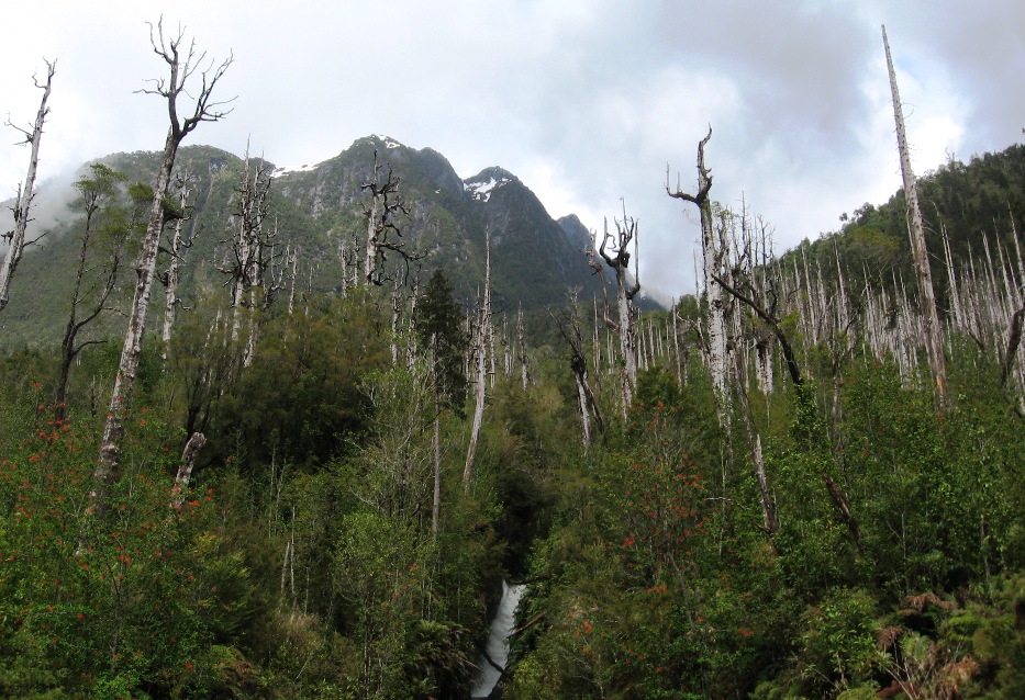
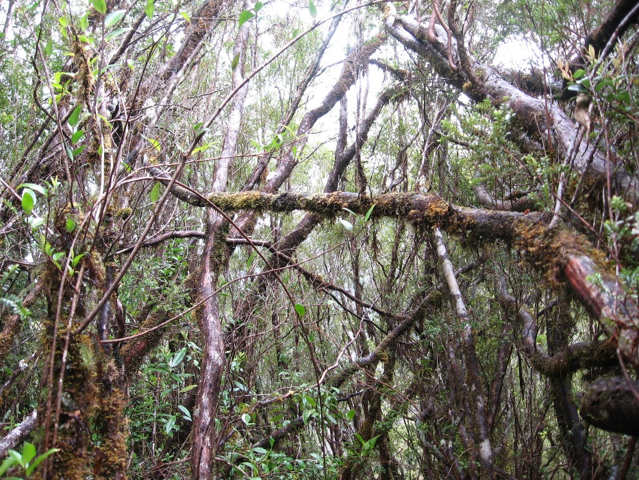
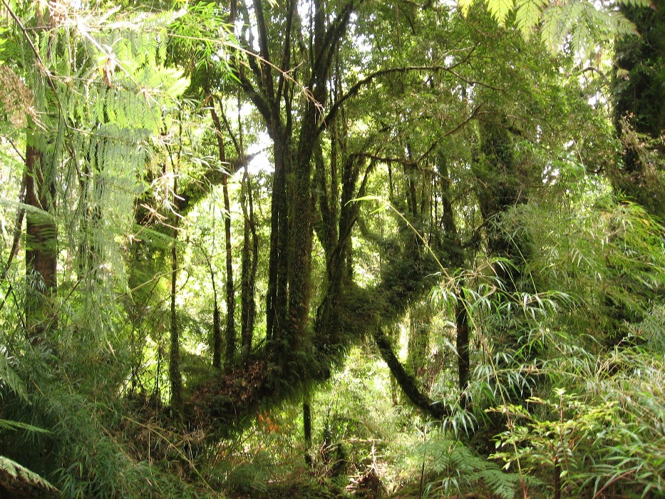
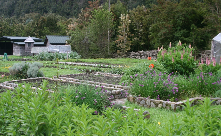
The afternoon we arrived, we wanted to visit the "demonstration farm" and gardens located on the other side of the road from our cabañas, but it rained very hard for about 2-3 hours. The next day, Friday, we took a couple of short hikes on trails leading off from the carretera. The rain from the previous day, and probably many other recent rains, had left the trails slick and muddy. This is one of the wettest and most dense temperate rainforest on the planet. The locals like to say that it rains "370 days a year."
The first hike took us across the Rio Gonzalo through a stand of ancient Alerce trees. Alerce are the South American redwood (similar to a Sequoia).
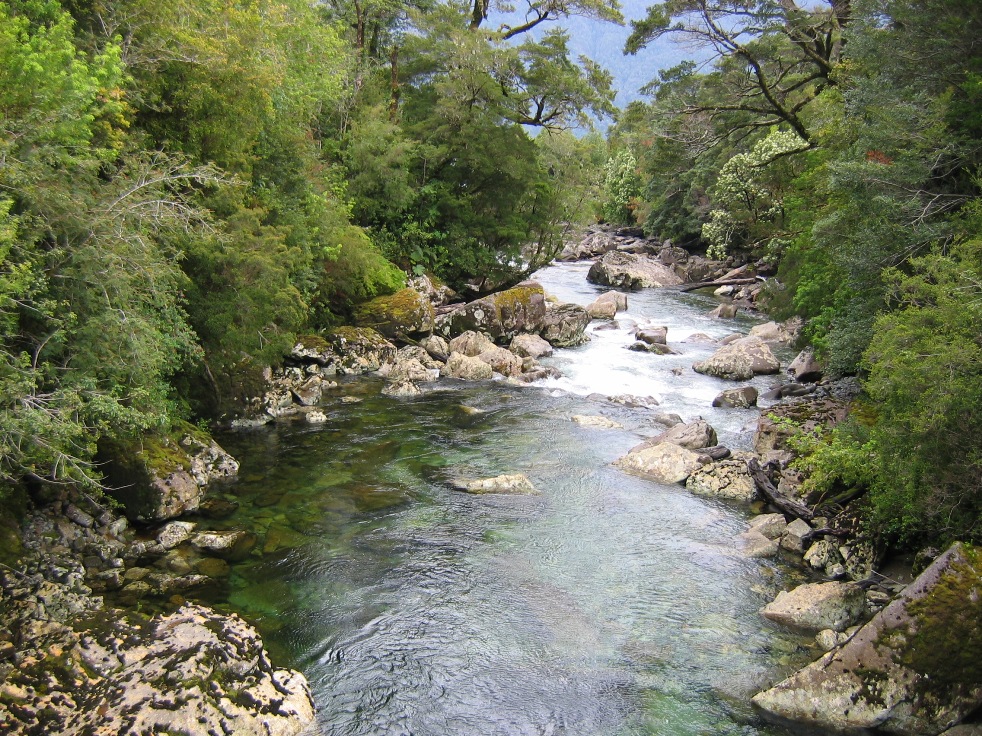
Rio Gonzalo.
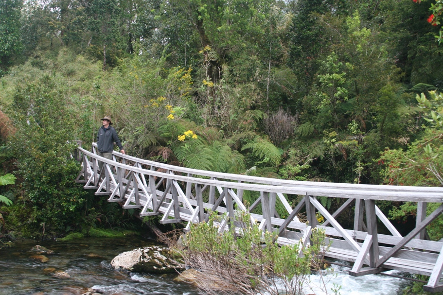
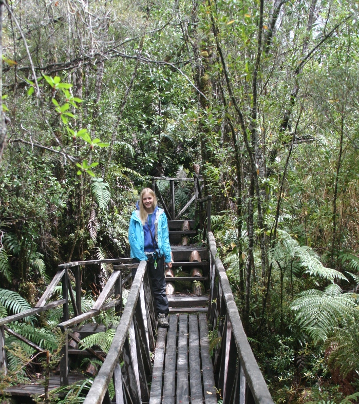
Crossing on a pedestrian bridge "pasarela."
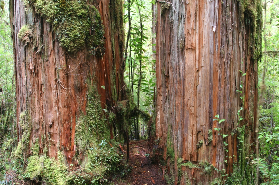
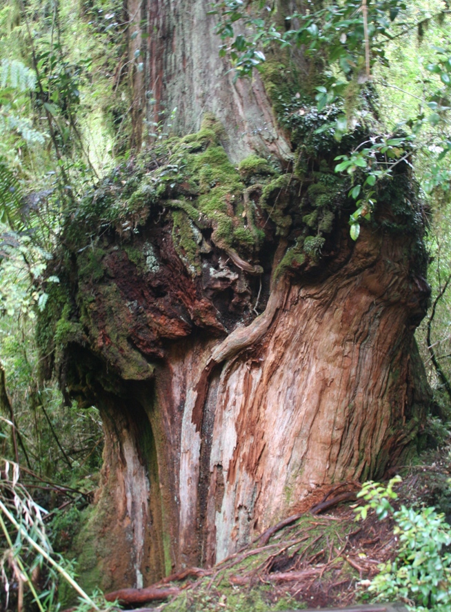
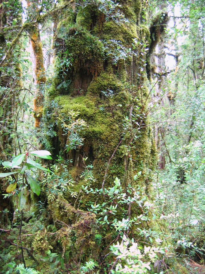
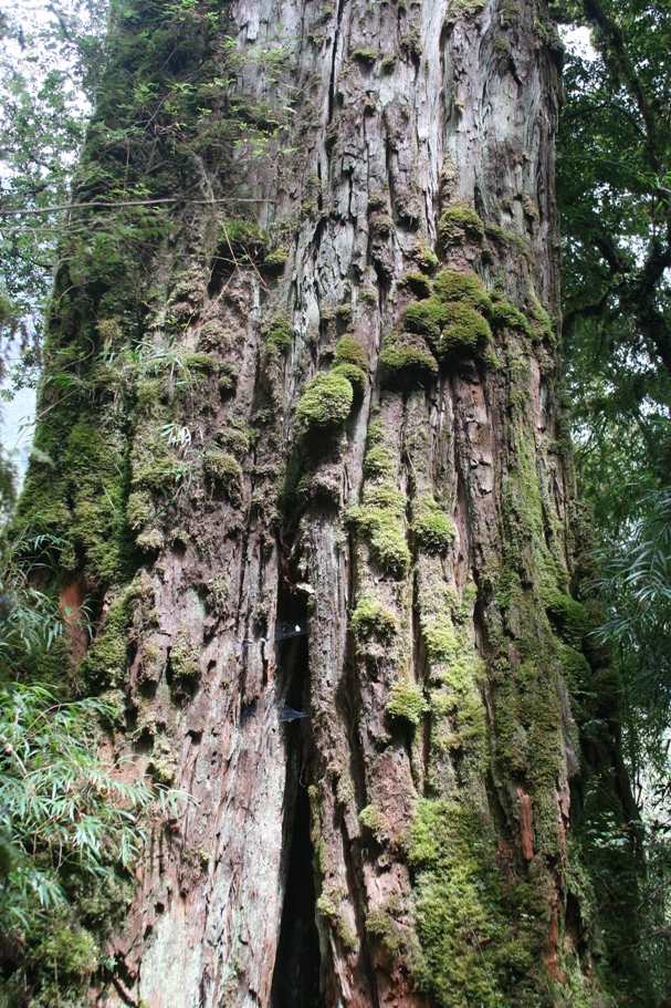
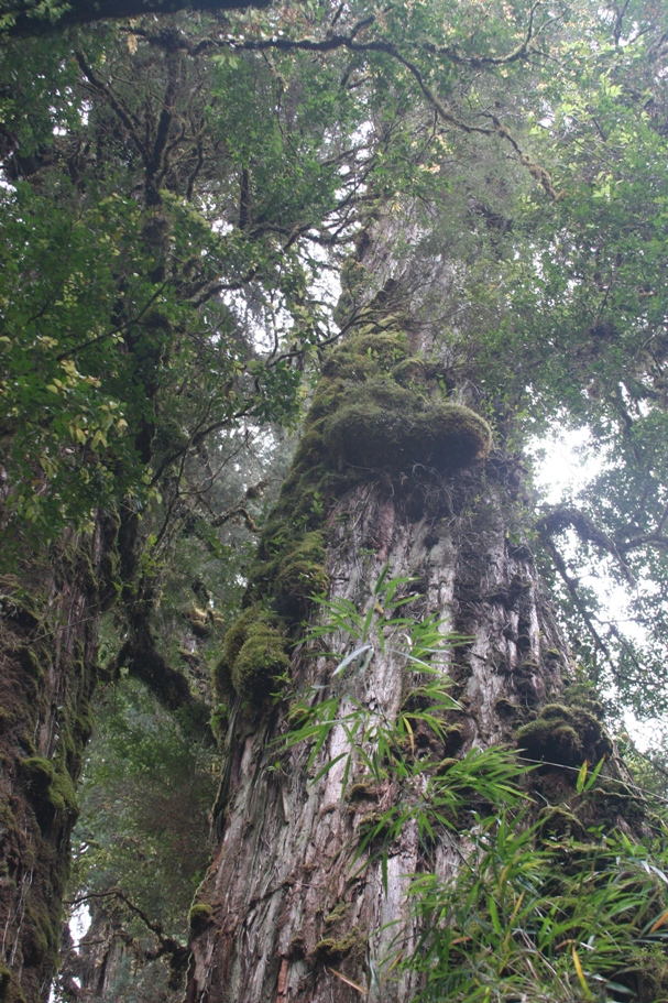
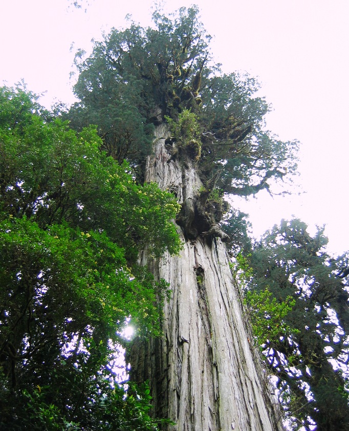
The giant, ancient trees. Just like the North American Sequoia, there are very few of the giant, thousand year-old trees remaining.
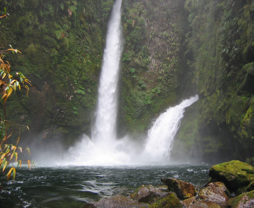
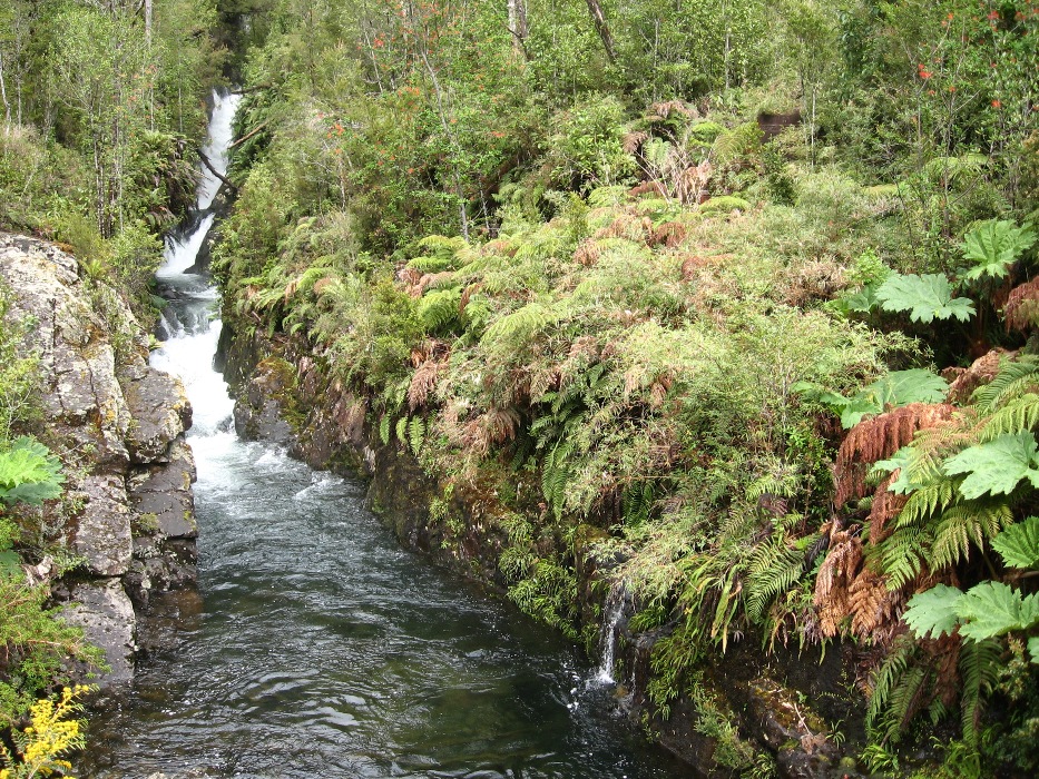
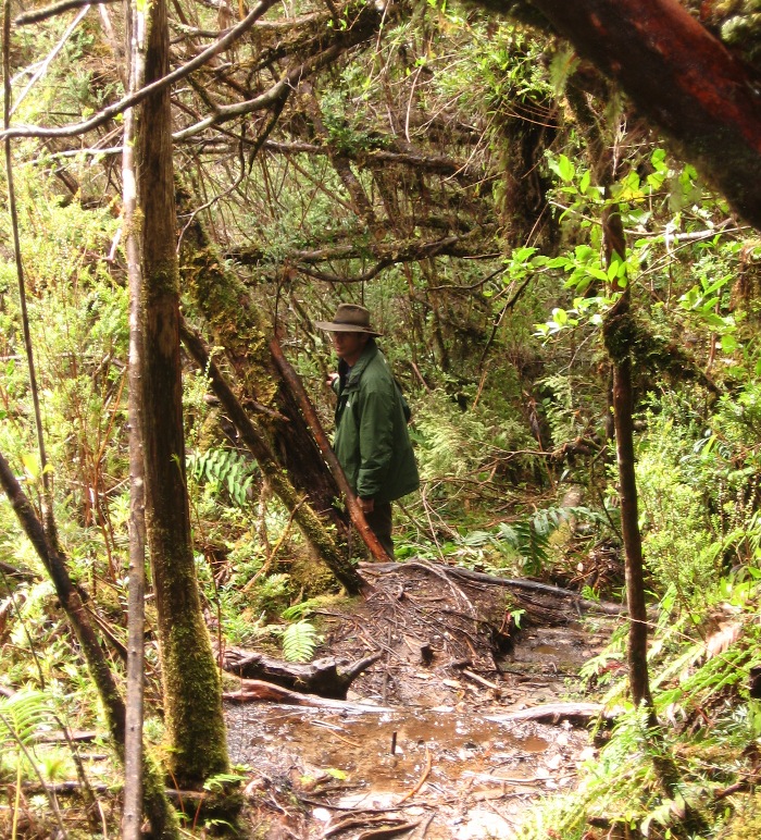
The second short hike on a different trail climbed up to a couple of waterfalls. Since the trail did in fact "climb" quite steeply, it was very slippery and treacherous in places. The hiking was slow going much of the way.
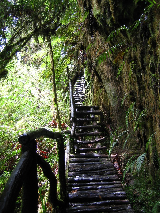
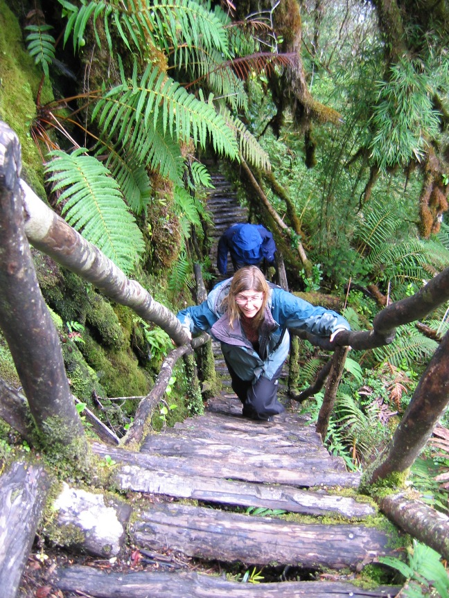
At least there were convenient (if not a little scary) steps in some places...
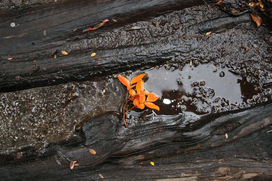
Lynn finds beauty with the lens of her camera everywhere - even lying in the mud.
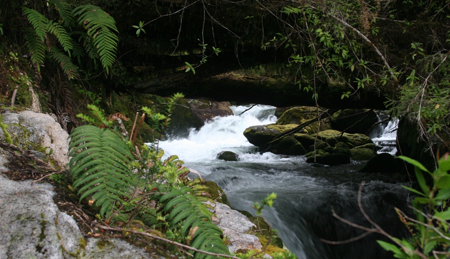
The creek passes under some logs,
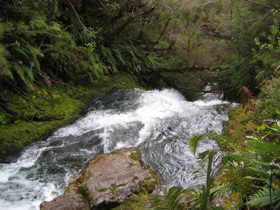
not too far downstream from this double cascade and ensuing rapids.
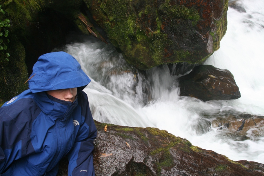
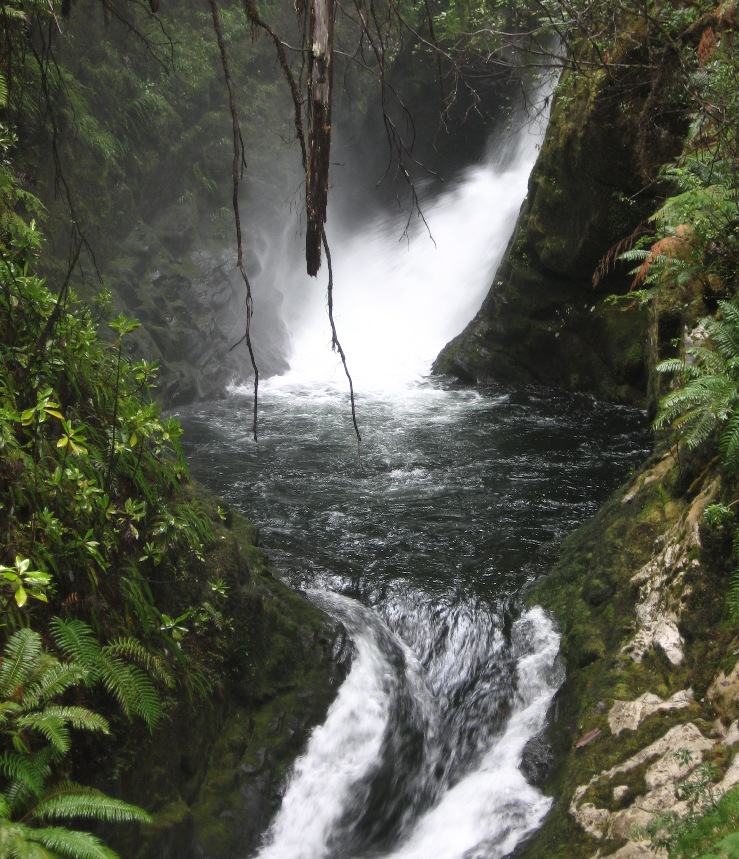
Tom stays warm and dry under the mist of the waterfalls.
After returning from the hikes and then spending a little time on schoolwork, we rented a launch which took us up the fjord to visit the sea lion colony. This being the South American Spring, the colony had recently produced a crop of new pups. Now not much more than a month old, the pups seemed to be already weaned, and many were out in the water swimming, frolicking, and trying to fish on their own.
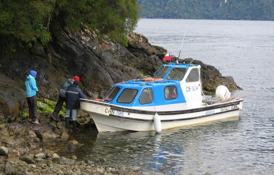
Heading out to find the sea lions ("Lobos Marinos" or "Sea Wolves" in Spanish).
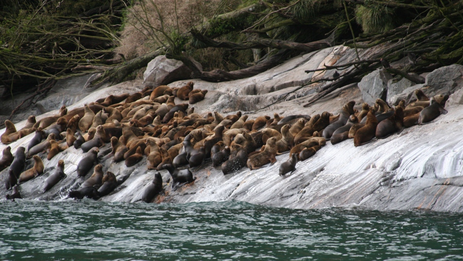
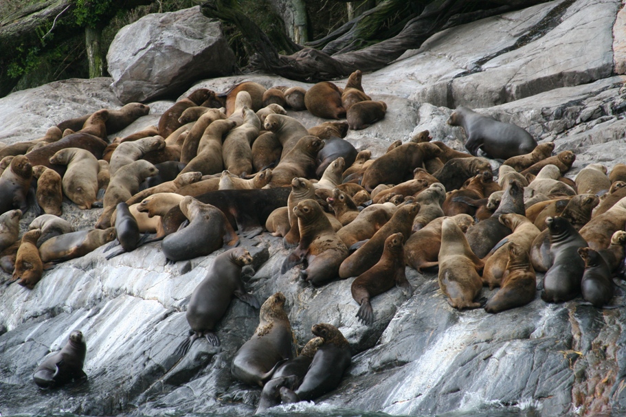
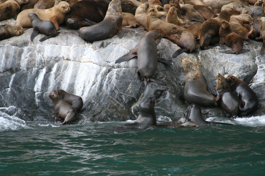
And here they are, smelly, slippery, and LOUD.
Friday night it rained again. We regret that Tom and Anna forgot to put out their rain gauge, because if they had, we'd have proof that it really did rain 3 or 4 inches in just a few hours. It certainly seemed like that much water must have come down. The sound of the rain crashing onto our roofs was a steady intense roar which made it almost impossible to sleep. I've experienced thunderstorms and intense cloudbursts, but never have I been through such an intense rain that lasted so long. Oh right, we're in one of, if not "the" wettest, wildest, thickest temperate rainforests on the planet...
so our hikes on Saturday were on trails freshly soaked by, and alongside streams surging with, an even more generous dose of fresh rainwater.
The Tronador gorge trail.
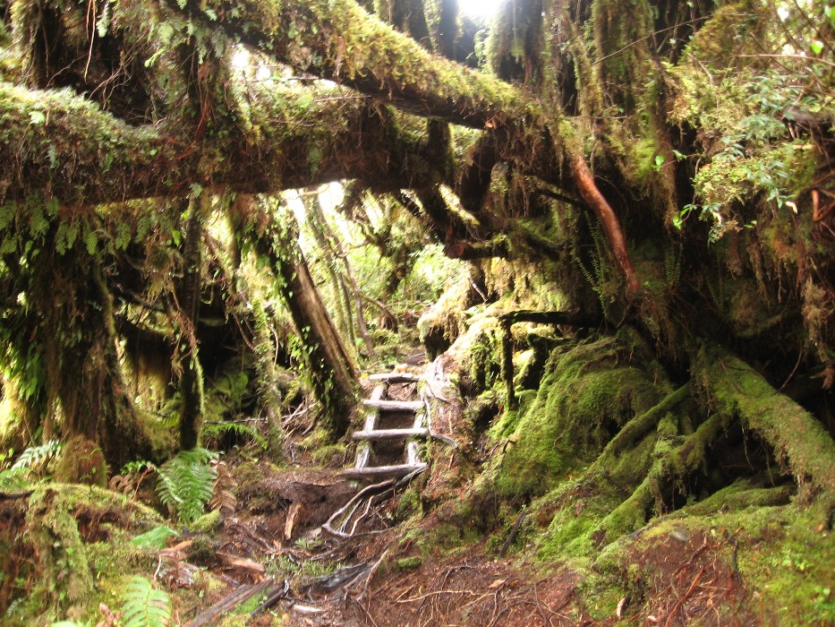
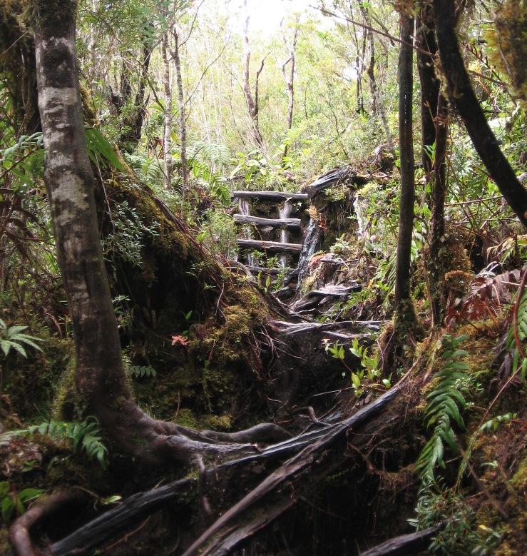
Is this really the trail?
It might seem that getting lost in the under and/or over-brush is a real risk, but without the assistance of a large machete or chainsaw, leaving the trail is impossible.
Every now and then, there was a nice little pasarela crossing the gorge.
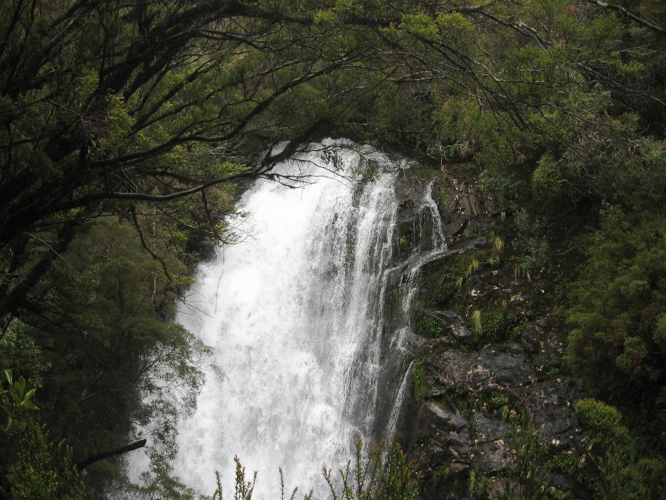
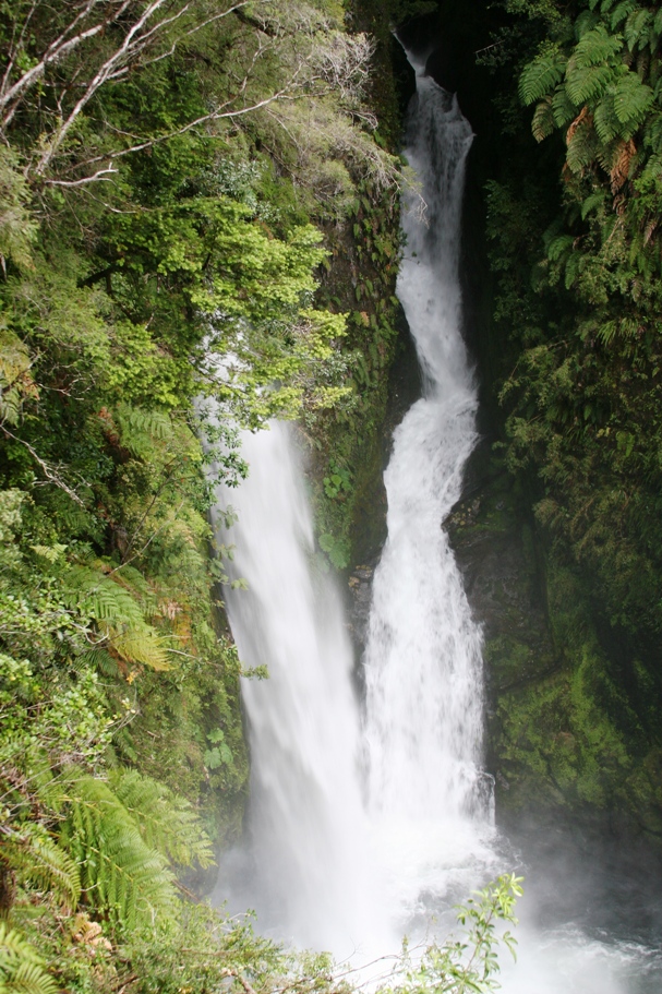
And of course, with all that water, and all these steep hills and cliffs, there are waterfalls after waterfalls upon more waterfalls, ranging in size from the little trickles cascading over a rock or two onto, over, and through the hiking footpath, up to the intensely powerful and roaring gushers like this one.
And after Saturday's hikes, when it wasn't raining more than an occasional sprinkle, we took a little stroll around the park's nearby campground, organic gardens, and sheep farm.

Lynn told me she had been seriously considering camping here. The campgrounds and associated restroom facilities are indeed very nice, but after listening to that rainstorm Friday night... I think we're all a little relieved not to have put our tent, our nerves, and our patience with each other through that kind of a test.
-Rolf