Curacautin & Surrounds
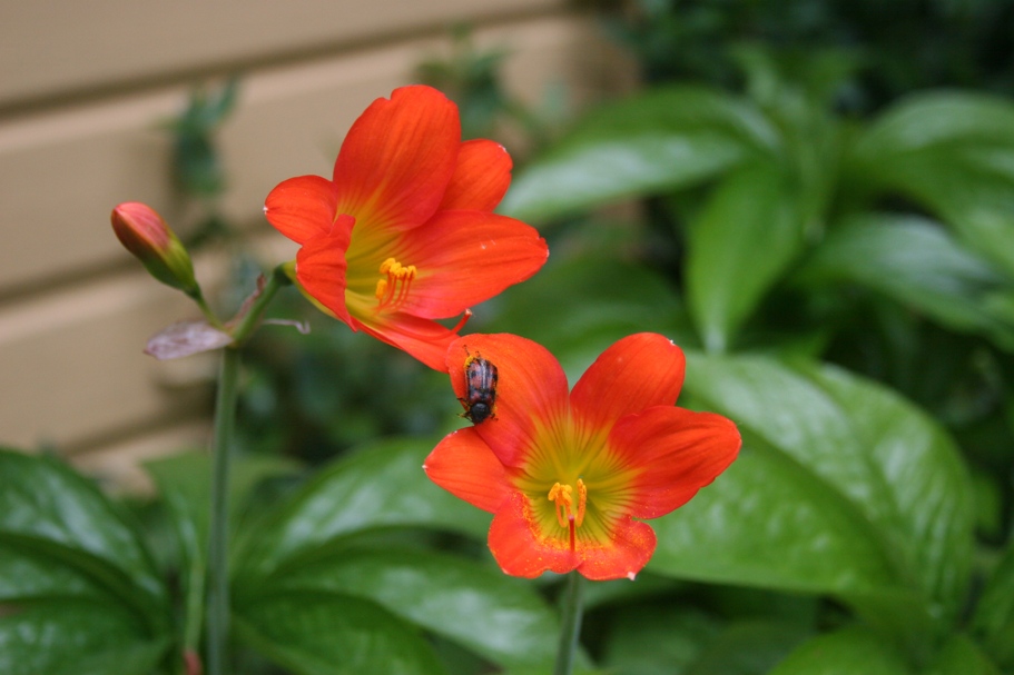
October Showers Bring November Flowers
or
Water Water Everywhere (and a few Volcanoes too)
Monday October 29, 2007
"October Showers Bring November Flowers" - I think it was Tom who first spoke these words that so aptly describe our recent submersion into the damp Austral Spring of Southern Chile. We spent three bone-dry months in the dehydrated Norte Grande before finally returning to a world with plants, lakes and rivers. Then it was almost another month before we got rained on. Now after a mere 6 days south of the Rio Bio Bio, we wish the rain would take a break. We don't mind driving or hiking around in a bit of rain, as long as it isn't too blustery or cold. But fog and clouds can wreak havoc on sightseeing excursions when panoramic vistas are the primary quarry. It hasn't been raining non-stop, but rain three days out of seven, and having to modify our plans on account of weather is something we're just not used to.
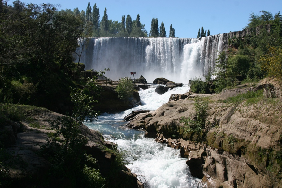
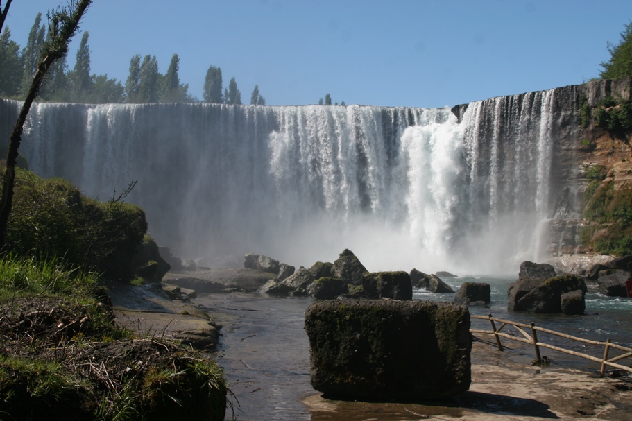
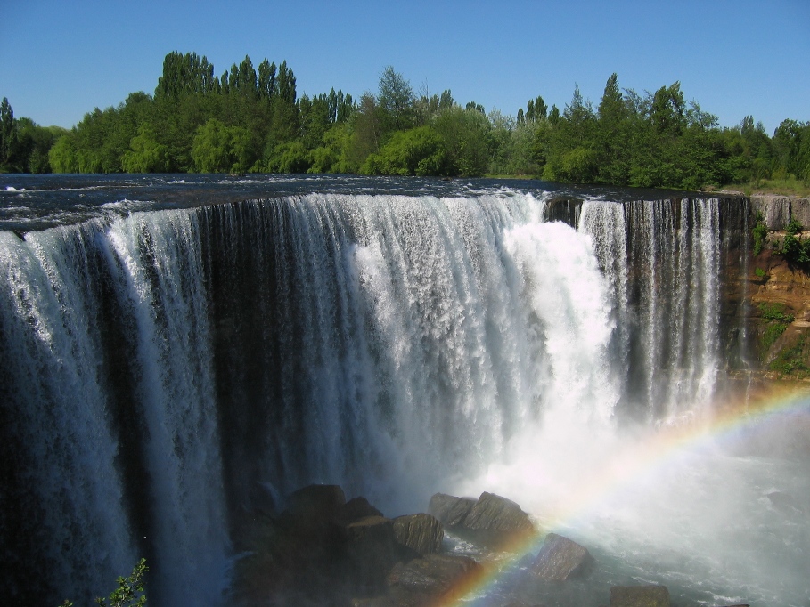
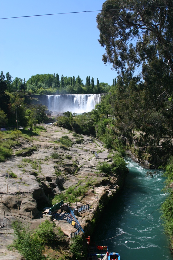
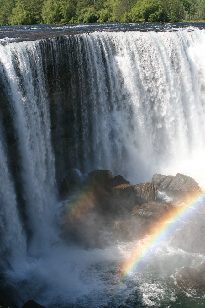
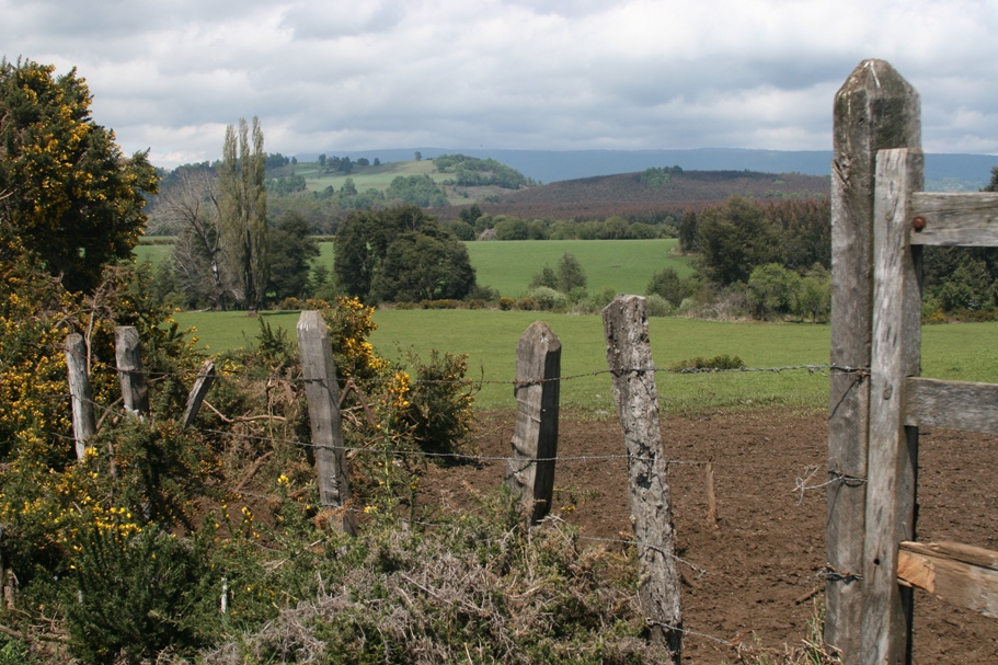
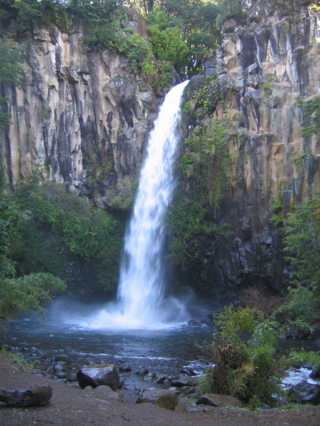
Last Tuesday we left Concepción on a gloriously warm and sunny spring day. It took us barely an hour to drive back to the Panamerican highway, after which we drive only a short distance south before stopping at a quaint hosteria in the woods. Since the impressive waterfall Salto El Laja, located on the Bio Bio tributary Rio Laja, can be found just a couple of kilometers off the highway, it was easy to stop for a short break to hike around and snap some photos.
A "mini-Niagra" is the best I can describe Salto El Laja.
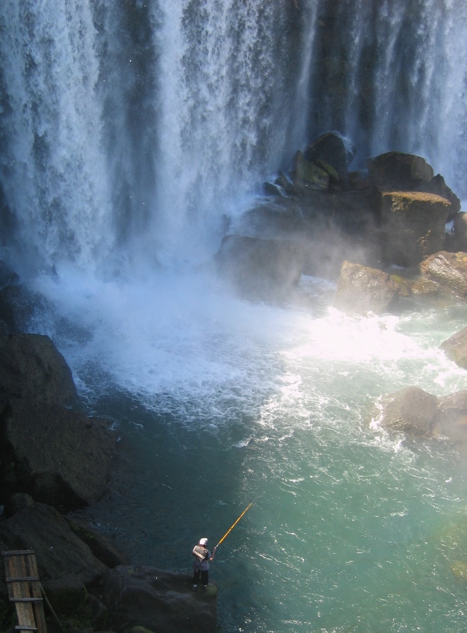
Now how in the heck did that guy get down there to fish (and how in the heck do the fish survive the falls)?
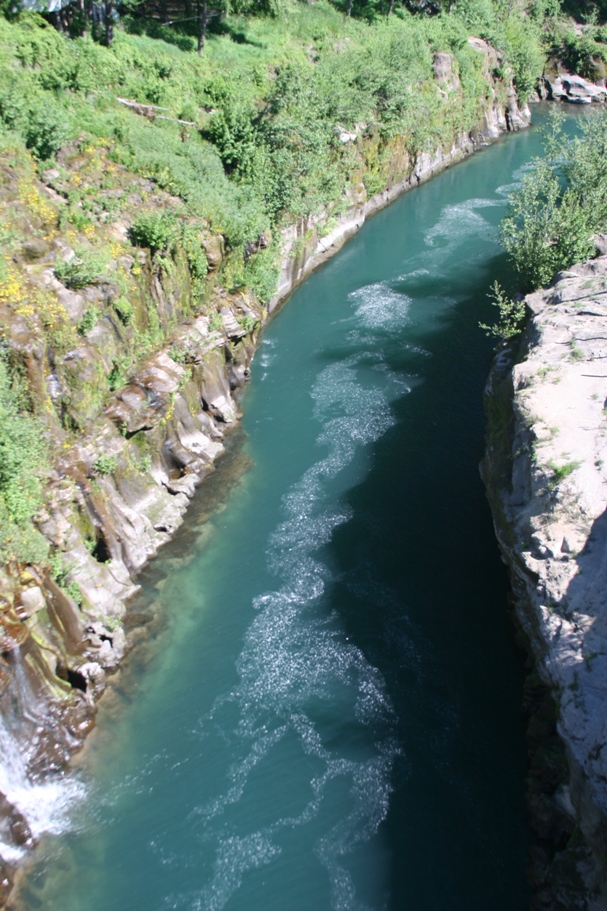
The Rio Laja downstream of the falls, carrying swirling clouds of cottonwood fluff.
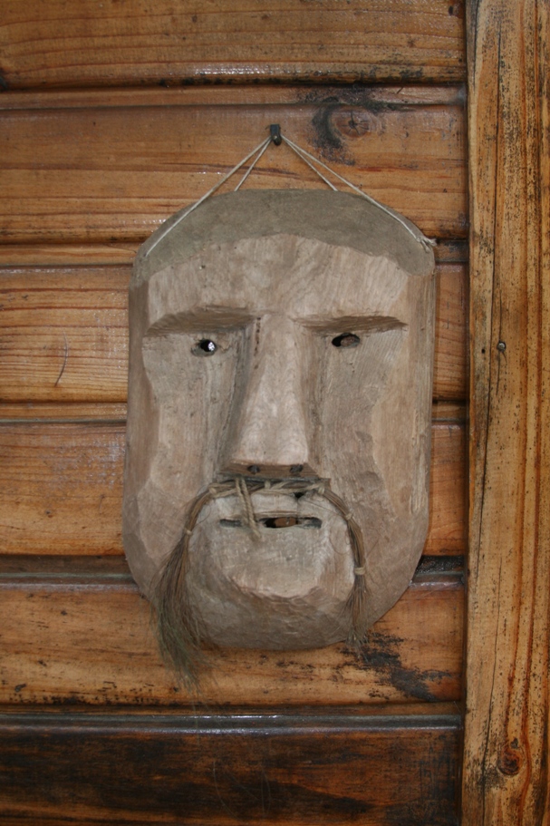
The charming Hosteria El Rincon is worth a few pictures. The owners are German ex-pats who have lived in Chile for 19 years, building their homestead and guesthouse literally from the ground up. The faces on the walls of the guest rooms and in their dining room are traditional Mapuche hand-carved wooden masks. The Mapuche are the native American tribe of Southern Chile, a proud, fierce people who stubbornly resisted and successfully fought-off Spanish colonization for several long centuries.
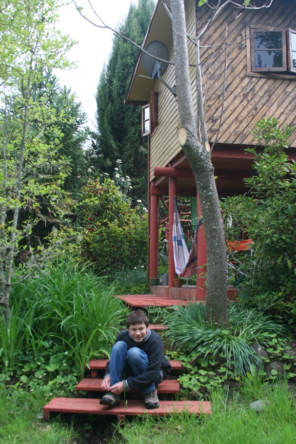
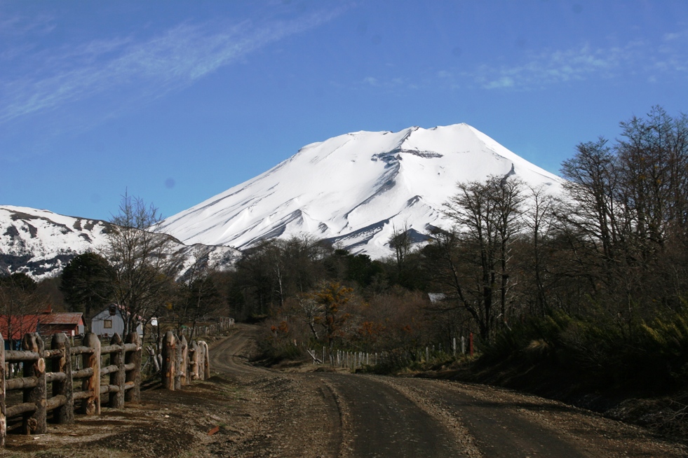
Wednesday morning dawned overcast, but the sun finally burned off most of the clouds by the mid-afternoon. Near the end of our short drive from Hosteria El Rincon to Hosteria Suizandina ("Suizandina" translates to "Swiss Andean"), we caught our first glimpse of the Volcano Lonquimay. Suizandina is located near the small town of Curacautin, and is surrounded by an assortment of lakes, volcanoes, and national parks.
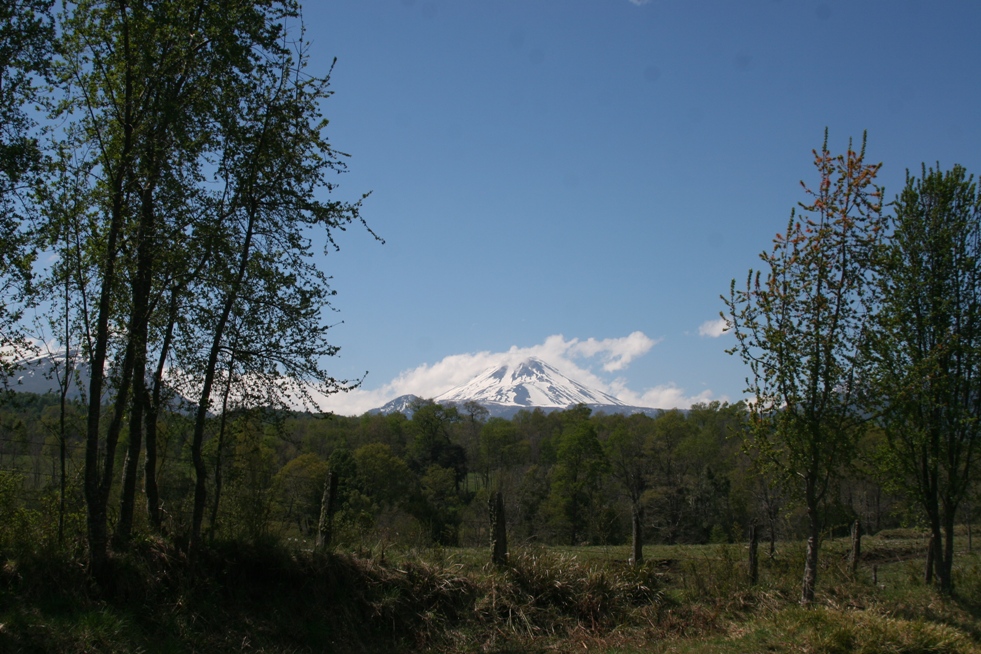
Pictures taken driving towards Hosteria Suizandina. Volcano Lonquimay is located about a dozen kilometers north of the hosteria.
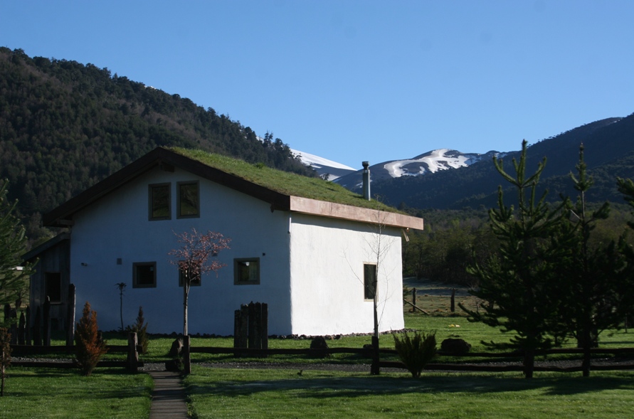
This is the owner's house on the grounds of Hosteria Suizandina, and a view looking northward toward Volcan Lonquimay. These photos were taken at one of the few sunny moments during our stay.
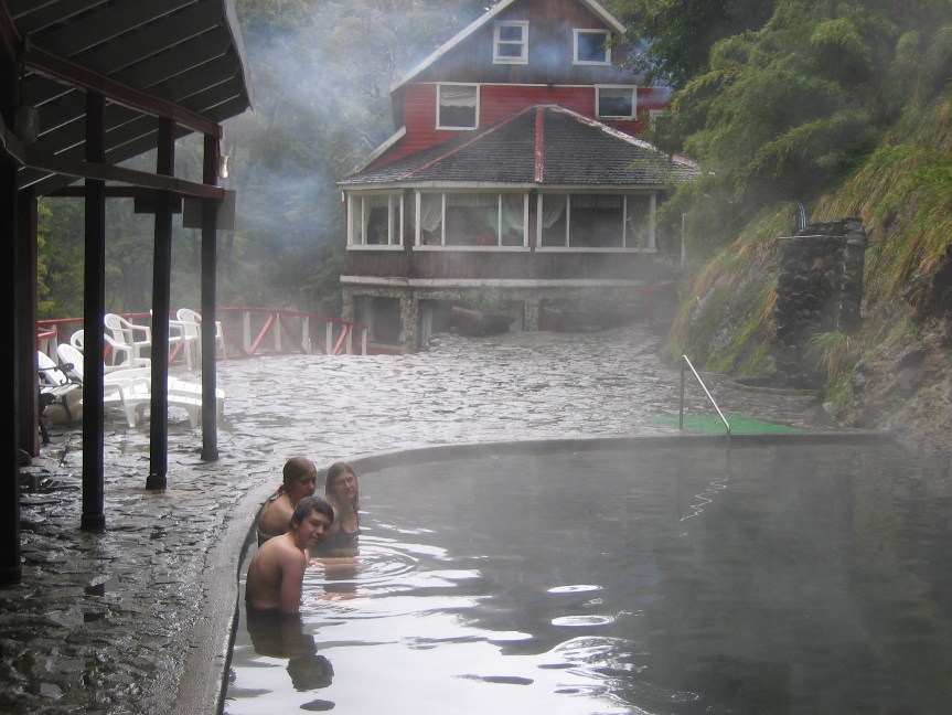
Shortly after our arrival on Wednesday afternoon, Thomas the Swiss owner of Suizandina informed us that the weather was supposed to turn nasty on Thursday, recommending that we postpone plans for any significant outdoor excursions until later in the week. He suggested that we visit one of the nearby termas of which there are several to choose from. Thursday dawned true to Thomas' prediction. Since it was raining hard, windy, and pretty cold, we opted to try the indoor "luxury spa" of thermal baths at a hotel in the tiny town of Malacahuello, a mere 10 minute drive from Suizandina. A busload of seniors was exiting the spa when we arrived, and we had the beautiful pool to ourselves to splash and play in. Then we went into the hotel restaurant for lunch just as the bus group was finishing up - excellent timing for both activites.
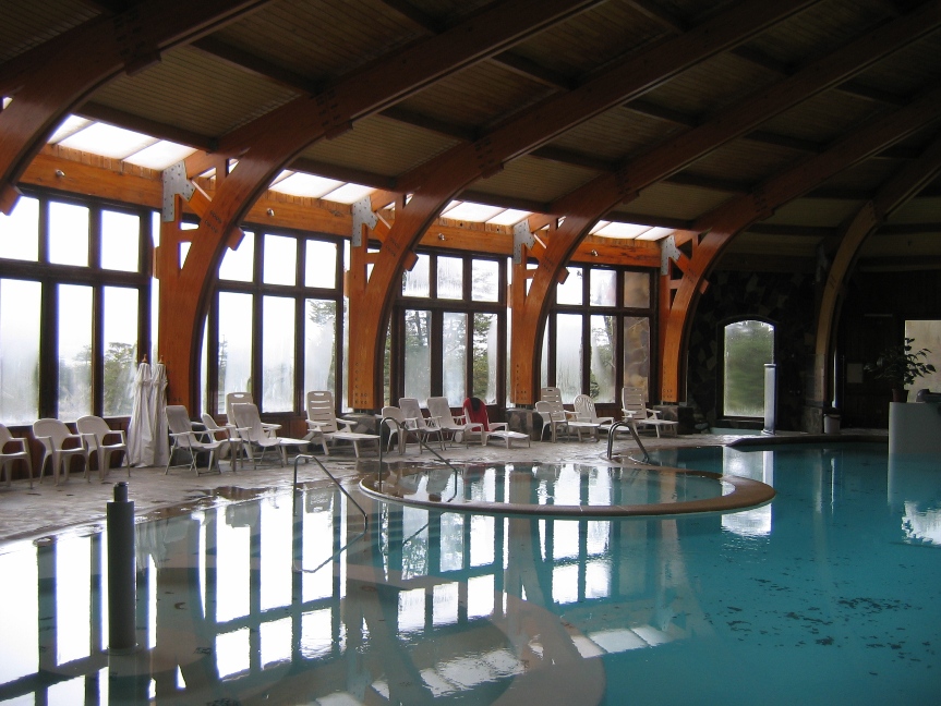
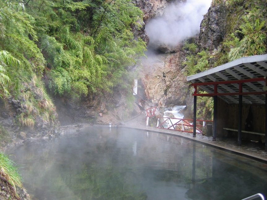
Termas Malacahuello
Friday started out looking just as gloomy as the previous day, but at least it wasn't raining hard during breakfast. Still the grey and foggy skies indicated a strong probability of more rain, and the weather seemed to continue to preclude the possibility of decent volcano viewing. We headed towards a different set of thermal baths and a national park featuring lakes, waterfalls, and a volcano that we might or might not be able to see. Driving 30 kilometers north of Curacaoutin on a gravel road, we first came upon Termas Tolhuaca. The thermal feature here was discovered by a Russian explorer in the late 19th century. What he discovered is a cave spitting out hot sulfur-smelling steam and near-boiling water - right next to a cascading stream full of frigid snow-melt. With a little human ingenuity and some clever piping, the too-hot water from the cave is added to the too-cold water from the stream to produce a just-right thermal bath surrounded by the beauty of nature and the gorge carved by the stream. Soaking in the steamy bath and inhaling a pleasant mixture of cold fresh air and musky mineral-rich steam, a little misty rain posed no real threat to our comfort.
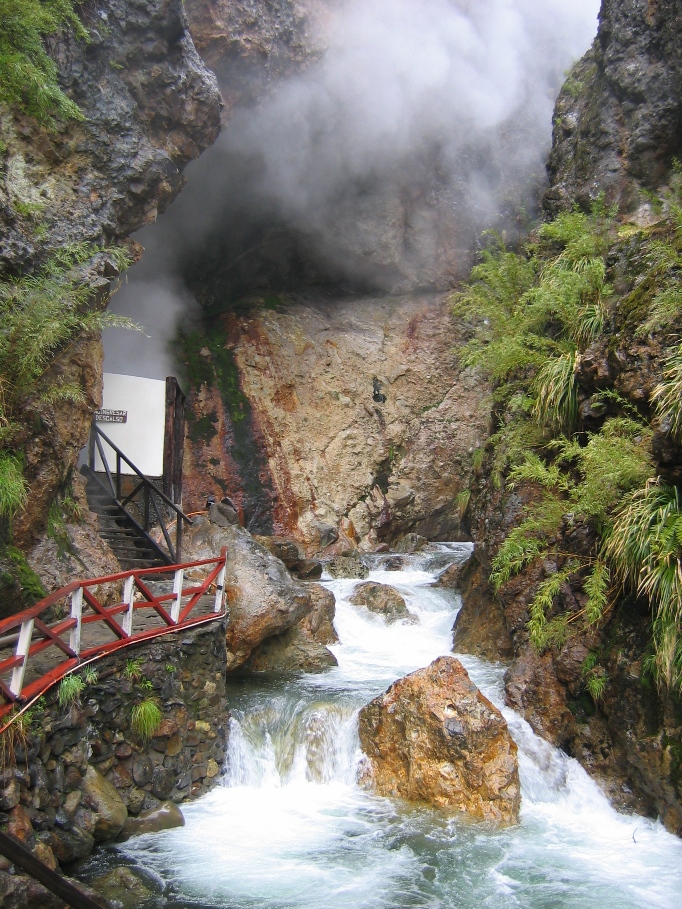
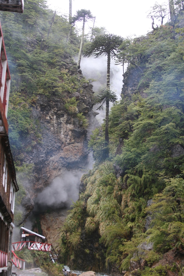
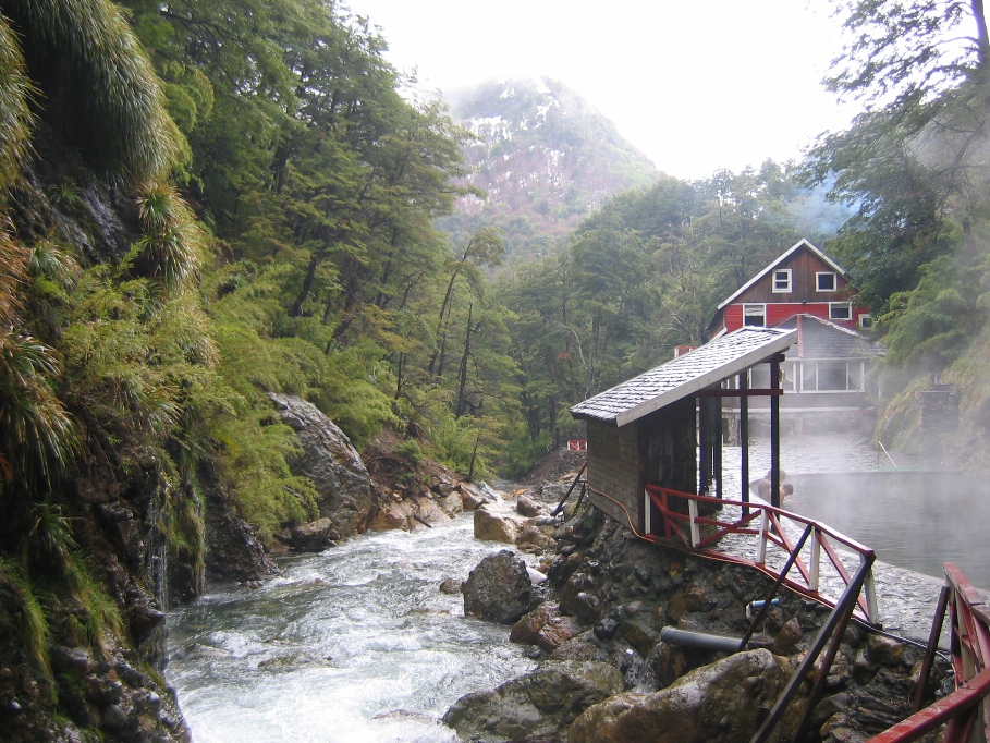
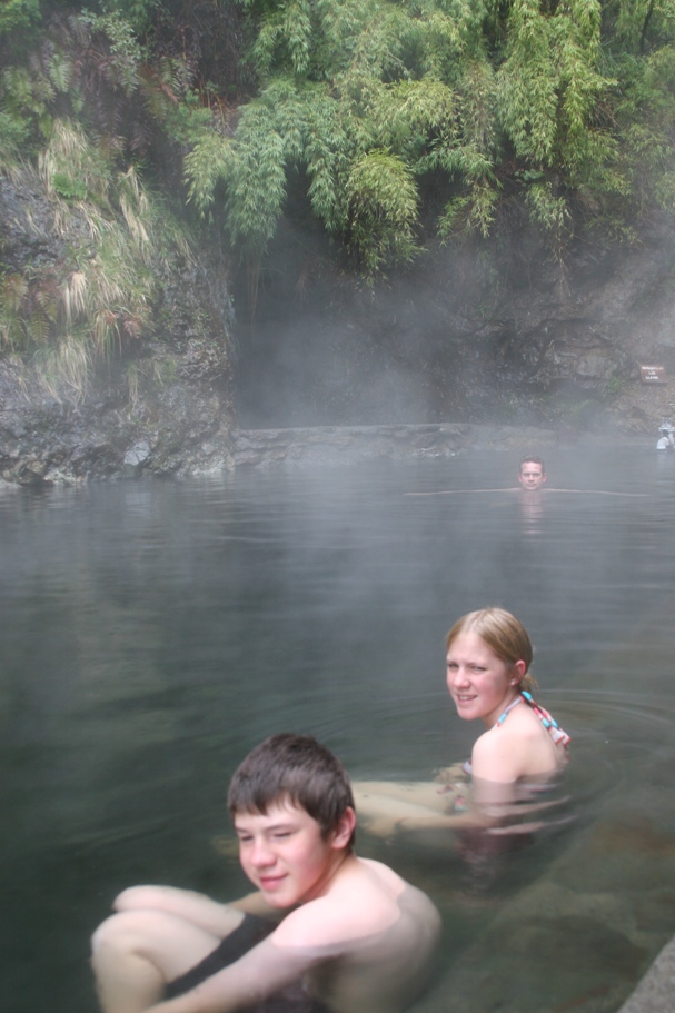
Termas Tolhuaca.
After eating lunch at a little hotel that manages the thermal baths, we continued northward on the deteriorating road towards Parque Nacional Tohuaca. In some spots, there were men with shovels working to clear our passage. In many other muddy, snowy, or watery places, there weren't.
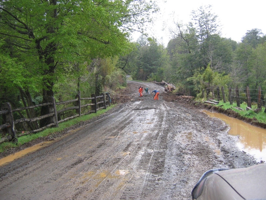
Waiting for the road crew to firm up the muddy road before plowing through (barely) in 4-wheel drive.
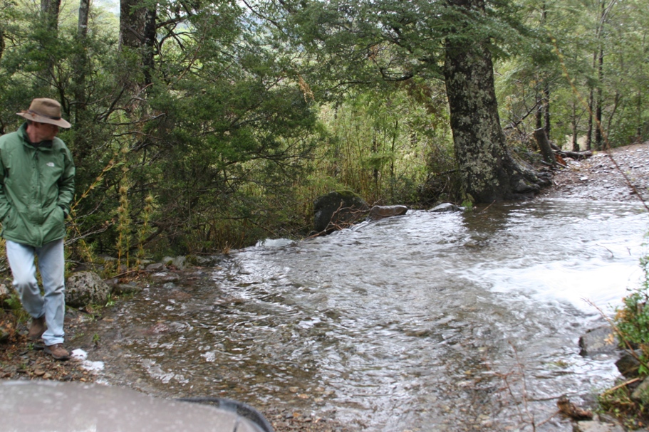
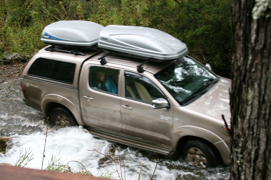
Here a little temporary rainstorm begotten river had decided to bisect the road. I got out to scout the crossing before attempting it. The water was moving fast, but it wasn't deep and the bottom was rocky. The crossing was uneventful and completely worthy of the bored expression on Anna's face.
We stopped at the first place where there seemed to be something worth stopping for - Laguna Malleco. A short walk down from a parking lot took us down to the lake. Here we found a few old row boats swamped in the shallows, a muddy white horse happily chomping on the ample supply of grass and reeds, and a one-word sign reading "Salto" (falls) pointing towards a trail leading off along the shore. What to do now? Go for a walk!
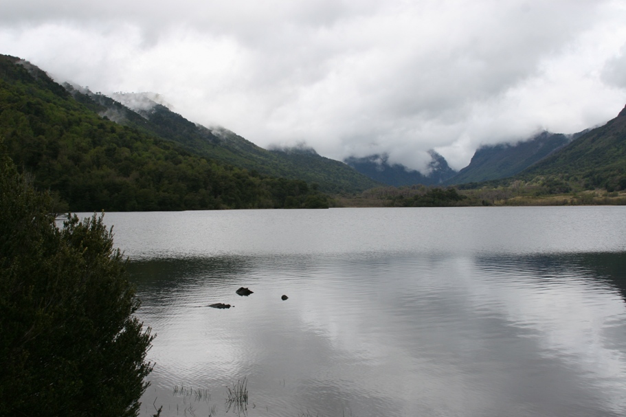
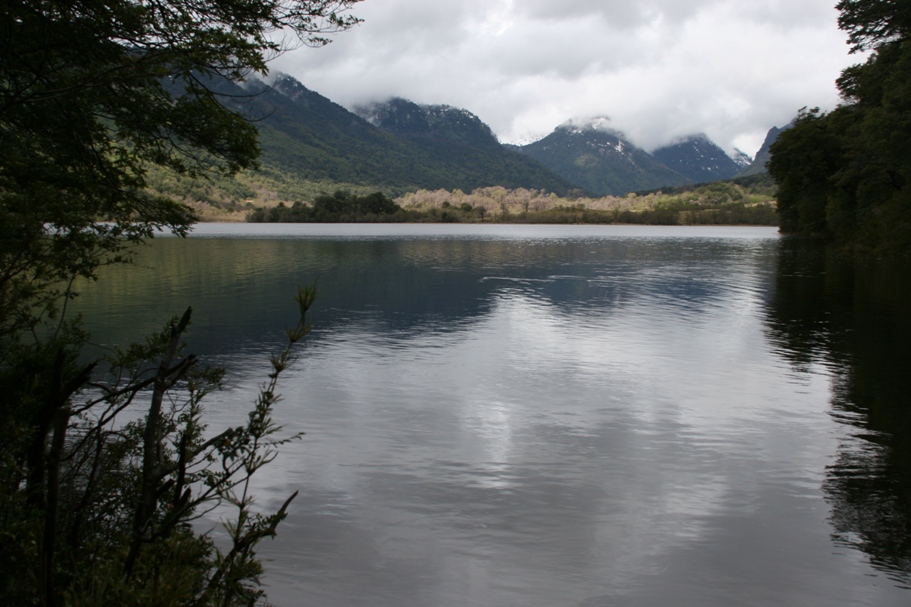
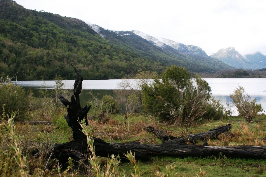
Laguna Malleco
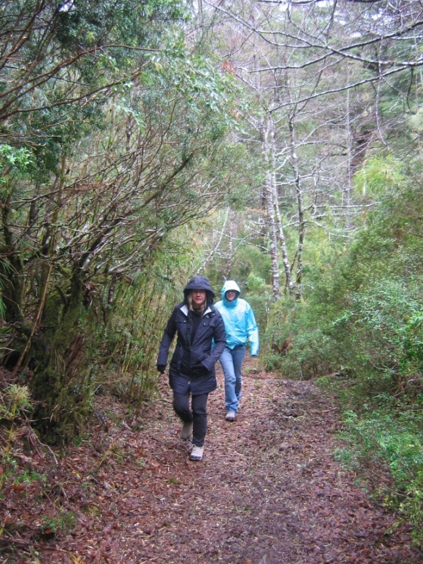
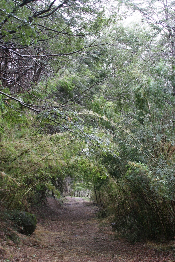
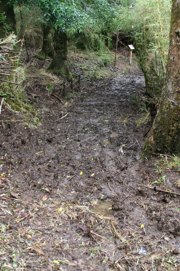
The trail was beautifully lush (a.k.a. "wet") and rather muddy in places. But once we had mud-hopped through a series of increasingly mucky spots, we found it harder and harder to simply give-up and turn back.
After circling around about 3/4ths of the lake, we came to a gushing shallow outlet river, where the total sum of all the assorted creeks and rivulets dumping snowmelt and rainwater into the lake was being removed by one giant rapid surge. Following this river downstream a few hundred yards, we found the opening of a large canyon where we could look back through the dense foliage to see that same river spilling over the canyon wall with a loud roar. Then we had the pleasure of reverse-navigating all those mud bogs back to the car!
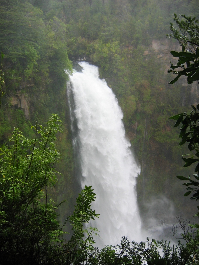
Salto Malleco and the river feeding it.

A lone statuesque Arucaria tree in Parque Tolhuaca.
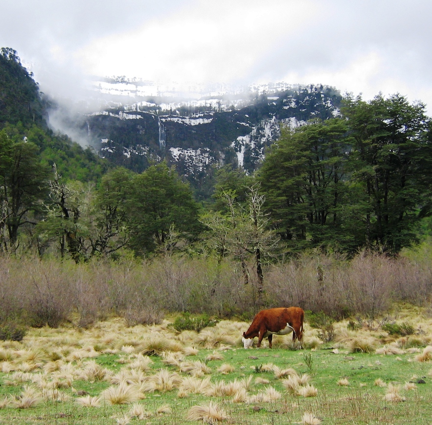
A lone statuesque cow in front of a cliff of waterfalls and Arucaria trees in the park.
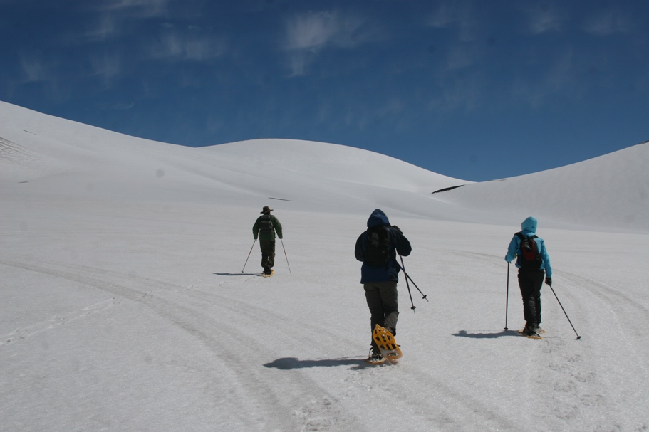
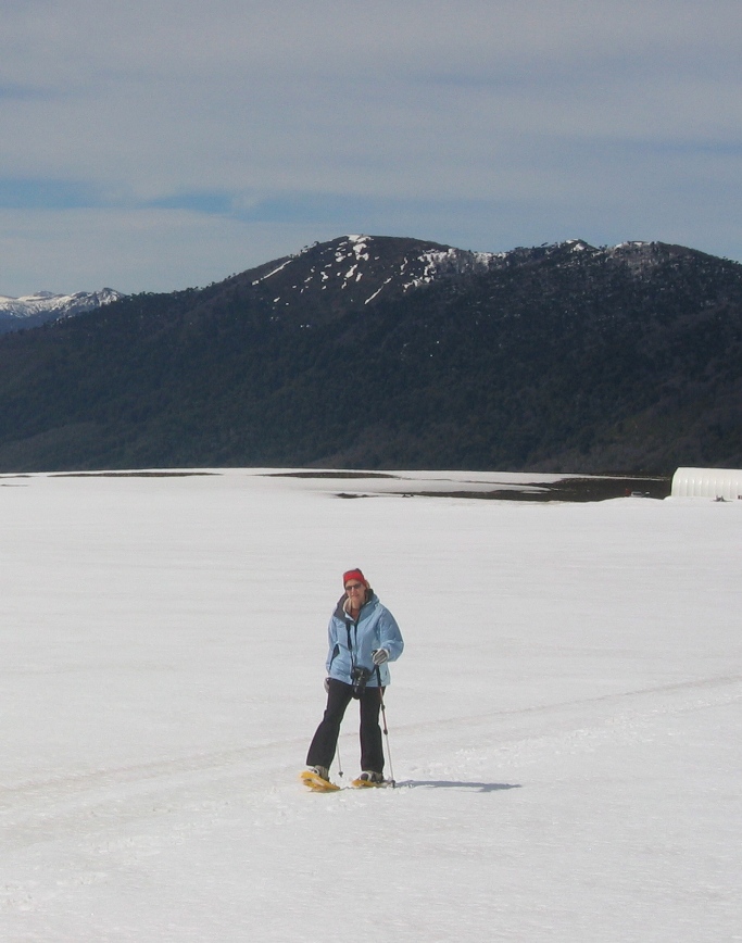
Saturday, it didn't rain - at least not until the late afternoon. Suizandina gave us some snowshoes and poles, and we headed for the flanks of the volcano Lonquimay.
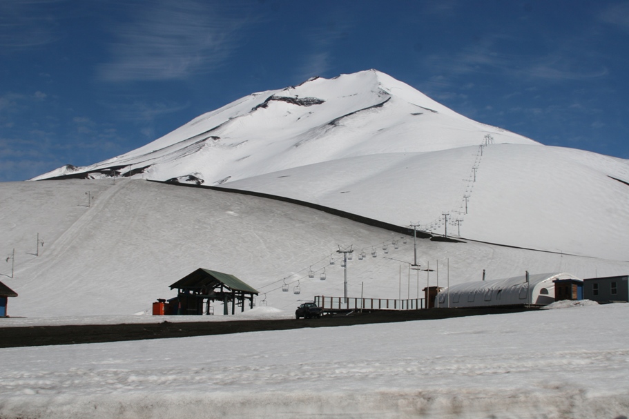
Views of Lonquimay driving towards it, and from our parking spot near the base.
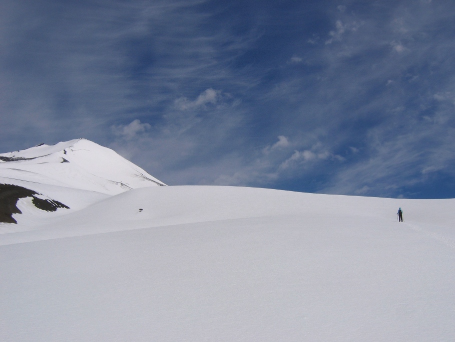
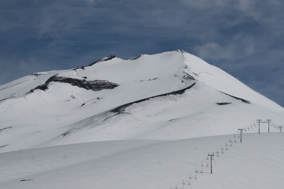
We had set out to see the "Navidad Crater," located off to the side of the big volcano, and so-named because it erupted on Christmas day, 1988. Everyone was initially enthusiastic, but a biting wind drove Lynn back to the car shortly after we started out. Tom lost his desire to continue onward a short time later. Anna and I continued to trudge onward towards the general direction where thought the crater might be. After ascending a small hillock, we took in some incredible views and then decided to turn back to join the others and have lunch - not realizing until we later viewed our snapshots that we had stopped not terribly far from the crater's edge!
![]()
A north looking view from Volcan Lonquimay.
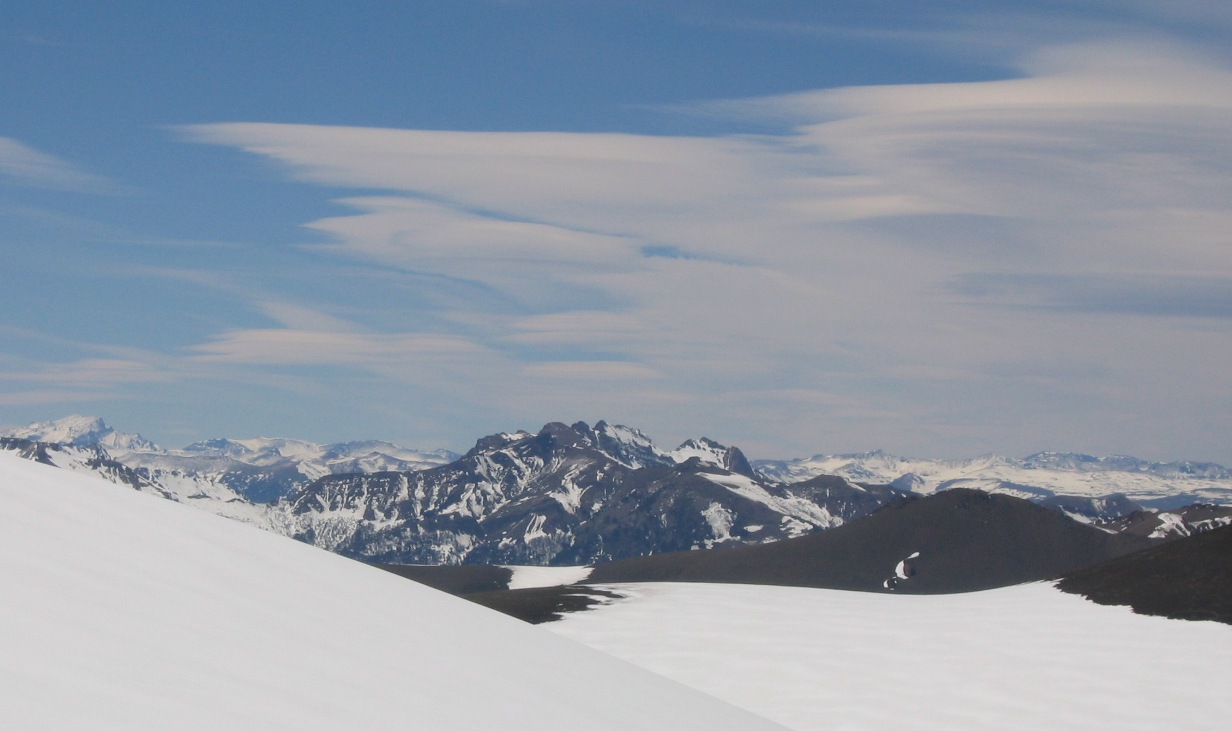
Since this is a north-western looking view, I'm guessing that the volcano (the prominent prominence) is Volcan Tolhuaca. Here in this picture, you can clearly see the near and far rims of the Navidad crater. Somehow, at the time, exactly what we were seeing escaped our comprehension - partly because we thought that the crater was located off in a slightly different direction.
![]()
Looking southward past the flank of Lonquimay towards a couple of other volcanoes. The right most distant peak (the one spewing a cloud of black smoke) is Llaima, the most active volcano in South America.
After our snowshoe trek, we headed off down a gravel road towards the small town of Lonquimay. We managed to forge past the first few snow drifts, but eventually encountered a solid 3-foot wall of snow that stretched interminably down the road. Why don't they put up a sign or something? I think the problem is that in Chile, there just isn't that kind of "they" anywhere who puts up those kinds of signs. I mean, we didn't go back and take the time to make a "Camino no Funciona!" sign and put it up for anyone else's benefit, either.
Today, even though the weather looked as dreary as the dreariest of recent days, we headed off towards Parque Congrillio and Volcan Llaima, hoping desperately that mother nature would heed our wishes along with the prognostications of some feeble human meteorologists and show us the sun. But she didn't. And the road leading to the visitor center center and around the park was rendered impassable by snow banks. Our hosteria host Thomas might have warned us had he not been off spending a couple of days with a friend climbing Volcan Villarica. Of course there were no signs, gates, or other type of indication which might warn wayward tourists not to bother driving 30 kilometers down a muddy road merely to find an impassable snow-bank a handful of kilometers from the lake and visitor's center (which is probably closed anyway). They'll find out soon enough when they hit the snow drifts. And once again, did we bother to go back and construct a gate or sign for the benefit of others? Nope.
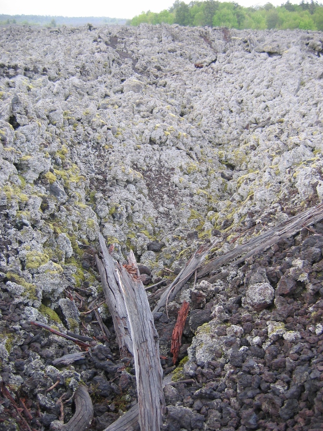
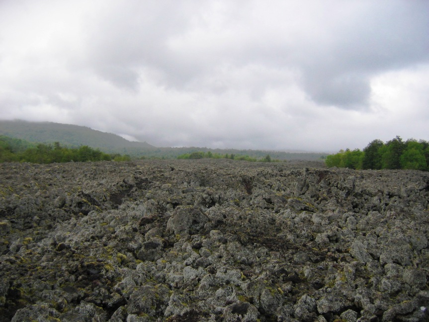
Looking across a lava field toward the active volcano Llaima, obscured by clouds. This lava came from an eruption in 1957.
![]()
![]()
![]()
![]()
Lava field near Volcan Llaima.
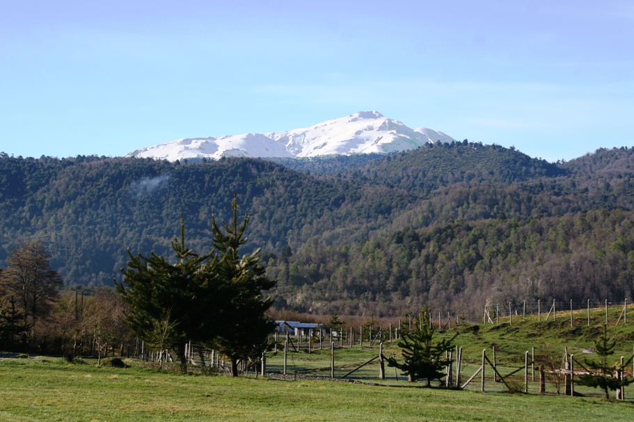
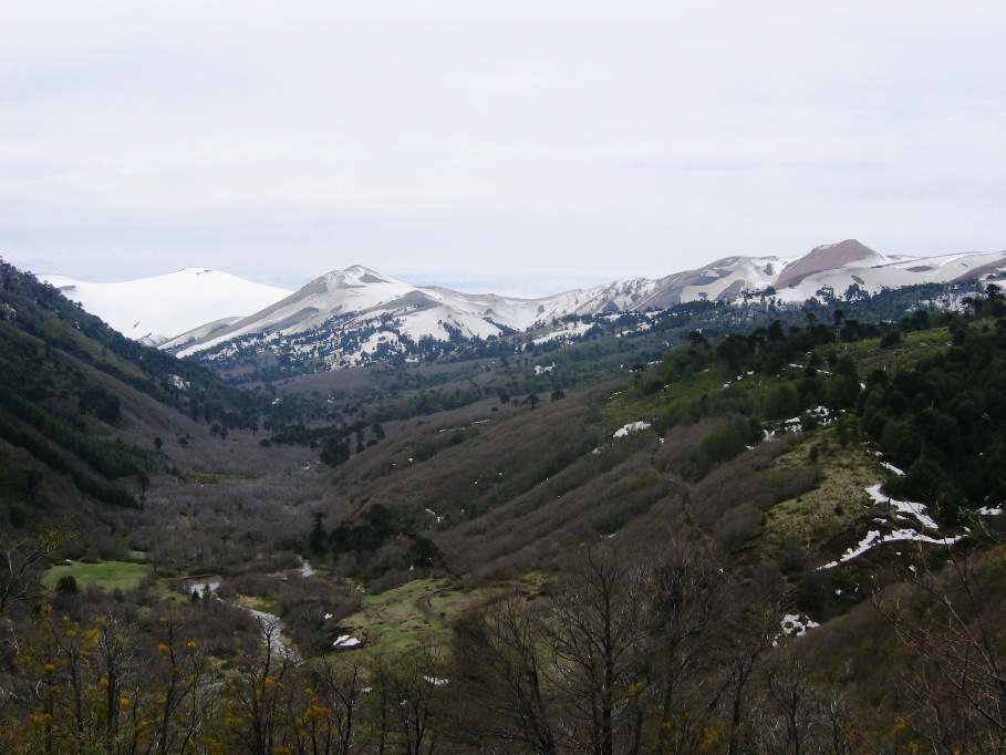
OK, Today(Monday) was finally clear and nice again, and returning to the lava field viewpoint, we were able to get some excellent views of Llaima and all the other volcanoes of the region: Longuimay, Sierra Nevada, and Tolhuaca.
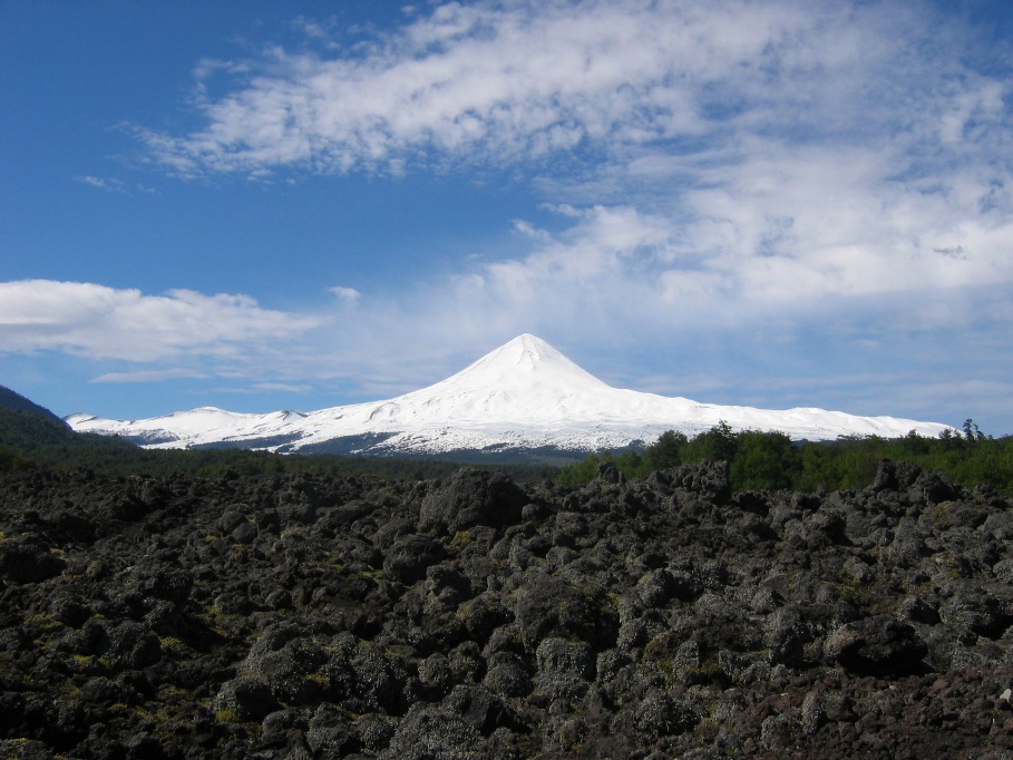
Yesterday's lava field now has a volcano off in the distance (the source of all that lava!).
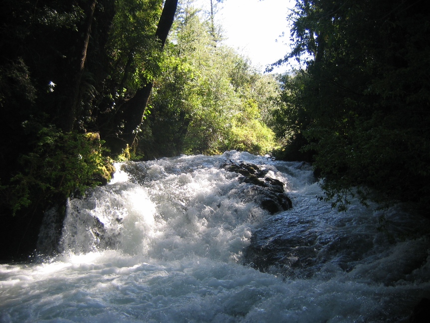
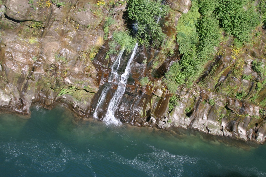
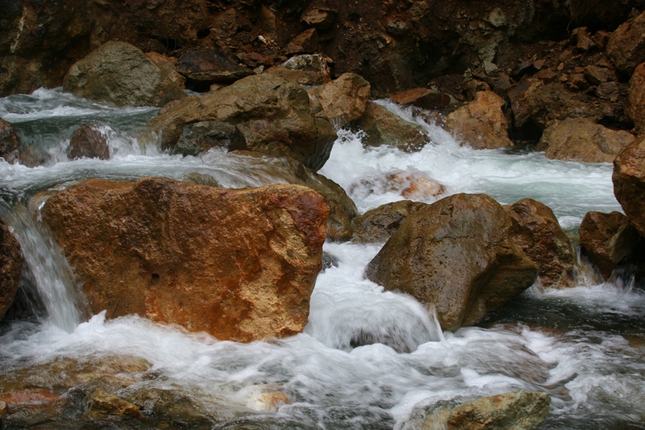
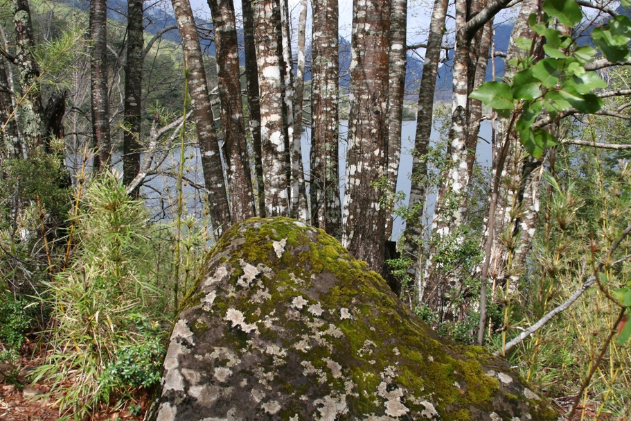
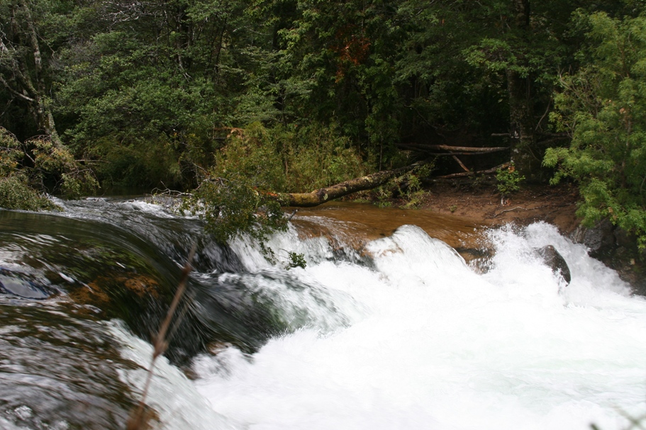
There are so many raging rivers and dramatic falls in the region, I loose track of all the names - here are a few more to look at!
There was certainly one significant side-benefit to spending rainy afternoons inside a comfortable, hospitable, and warm hosteria that serves good food and drink (aside from the warmth, comfort, hospitality, food, and drink, that is...). Now Thomas and Anna are both, for the moment, pretty well caught up with their schoolwork.
-Rolf