Iquique - Arica
Gost Town, Scary Road
Thursday July 19
A relatively short overall drive, an interesting tourist diversion, and one hour of awesome road.... that's the quick description of our day, although we haven't eaten dinner or watched the Chile vs. Argentina soccer match yet. We had aspirations of enjoying one of the beaches in Iquique yesterday, but the weather was damp and foggy. Dust, truck exhaust, and the odor of fishmeal co-mingled with the mist to create a most unpleasant respiratory experience. After a short walk to find lunch, we opted to spend the rest of the afternoon indoors working on schoolwork. Iquique looked and smelled about the same this morning when we left.
Finding the route 16, eastward-heading path out of town without too much trouble, soon we were driving on top of the cordillera in hazy sunlight. Just a few kilometers inland, there is no fog or fishmeal in the air - the haze is looks and smells like pure desert dust.
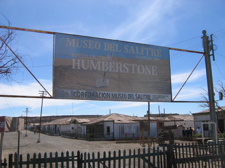
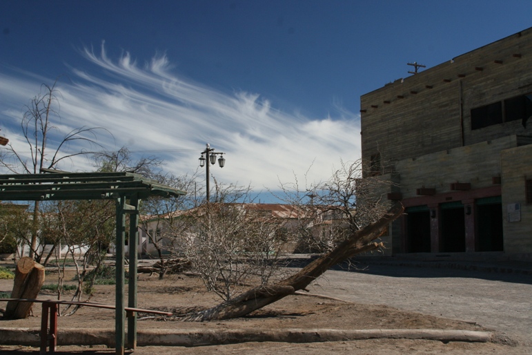
About 35 km east of Iquique on route 16, we stopped to visit the deserted old nitrite processing encampment of "Humberstone." With no rain to precipitate decay, the old wooden buildings remain eerily intact and similar to how they must have appeared when the residents padlocked the front gate and left en-masse one day in 1961.
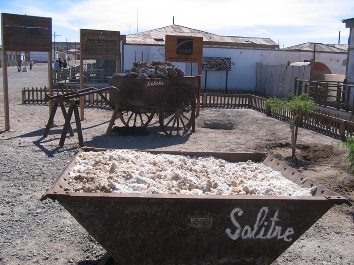
The economic enterprise of Humberstone was the production of "salitre," (saltpeter) from crunchy chunks of desert crust, or "caliche." Salitre is a mixture of sodium nitrate and potassium nitrate that is used to make fertilizer and dynamite, among other things. These days, chemical-factory production has rendered the mining of saltpeter virtually obsolete.
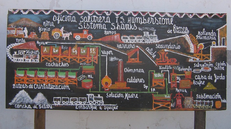
A simple flow chart describing how to make saltpeter out of dirt.
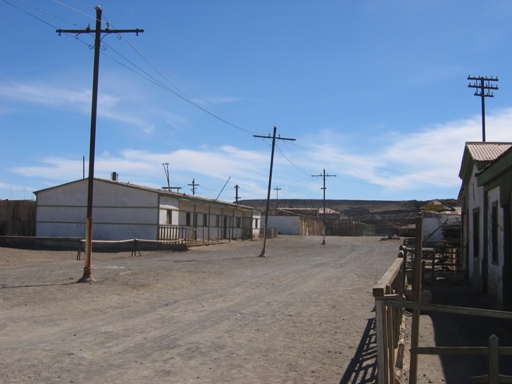
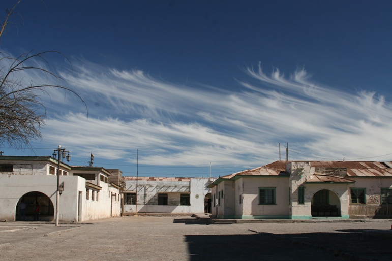
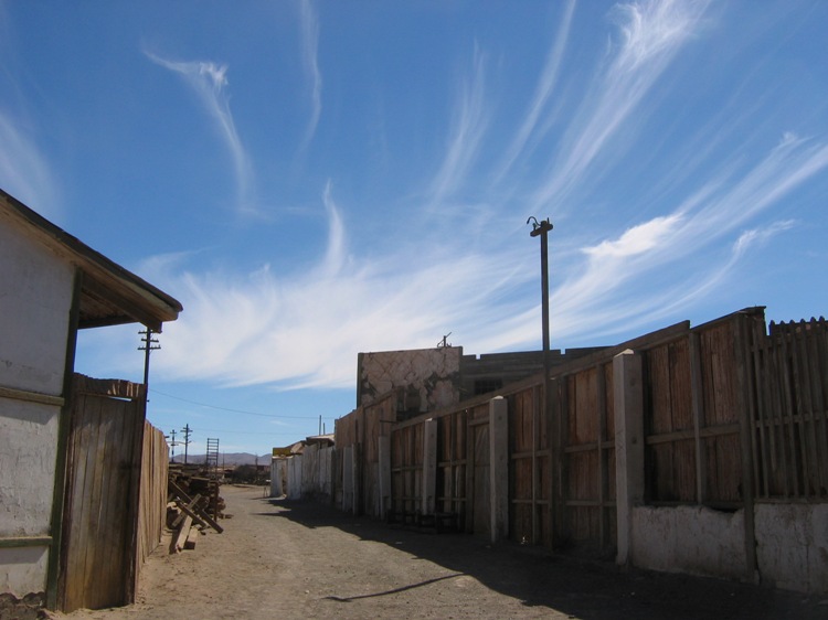
The streets of Humberstone.
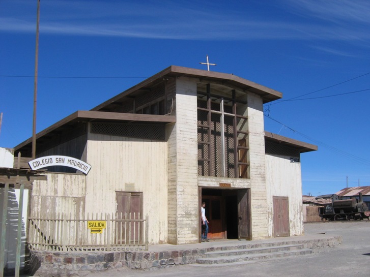
Geoff hangs out in the door to the church. The cross is fabricated from plumber's pipe.
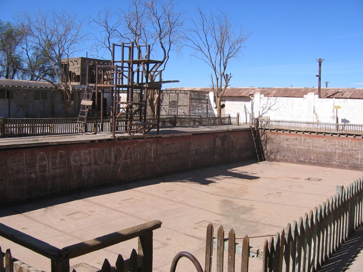
The old swimming pool. It looks like it was pretty nice in it's day.

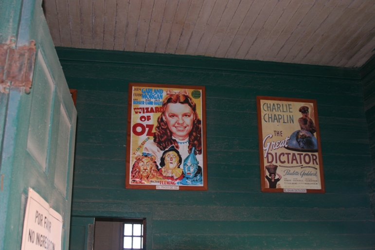
Theater.
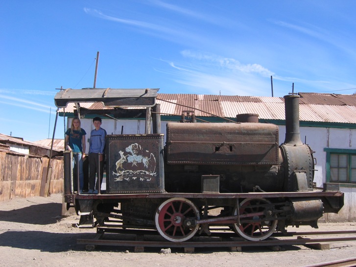
Wietelmann children in old steam locomotive.
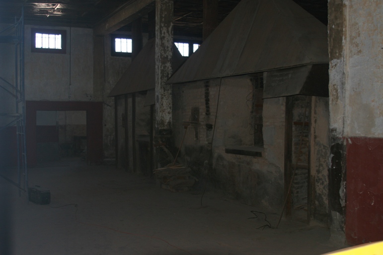
Bread Ovens for the town.
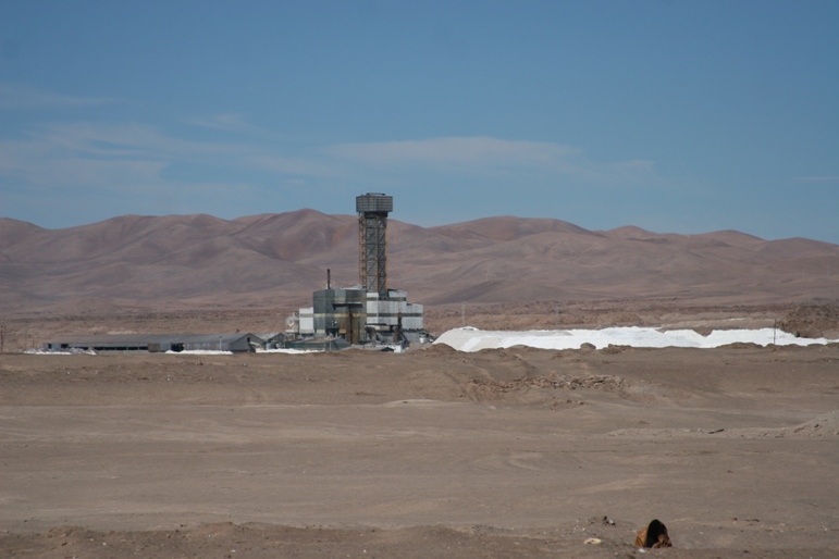
Nearby (active?) mining activity.
After leaving Humberstone in the late morning, we drove just a short distance further eastward before route 16 terminated at an intersection with route 5, the Pan-American Highway that runs from Tierra del Fuego to Alaska. We turned left (north) to finish the day's drive to Arica. Arica is Chile's northern-most major city, and it sits on the Pacific coast a mere 20km south of the border with Peru.
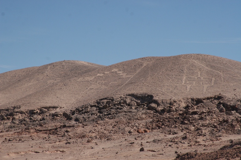
We passed the Geoglyphs of Chiza (Not the pyramids of Giza) on the way...
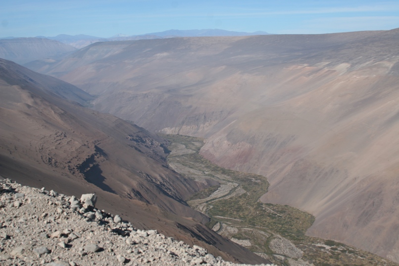
Several long sections of this road stunned us with incredible views and a stiff dose of sober caution. Alternating between steep climbs and brake frying descents, the road twisted along the wall of the astoundingly massive and horribly steep Cuya valley. The shoulder looked crumbly and guardrails were few and far between. We lost count of the little shrines placed along the side of the road, presumably at the sight of fatal accidents. I wondered why the road didn't just follow the nice flat valley floor, but perhaps there was no way to get it down there. We weren't in a hurry, and the drive wasn't that long, so we took our time, downshifted a lot, and saved both our brakes and our lives so as to be able to drive yet another day.
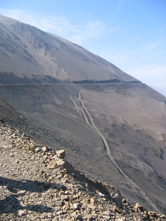
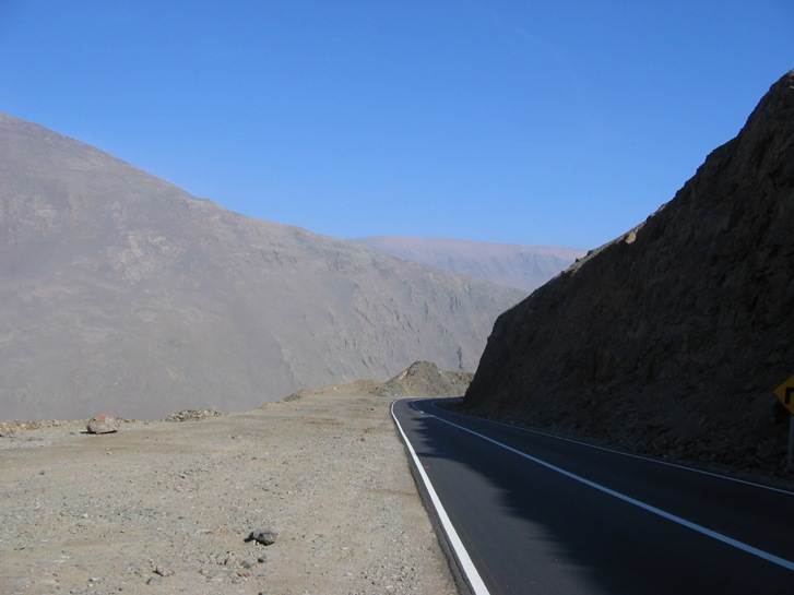
I couldn't help but wonder if those steep tracks in the left-most picture were made by a vehicle that careened over the edge...
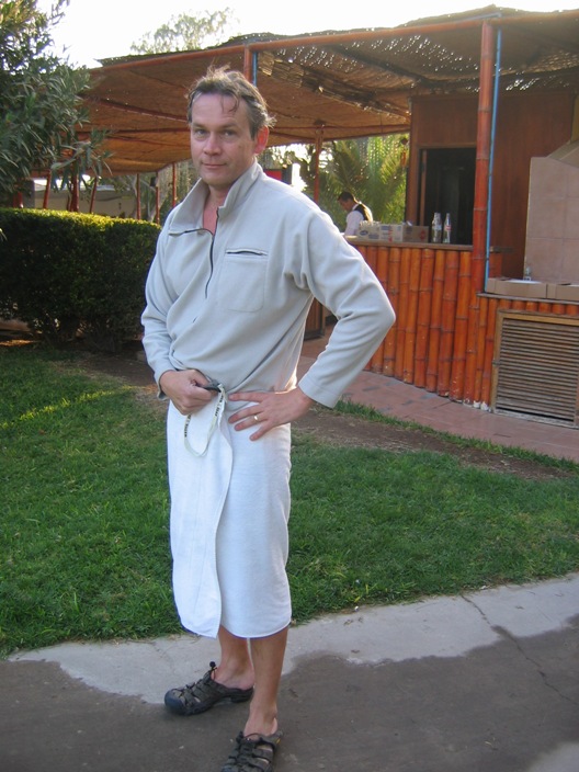
It was frigid and questionably clean, but I couldn't resist jumping in the pool to swim a few jerky, panicky laps at the hotel in Arica. My body was craving aerobic exercise. I doubt if there is any chlorine in the pool, but then again, it probably doesn't need it because obviously no one else is crazy enough to swim in it. Then Anna took this picture and made me promise to put it in the website as retribution for me showing her "jetlag" picture which I took the morning after she arrived in Santiago. I hope she's happy now.
-Rolf