Reserva Las Vicuñas
Parque Nacional Volcan Isluga
Flamingos, Termas, & Refugios
Monday July 30
Barbara told us that there were was a "warm," stone building in the refugio at Salar de Surire, and a frigid metal container converted to bunkhouse with some more beds. Sleeping arrangements at the refugios are first-come first-choice, so arriving relatively early was a priority. We wanted the stone building that had the kitchen and a fireplace! Lynn and I tried to cajole the kids into getting packed up completely Friday night, but this was a stressful task for the exhausted twins. Geoff wadded his clothes into his over-sized duffle in about 30 seconds, declared "I'm done," and flopped down on his bed, a display that only further agitated the already exasperated Tom & Anna. Geoff doesn't have homework and a year's worth of stuff to contend with - but it would be nice if he didn't flaunt it.
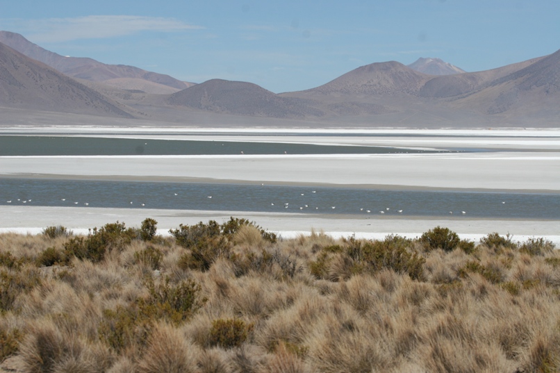
The twins did get their stuff in reasonable order and themselves into bed before 10pm and astoundingly enough, we were on the road Saturday morning shortly after 9am. The 70+ kilometer drive south to Salar Surire followed a wide, well graded dirt road, created and maintained as such for the operation of the borax mine at the salar. The drive was uneventful and fairly boring (although the scenery was typically fantastic). We passed a steady stream of large borax-laden trucks heading away from the salar. Each kicked up a fine powder of dust which, as we would soon discover, entered the not-airtight rear bed of the truck and thickly coated just about everything. The drive wasn't too stressful, but we were all glad to crest a gentle rise and peer down at the vast salar (salt lake). The road passed right up against the edge of the salar, where glistening chunks of the white crust had been bulldozed into long mounds, ready to load and be taken away by those big trucks.
It was a pleasant surprise to find the refugio occupied solely by the good-natured caretaker when we arrived shortly after noon. He lit the oven so we could warm our empanadas for lunch, and the kids played with the semi-tame viscachas out back. We dumped sleeping bags on the four beds and decided that Geoff would fit on the floor in front of the fireplace (the warmest spot in the house), a much better alternative than the bunks in the metal railroad-car container. After eating our lunch we went back out to drive around the salar and look for the three species of flamingo that the guidebooks say live here. Slightly surprising to us, we could only find two of the three, and the "missing" species ("Chilean flamingo") was listed as the most common. Later when I asked the refugio caretaker where this species of flamingo might be, he shrugged and said "Sometimes they just all get up and fly away - probably to some other nearby lake in Bolivia." It's Bolivia's fault - again!
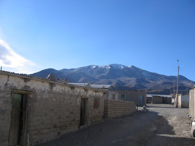
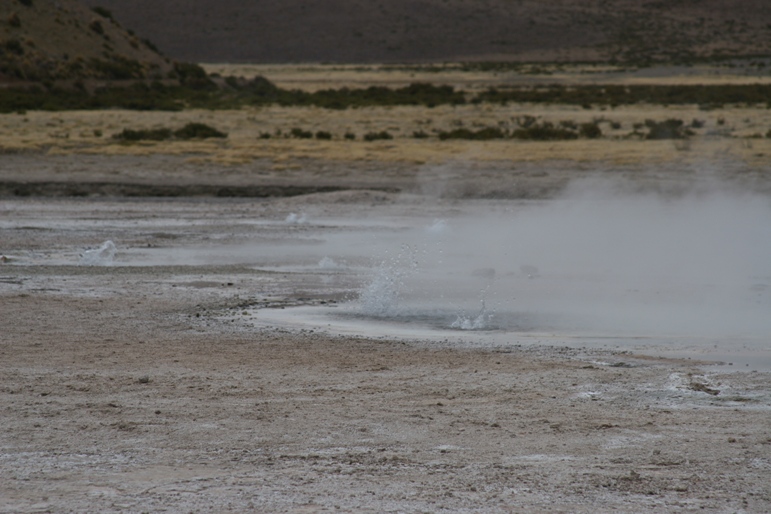
Approaching Salar de Surire.
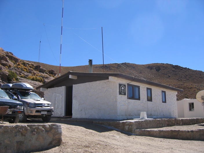
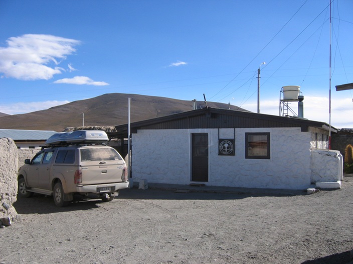
The refugio.
View from the refugio.
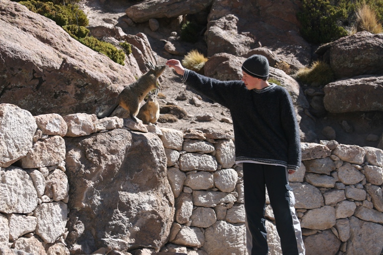
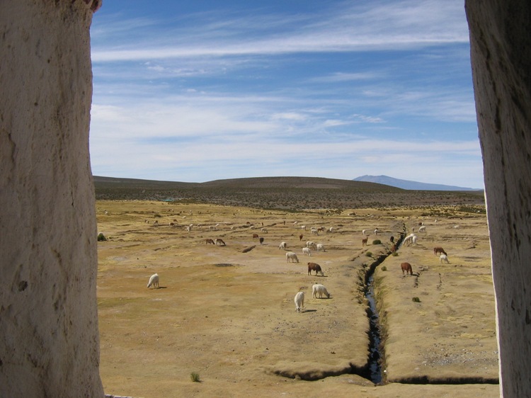
Tom figured out that the viscachas liked to eat a thistly sort of plant and were just as happy to eat it out of his hand as off the ground. Lynn wouldn't let us break out the raisons.
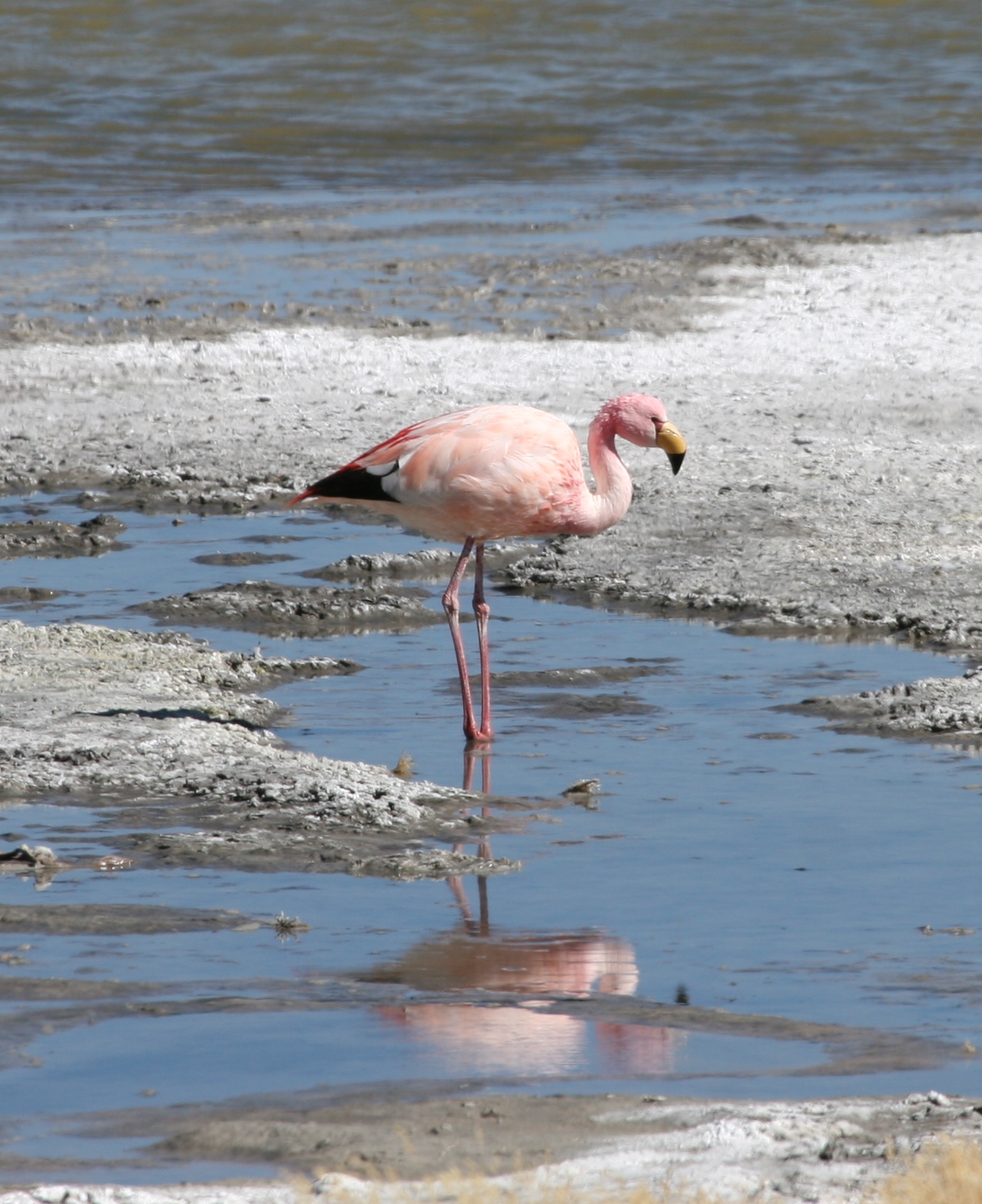
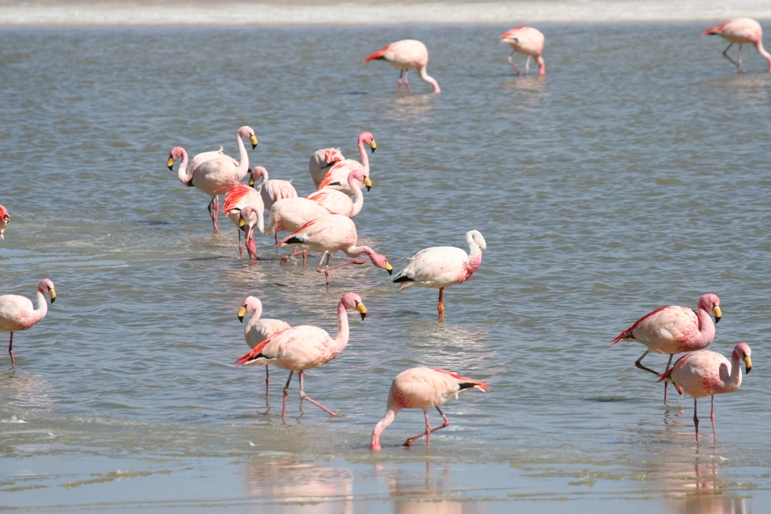
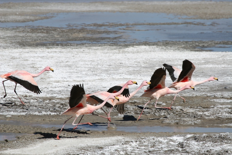
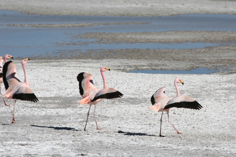
We saw mostly James flamingos (the ones with pink legs), but also a few Andean flamingos (yellow legs). The Andean flamingo is one of, if not the most, endangered species of flamingo in the world.
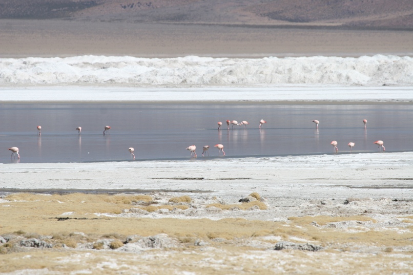
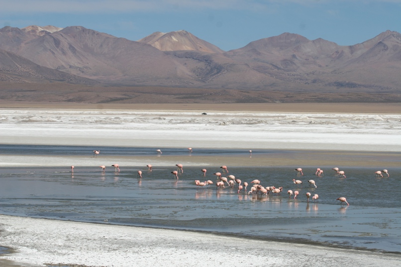
Flamingos at the salar - piles of salt/borax piled up to be taken away by large trucks.
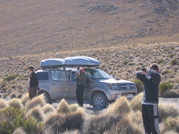
Human flamingo watchers.
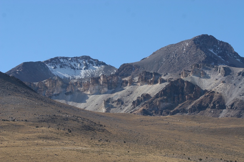
When we tired of looking at birds, we turned around to look at this.
On the way back to the refugio, I pulled into the mining camp, got out of the truck, and started tramping around looking for someone. I hadn't seen any armed guards, and the refugio caretaker had told me that the mine would sell me gas. The mine is controversial, so I had mixed feelings about doing business with the proprietors (take one look around at the pristine salt lake and how they are just scooping up massive loads of the surrounding salt bed - it's difficult to believe that the activity won't have a significant environmental impact), but I found the opportunity to get a quarter tank of fuel in the middle of nowhere irresistible. Also, I wasn't keen on using our reserve can with make-shift plastic-bottle funnel until it was absolutely necessary. Eventually I stumbled upon a good-natured worker who was painting a chain and he happily led me into the camp cafeteria to meet the hefe (boss). He explained that it would be better if the guy could see that I really existed. He looked up from his soup and gruffly asked if I was alone. "No, I'm with my family - there are five of us." Clearly this wasn't the answer he would have preferred. He gave me a long hard look.
"No fotos!"
"Si. Entiendo." I answered, wondering if our pictures of the flamingos with mounds of borax in the background counted. Then my happy helper escorted me back to the pumps and put 20 liters in the truck. He even rounded down the price. He was obviously bored out of his gourd with painting chains and happy to have the legitimate diversion of entertaining tourists.
This mining is why there now are Parque Nacional Lauca, Reserva Nacional Las Vicuñas, and Parque Nacional Volcan Isluga. Thay all used to be one large national park, but mining in a national park is prohibited by law. The solution? - create a "national reserve" where you or someone with economic clout wants to mine. Mining is allowed in national reserves.
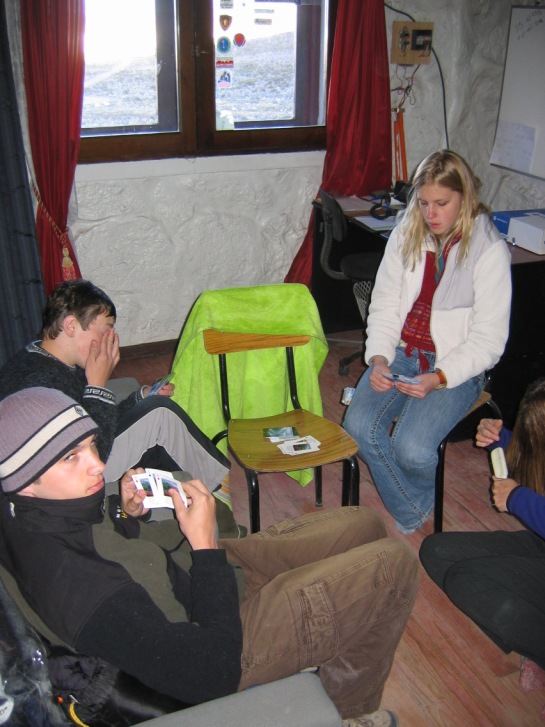
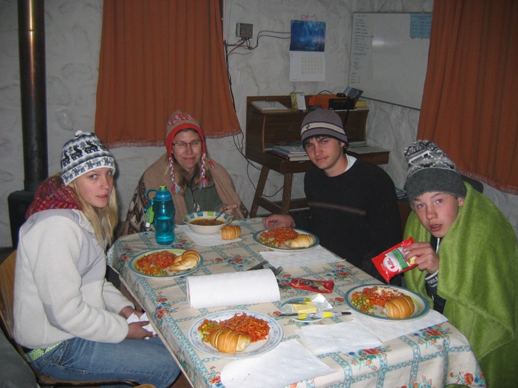
We dined on French bread, canned soup and ravioli, and cookies. Then we stoked the fireplace and played cards for an hour or so before climbing into our sleeping bags. Even with a raging fire going the temperature was dropping fast, both outside and in.
Sunday morning I sluggishly crawled out of my sleeping bag to make coffee a little after 8am. Geoff had little choice but to get up, as I first re-lit the fire that had gone stone cold a few feet from his head. The rest of the family gradually followed suit. All-in-all, we were quite pleased with the refugio. It had battery powered (solar recharged) lights for the evening, and a small water heater which produced a tepid output, allowing us to wash dishes and take invigorating (quick) showers.
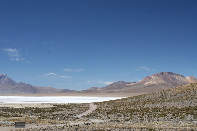
After paying the caretaker, who had left at 6pm the prior evening and returned promptly at 8:30 in the morning, we left to visit the hot-springs on the southeast corner of the salar before heading south to Parque Nacional Volcan Isluga.
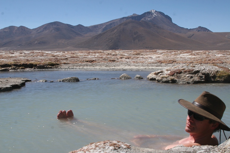
Relaxing in the hot spring. It was the warmest I'd been in a week.
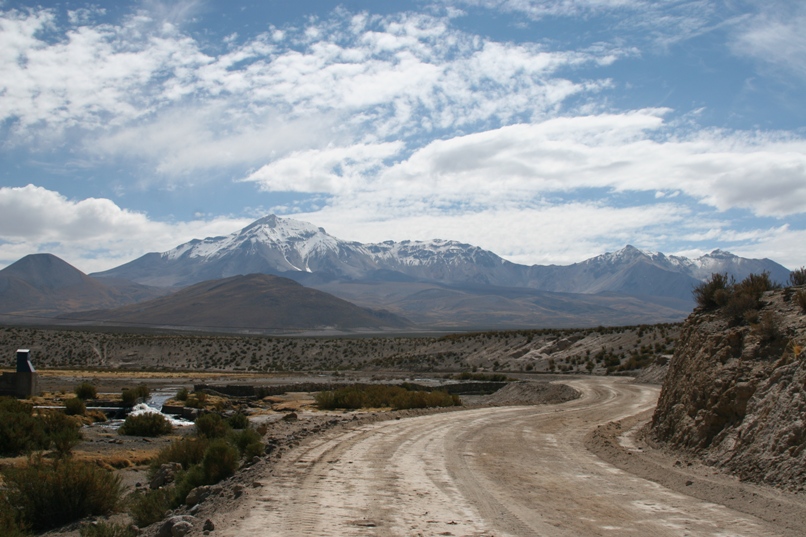
The drive from Salar de Surire to Enquelga in Parque Nacional Volcan Isluga (site of another refugio), was more rugged, scenic, and interesting than the drive a day earlier. No mining-truck could possibly traverse this road. A handful of stream crossings, deep ruts, and steep climbs put our truck to the test. The road flirted with 5000 meters elevation shortly south of Salar de Surire, and the Bolivian border off and on throughout most of the drive. Lynn and the twins all reported feeling dizzy and slightly numb in their fingers for a brief while, and I assume it was due to the elevation and not the proximity of Bolivia.
As an aside, I have noticed the international border on more than one of our maps of Chile marked as "unofficial." I think a more accurate description would be "contested." I know that border wrangling between Chile and both Bolivia and Argentina is a perpetual issue. As the specific border in question often passes through desolate and inaccessible mountain territory which provides virtually no conceivable resource, the situation lies dormant (most of the time) in "we agree to disagree" status.
Problems flare up now and then for various reasons - an adventure travel company might start taking tourists to visit a glacier via helicopter and end up plunking them down in contested territory to take a stroll (for profit!). Contested borders could be tacked on to other issues of international diplomacy like riders on a law running through congress. And of course when some politician or military leader needs a patriotic issue to take a strong stand on, why not pick a fight with those pesky foreigners? I have read news articles about the tourist industry re-igniting old border disputes between Chile and Argentina. The latter two mechanisms I mention are un-researched assumptions, but having visited Peru, Bolivia, and now Chile, I know that Peru and Bolivia are not at all happy about the legacy of the War of the Pacific and the fact that Chile took such a huge chunk of land from both the other two countries in winning the war. And why might I assume that politicians are not above starting a war just to get re-elected and stay in power?
The road passing through Parque Nacional Lauca is an international highway, and as result of a recent treaty with Bolivia, Bolivian trucks have unlimited, duty free use of this road to deliver goods to and from the port at Arica. Chile picks up the tab for maintaining the road. Bolivia wants to negotiate a strip of Bolivian owned land on which to build a railroad running to the Pacific. Chile thinks they are crazy, when they have a "free ride" on a Chilean road and through a Chilean port already. Pinochet had agreed to give the land bridge to Bolivia back in the 1970's, but as part of a very old treaty, this arrangement had to be ratified by Peru, which refused. Bolivia and Chile currently maintain consular relations but technically have severed diplomatic ties (although somehow they still manage to talk enough to work out an arrangement for Bolivia to use Ruta 11). An unfortunate, very real, and very current aspect of this legacy is the presence of land mines along the border that were laid when the two countries were rattling sabers sometime back around the 1970's (or perhaps even more recently?). Our guidebooks warn about mines on one of the high-mountain sightseeing drives we had been considering taking. That was before we figured out the correct translation for that funny word which for a while, we thought was just some sort of industrial mine. Good thing we bothered to look it up. This is about as much detail as I care to take in or write about at the moment.
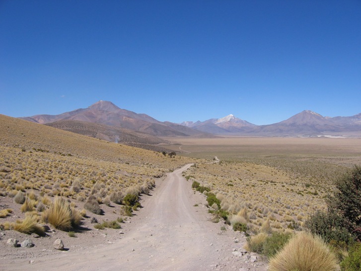
The road rarely traveled. This is not Ruta 11, the international road passing through Lauca, but some 3 digit or un-named road leading from Salar de Surire to Colchane (and Enquelga along the way). We consulted three different maps before and during the drive, and none of them matched the reality of where the road went quite exactly. Two of the three were quite wrong, and the third was "pretty close." I had given up on the idea of using a GPS, because without an accurate map to set waypoints (and my GPS topo map was one of the least accurate maps as far as roads were concerned), it was pretty useless.
Fortunately, the "follow the best looking choice that points closest to south" strategy at all unmarked intersections worked almost every time. There was only one instance where we had to back-track, and it was near the very beginning of the drive when we could still see the salar an use it for navigational reference. We turned and drove several kilometers on a road that wasn't on any of our maps, but ended up in a small town that was.
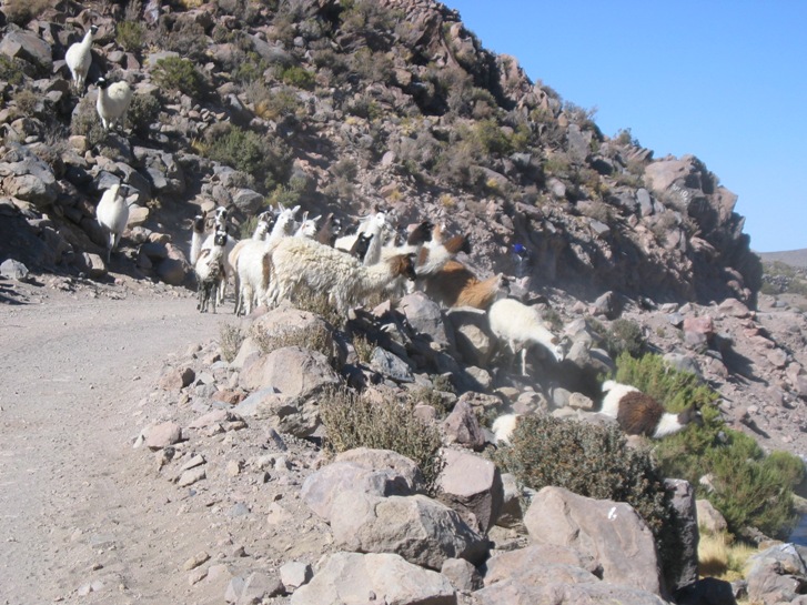
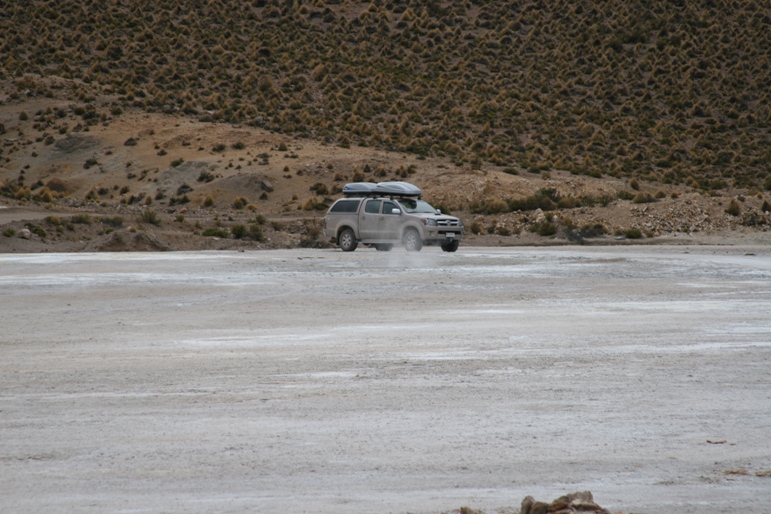
Traffic jam.
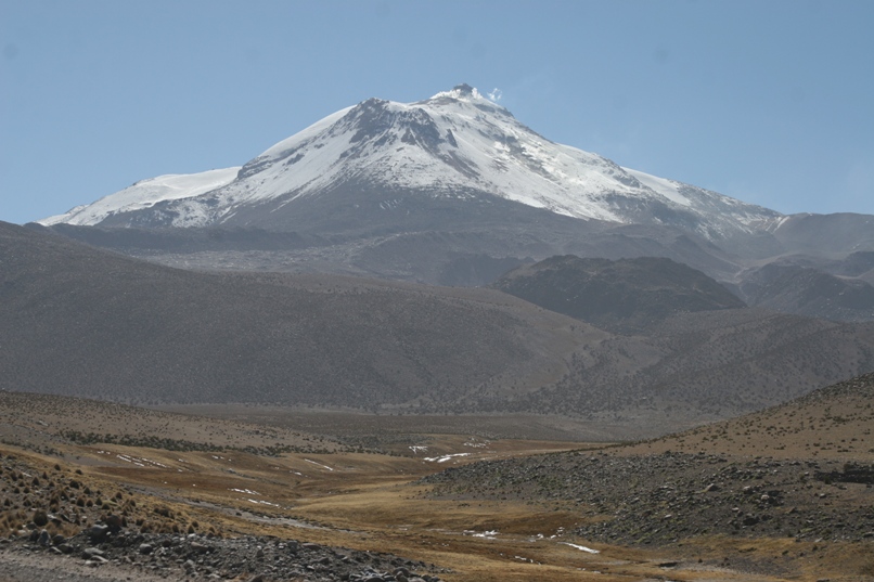
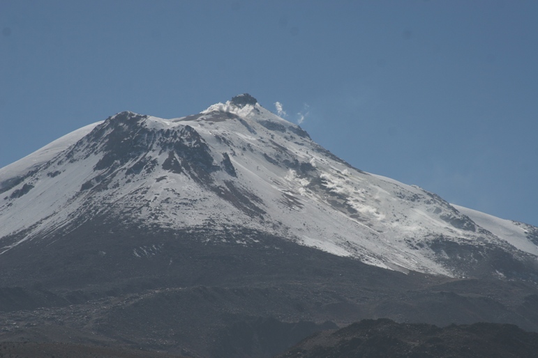
Views of the active volcano Guallatire.
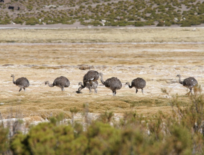
South America's version of an ostrich or emu, called a "rhea." Curious how the three major southern hemisphere continents (other than Antarctica) all have similar but clearly different species of large, running birds.
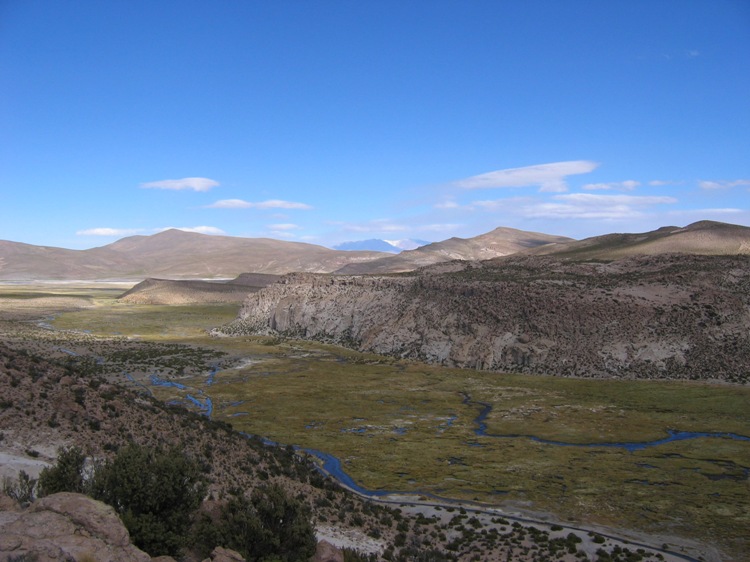
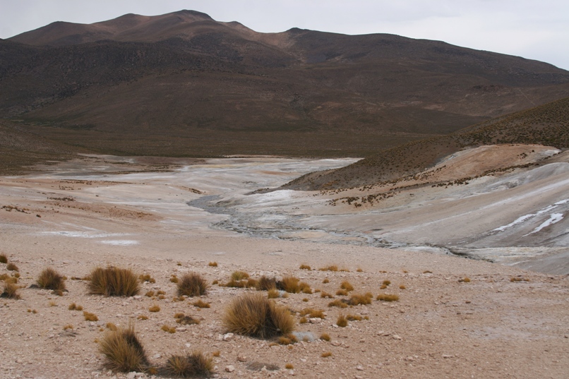
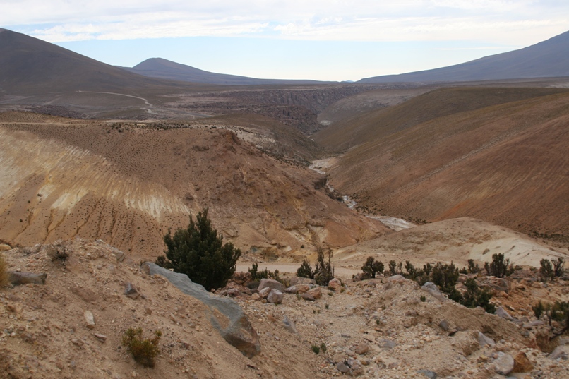
Another incredible valley on the way from Salar de Surire to Enquelga.
At Enquelga, the brusk refugio caretaker informed me that the water heater didn't work and that we couldn't have more than a couple pieces of firewood because "his friend had the key." Neither Geoff nor I could pick out more than one word out of twenty from his rapid fire agitated speech pattern. By gesture and inference, it was clear that he was trying to tell me that the water pressure was insufficient to create enough of a flow to trip the gas valve on the in-line, on-demand water heater. And that was that - "Sorry, no funciona!"
After he left, I rummaged around for a multi-tool and attacked the water heater. After a few minutes I had succeeded in taking off the cover so I could turn any and all screws in the vicinity of the gas valve, and shortly after that, we had some precious lukewarm water - and I felt like quite the handy-man and competent, useful, human being. I also scoured the yard around the building and came up with one more large piece of firewood to burn. The family was quite impressed and very grateful, at least.
Enquelga and it's refugio.
I think this is one of the best "are we having fun yet?" pictures I've every taken. Yummm - canned spaghetti with canned mixed vegetables and funky packaged cookies for desert. The hot tea was heavenly. We slept soundly, too tired to worry about the smoking, active, Volcan Isluga looming over the town. Why did these people choose to live at the base of an active volcano? It is pretty I suppose.
In the morning, the formerly crotchety caretaker reappeared along with an entourage of dog, friend, and young boy. He was in a much improved mood, and seemed very happy to see the water heater working. A friendly old woman spinning alpaca yarn into thread approached Lynn while we were packing up, asked her several questions about us and our trip, and wished her well. The bright, warm, morning (after a dark, freezing night) appeared to have lifted everyone's spirits.
A few kilometers east of Enquelga, we came to the town of Isluga, home to another 17th century church. Just like the church in Parinacota, the church here is unused save for one special fiesta during the year. There isn't a priest around to conduct mass on a weekly basis.
Driving from Enquelga to Isluga.
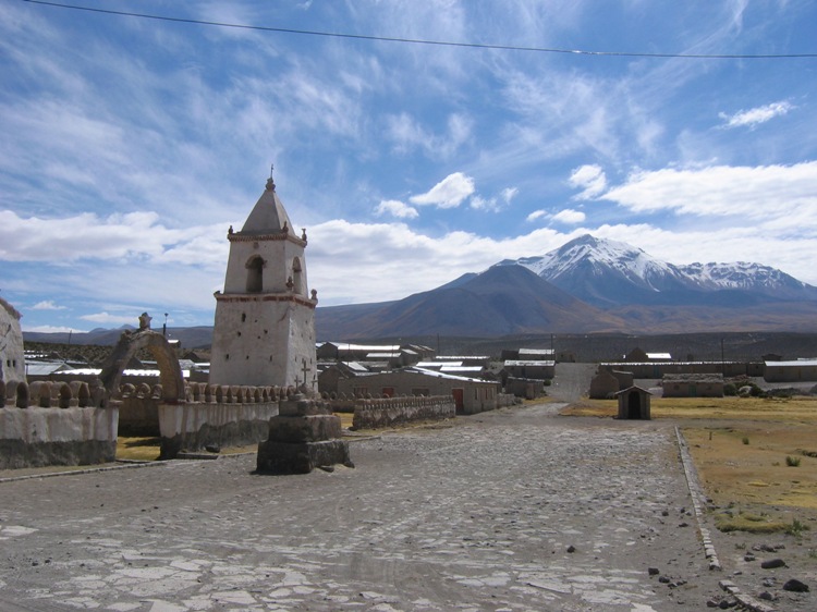
The church in Isluga.
View from the bell tower.
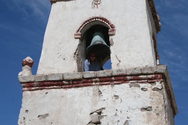
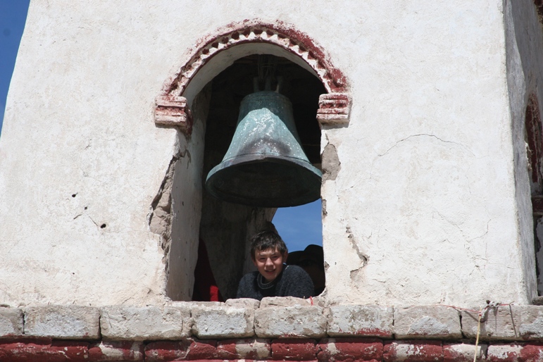
Views of Lynn and Tom in the bell tower.
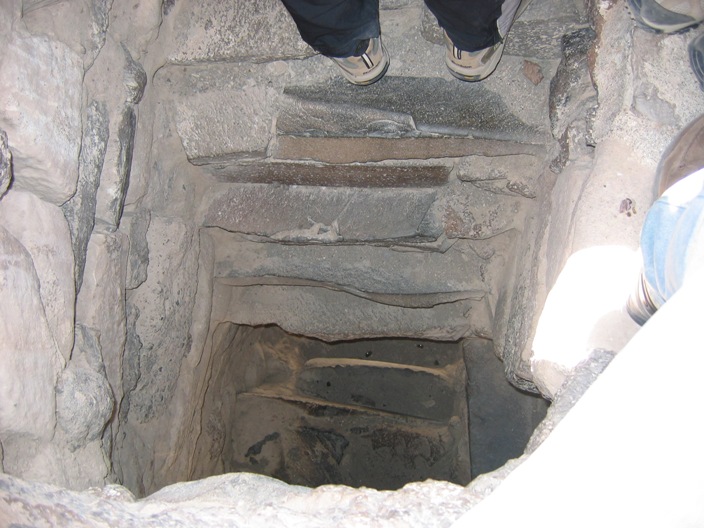
Steps up to the bell tower - maybe this is why Geoff "didn't want to" climb the tower.
After leaving Isluga, we turned westward on ruta A-55 to head back downhill towards larger cities and more oxygen. There was still one more side trip on the agenda, a 25 kilometer jaunt to see some geysers. In addition to the incredible geysers, we also saw a very rare Andean wildcat crossing the road on the way.
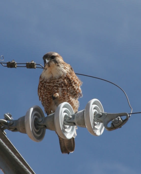
Even after looking long and hard through his binoculars for several minutes, Geoff was still unsure of the species of this bird (spotted on an electric-wire pole not far from Isluga). Can anyone help us? Which do you think it is?
a) Juvenile Harris's hawk
b) Juvenile Juan Fernandez hawk
c) Other

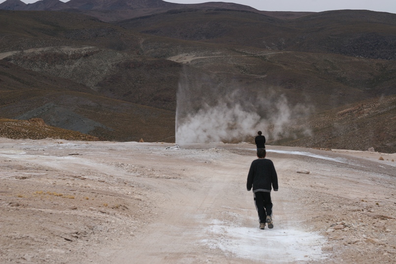
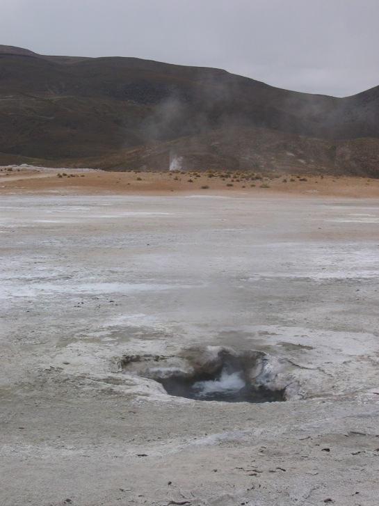
Those geysers we went to visit. The snow patch on the ground is from the nearby geyser. It is so cold, the steaming geyser mist freezes just a few seconds after leaving the ground. We all took a cold shower running through the mist since the walking path led right by the geyser. After reading warnings about the thin crust of ground boiling water, we didn't want to stray from the path. The kids screamed in terror when I pulled a few feet off of the tire-track route to park. They are probably wiser than I.
The rest of the drive proceeded along route A-55 west, which followed a narrow descending ridge that delineated two massive canyons. At times it felt like we were "balancing on" more so than driving along the road. When we finally reached the Pan-American highway and I rolled down my window to hand documents to a carabinero manning a checkpoint, everyone deeply inhaled the warm, oxygen rich air. It was almost as invigorating an experience as the scenery in the altiplano.
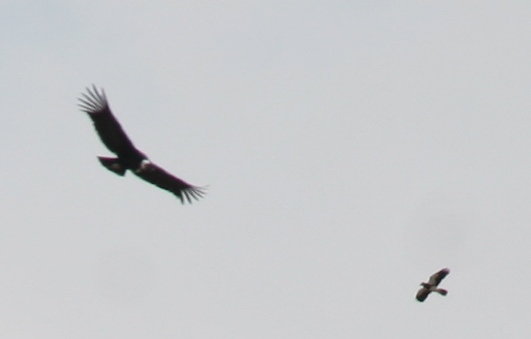
The higher elevation part of route A-55 followed along this valley. Geoff spotted a handful of Andean condors in the far distance, and this picture was the best that Lynn could manage, even with her telephoto lens.

The valley "on the left" of A-55
-Rolf